Property Record
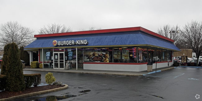
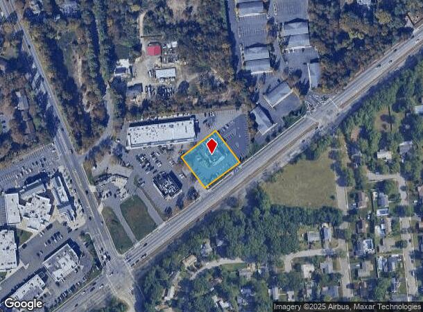
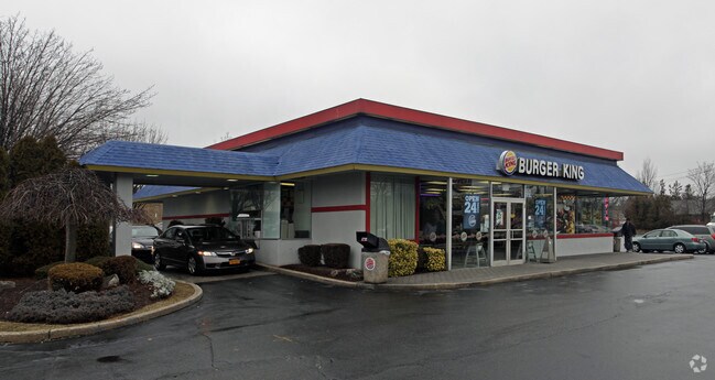
0 Nesconset Hwy, Stony Brook, NY 11790
NEARBY LISTINGS FOR SALE OR LEASE
Property Detail
0 Nesconset Hwy
Nassau County-Suffolk County, NY
N SMITH PT PARTNRS E SMITH PT PARTN
0200-418-00-03-00-001-000
Suffolk
Restaurantdrivein
New York
X
1
36103C0390H
0.74 AC
2024
Central Suffolk
2024
Long Island (New York)
158012
DEMOGRAPHICS near 0 Nesconset Hwy
1 Mile
3 Mile
5 Mile
2024 Total Population
9,366
82,175
217,001
2029 Population
9,245
80,893
213,748
Pop Growth 2024-2029
(1.29%)
(1.56%)
(1.50%)
Average Age
46
41
41
2024 Total Households
3,553
25,317
68,654
HH Growth 2024-2029
(1.35%)
(1.84%)
(1.74%)
Median Household Inc
$118,848
$129,038
$124,685
Avg Household Size
2.50
2.90
2.90
2024 Avg HH Vehicles
2.00
2.00
2.00
Median Home Value
$528,639
$503,062
$476,879
Median Year Built
1969
1969
1969
Nearby Places
- Restaurants
- Banks
- Shops
- Fitness
- Groceries
PUBLIC TRANSPORTATION
COMMUTER RAIL
St James Station (Port Jefferson Branch - Long Island Rail Road)
DRIVE
WALK
Distance
St James Station (Port Jefferson Branch - Long Island Rail Road)
7 min
3.2 mi
Stony Brook Station (Port Jefferson Branch - Long Island Rail Road)
DRIVE
WALK
Distance
Stony Brook Station (Port Jefferson Branch - Long Island Rail Road)
9 min
4.6 mi
AIRPORT
Long Island MacArthur
DRIVE
WALK
Distance
Long Island MacArthur
20 min
9.2 mi
Tweed/New Haven
DRIVE
WALK
Distance
Tweed/New Haven
125 min
47.5 mi
Freight Ports
Port of New Haven
DRIVE
WALK
Distance
Port of New Haven
120 min
44.7 mi
Nearby Properties
Address
Land Use
TOTAL SIZE
Lot Size
Zoning
Address
Land Use
TOTAL SIZE
Lot Size
Zoning
Address
Land Use
TOTAL SIZE
Lot Size
Zoning
200 AC
Address
Land Use
TOTAL SIZE
Lot Size
Zoning
Address
Land Use
TOTAL SIZE
Lot Size
Zoning
Address
Land Use
TOTAL SIZE
Lot Size
Zoning
16.30 AC
Address
Land Use
TOTAL SIZE
Lot Size
Zoning
1.55 AC
Address
Land Use
TOTAL SIZE
Lot Size
Zoning
39.56 AC
Address
Land Use
TOTAL SIZE
Lot Size
Zoning
Address
Land Use
TOTAL SIZE
Lot Size
Zoning
Address
Land Use
TOTAL SIZE
Lot Size
Zoning
71.46 AC
Address
Land Use
TOTAL SIZE
Lot Size
Zoning
Address
Land Use
TOTAL SIZE
Lot Size
Zoning
18.80 AC
Address
Land Use
TOTAL SIZE
Lot Size
Zoning
64.80 AC
Address
Land Use
TOTAL SIZE
Lot Size
Zoning
Address
Land Use
TOTAL SIZE
Lot Size
Zoning
Address
Land Use
TOTAL SIZE
Lot Size
Zoning
49.83 AC
Address
Land Use
TOTAL SIZE
Lot Size
Zoning
38.30 AC
Address
Land Use
TOTAL SIZE
Lot Size
Zoning
18.57 AC
Address
Land Use
TOTAL SIZE
Lot Size
Zoning
22.52 AC
Address
Land Use
TOTAL SIZE
Lot Size
Zoning
Address
Land Use
TOTAL SIZE
Lot Size
Zoning
15.37 AC
Address
Land Use
TOTAL SIZE
Lot Size
Zoning
Address
Land Use
TOTAL SIZE
Lot Size
Zoning
13.90 AC
Address
Land Use
TOTAL SIZE
Lot Size
Zoning
Address
Land Use
TOTAL SIZE
Lot Size
Zoning
10.90 AC
Address
Land Use
TOTAL SIZE
Lot Size
Zoning
11.62 AC
Address
Land Use
TOTAL SIZE
Lot Size
Zoning
19.50 AC
Address
Land Use
TOTAL SIZE
Lot Size
Zoning
6.70 AC
Address
Land Use
TOTAL SIZE
Lot Size
Zoning
8.50 AC
The World's #1 Commercial Real Estate Marketplace
Connect with us
© 2025 CoStar Group
The information above has been obtained from sources believed reliable. While we do not doubt its accuracy we have not verified it and make no guarantee, warranty or representation about it. It is your responsibility to independently confirm its accuracy and completeness. Any projections, opinions, assumptions, or estimates used are for example only and do not represent the current or future performance of the property. The value of this transaction to you depends on tax and other factors which should be evaluated by your tax, financial, and legal advisors. You and your advisors should conduct a careful, independent investigation of the property to determine to your satisfaction the suitability of the property for your needs.