Property Record
0 None, Santa Rosa, CA


Property Detail
0 None
North Bay/Santa Rosa
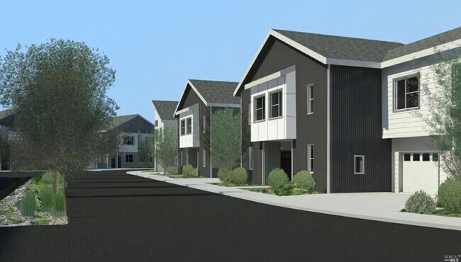
2022 PM 751, LOT 1
Santa Rosa-Petaluma, CA
SONOMA
032-530-001
California
Publicstorage
1
2024
1.52 AC
2025
Santa Rosa
152204
NEARBY LISTINGS FOR SALE OR LEASE
DEMOGRAPHICS near 0 None
1 mile
3 mile
5 mile
2025 Total Population
14,330
89,209
187,617
2030 Population
14,309
89,711
188,909
Pop Growth 2025-2030
(0.15%)
+ 0.56%
+ 0.69%
Average Age
45
44
42
2025 Total Households
6,059
36,281
70,148
HH Growth 2025-2030
(0.13%)
+ 0.68%
+ 0.75%
Median Household Inc
$101,380
$103,382
$96,487
Avg Household Size
2.30
2.40
2.60
2025 Avg HH Vehicles
2.00
2.00
2.00
Median Home Value
$794,622
$799,919
$746,796
Median Year Built
1975
1975
1980
Nearby Places
Map Layers
Map Styles
 Street
 Aerial
Transit
 Traffic
 Biking
Places
Listings with unknown addresses are not visible on the map
- Restaurants
- Banks
- Shops
- Fitness
- Groceries
PUBLIC TRANSPORTATION
COMMUTER RAIL
Drive
Walk
Distance
7 min
3.6 mi
Drive
Walk
Distance
9 min
4.8 mi
AIRPORT
Charles M Schulz - Sonoma County
Drive
Walk
Distance
Charles M Schulz - Sonoma County
17 min
10.8 mi
Freight Ports
Port of Richmond
Drive
Walk
Distance
Port of Richmond
68 min
51.8 mi
SALE & LEASE HISTORY
LISTING DATE
SALE/LEASE

Apr 08, 2020
For Sale
Nearby Properties
Address
Land Use
TOTAL SIZE
Lot Size
Zoning
Address
Land Use
TOTAL SIZE
Lot Size
Zoning
695,457 SF
128.68 AC
CITYSR
Address
Land Use
TOTAL SIZE
Lot Size
Zoning
258,134 SF
7.42 AC
CITYSR
Address
Land Use
TOTAL SIZE
Lot Size
Zoning
22.45 AC
MCPD
Address
Land Use
TOTAL SIZE
Lot Size
Zoning
434,911 SF
30.22 AC
Address
Land Use
TOTAL SIZE
Lot Size
Zoning
Address
Land Use
TOTAL SIZE
Lot Size
Zoning
441,698 SF
10.23 AC
C2
Address
Land Use
TOTAL SIZE
Lot Size
Zoning
92,480 SF
33.80 AC
Address
Land Use
TOTAL SIZE
Lot Size
Zoning
191,385 SF
13.77 AC
C2P
Address
Land Use
TOTAL SIZE
Lot Size
Zoning
447,600 SF
22.01 AC
Address
Land Use
TOTAL SIZE
Lot Size
Zoning
167,485 SF
7.81 AC
Address
Land Use
TOTAL SIZE
Lot Size
Zoning
74,000 SF
0.51 AC
Address
Land Use
TOTAL SIZE
Lot Size
Zoning
178,704 SF
10.76 AC
CITYSR
Address
Land Use
TOTAL SIZE
Lot Size
Zoning
131,210 SF
10.41 AC
Address
Land Use
TOTAL SIZE
Lot Size
Zoning
90,079 SF
3.09 AC
Address
Land Use
TOTAL SIZE
Lot Size
Zoning
9,450 SF
0.76 AC
Address
Land Use
TOTAL SIZE
Lot Size
Zoning
107,765 SF
5.70 AC
CITYSR
Address
Land Use
TOTAL SIZE
Lot Size
Zoning
146,611 SF
9.44 AC
Address
Land Use
TOTAL SIZE
Lot Size
Zoning
29,397 SF
6.33 AC
Address
Land Use
TOTAL SIZE
Lot Size
Zoning
122,645 SF
9.46 AC
CITYSR
Address
Land Use
TOTAL SIZE
Lot Size
Zoning
58,551 SF
4.24 AC
Address
Land Use
TOTAL SIZE
Lot Size
Zoning
181,593 SF
0.80 AC
R3PD
Address
Land Use
TOTAL SIZE
Lot Size
Zoning
89,168 SF
5.50 AC
CITYSR
Address
Land Use
TOTAL SIZE
Lot Size
Zoning
161,466 SF
13.82 AC
CITYSR
Address
Land Use
TOTAL SIZE
Lot Size
Zoning
71,739 SF
3.14 AC
Address
Land Use
TOTAL SIZE
Lot Size
Zoning
33,698 SF
2.94 AC
CITYSR
Address
Land Use
TOTAL SIZE
Lot Size
Zoning
109,126 SF
3.91 AC
Address
Land Use
TOTAL SIZE
Lot Size
Zoning
56,151 SF
4.21 AC
Address
Land Use
TOTAL SIZE
Lot Size
Zoning
128,092 SF
7.12 AC
Address
Land Use
TOTAL SIZE
Lot Size
Zoning
810 SF
4.19 AC
CITYSR
Address
Land Use
TOTAL SIZE
Lot Size
Zoning
62,088 SF
3.80 AC
PC
The World's #1 Commercial Real Estate Marketplace
Connect with us
© 2026 CoStar Group
The information above has been obtained from sources believed reliable. While we do not doubt its accuracy we have not verified it and make no guarantee, warranty or representation about it. It is your responsibility to independently confirm its accuracy and completeness. Any projections, opinions, assumptions, or estimates used are for example only and do not represent the current or future performance of the property. The value of this transaction to you depends on tax and other factors which should be evaluated by your tax, financial, and legal advisors. You and your advisors should conduct a careful, independent investigation of the property to determine to your satisfaction the suitability of the property for your needs.