Property Record
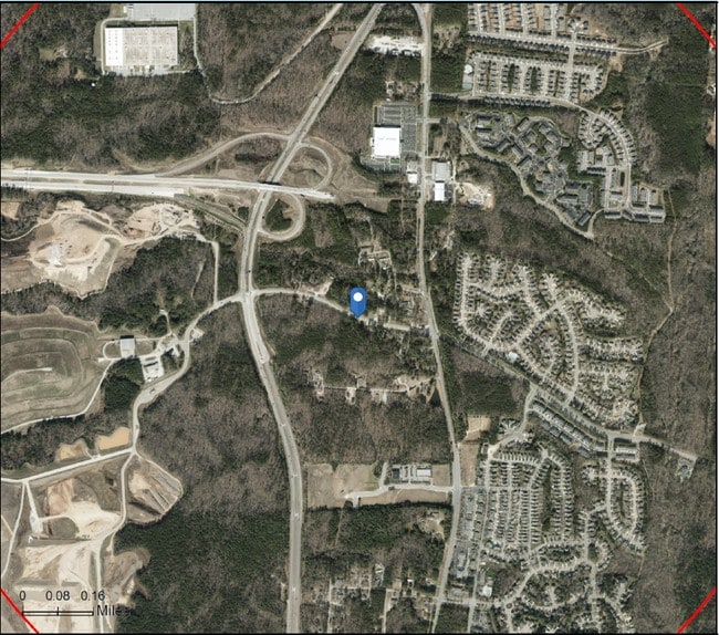
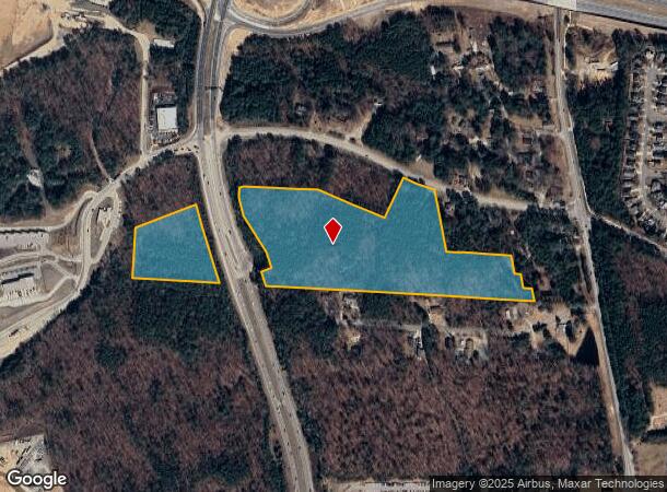
5809 Old Smithfield Rd, Apex, NC 27539
NEARBY LISTINGS FOR SALE OR LEASE
Property Detail
5809 Old Smithfield Rd
Raleigh, NC
Smithsville Sub
0740.04-73-9540-000
SMITHSVILLE SUB BM1977-00802
Vacantlandnec
Wake
X
North Carolina
3720074000K
20.24 AC
2025
Southwest Wake County
2025
Raleigh/Durham
053432
DEMOGRAPHICS near 5809 Old Smithfield Rd
1 Mile
3 Mile
5 Mile
2024 Total Population
4,931
44,643
124,940
2029 Population
5,305
48,660
136,158
Pop Growth 2024-2029
+ 7.58%
+ 9.00%
+ 8.98%
Average Age
34
37
38
2024 Total Households
1,776
15,483
43,164
HH Growth 2024-2029
+ 7.55%
+ 8.93%
+ 8.94%
Median Household Inc
$83,001
$114,131
$127,674
Avg Household Size
2.80
2.90
2.90
2024 Avg HH Vehicles
2.00
2.00
2.00
Median Home Value
$353,563
$434,643
$443,812
Median Year Built
2001
2004
2003
Nearby Places
- Restaurants
- Banks
- Shops
- Fitness
- Groceries
PUBLIC TRANSPORTATION
AIRPORT
Raleigh-Durham International
DRIVE
WALK
Distance
Raleigh-Durham International
28 min
21.0 mi
Freight Ports
Port of Wilmington
DRIVE
WALK
Distance
Port of Wilmington
166 min
135.2 mi
SALE & LEASE HISTORY
LISTING DATE
SALE/LEASE

Jun 18, 2019
For Sale
Nearby Properties
Address
Land Use
TOTAL SIZE
Lot Size
Zoning
Address
Land Use
TOTAL SIZE
Lot Size
Zoning
898,348 SF
147.52 AC
BRT
Address
Land Use
TOTAL SIZE
Lot Size
Zoning
600,780 SF
157.91 AC
PUD
Address
Land Use
TOTAL SIZE
Lot Size
Zoning
295,615 SF
38.04 AC
SP
Address
Land Use
TOTAL SIZE
Lot Size
Zoning
402,468 SF
37.03 AC
HD MF
Address
Land Use
TOTAL SIZE
Lot Size
Zoning
362,567 SF
17.97 AC
NMX
Address
Land Use
TOTAL SIZE
Lot Size
Zoning
364,727 SF
27.65 AC
RMF-C
Address
Land Use
TOTAL SIZE
Lot Size
Zoning
301,882 SF
19.44 AC
MXR
Address
Land Use
TOTAL SIZE
Lot Size
Zoning
338,234 SF
18.77 AC
PUD-C
Address
Land Use
TOTAL SIZE
Lot Size
Zoning
242,251 SF
35.55 AC
SR
Address
Land Use
TOTAL SIZE
Lot Size
Zoning
208,323 SF
36.14 AC
CB
Address
Land Use
TOTAL SIZE
Lot Size
Zoning
230,176 SF
16.83 AC
MXR
Address
Land Use
TOTAL SIZE
Lot Size
Zoning
210,686 SF
14.57 AC
PUD-C
Address
Land Use
TOTAL SIZE
Lot Size
Zoning
361,582 SF
45.01 AC
LI
Address
Land Use
TOTAL SIZE
Lot Size
Zoning
221,860 SF
40.32 AC
PUD
Address
Land Use
TOTAL SIZE
Lot Size
Zoning
302,498 SF
25.99 AC
LI-CZ
Address
Land Use
TOTAL SIZE
Lot Size
Zoning
99,326 SF
12.66 AC
TF-CZ
Address
Land Use
TOTAL SIZE
Lot Size
Zoning
160,410 SF
14.11 AC
PUD-C
Address
Land Use
TOTAL SIZE
Lot Size
Zoning
234,000 SF
21.53 AC
LI-CZ
Address
Land Use
TOTAL SIZE
Lot Size
Zoning
161,910 SF
22.83 AC
HD MF
Address
Land Use
TOTAL SIZE
Lot Size
Zoning
138,083 SF
16.18 AC
LI-CU
Address
Land Use
TOTAL SIZE
Lot Size
Zoning
144,356 SF
31.35 AC
HD MF
Address
Land Use
TOTAL SIZE
Lot Size
Zoning
95,819 SF
22.63 AC
NR
Address
Land Use
TOTAL SIZE
Lot Size
Zoning
146,215 SF
22.83 AC
LI
Address
Land Use
TOTAL SIZE
Lot Size
Zoning
503,896 SF
80.17 AC
LI
Address
Land Use
TOTAL SIZE
Lot Size
Zoning
95,937 SF
11.44 AC
LI
Address
Land Use
TOTAL SIZE
Lot Size
Zoning
125,702 SF
1.35 AC
GCP
Address
Land Use
TOTAL SIZE
Lot Size
Zoning
86,830 SF
6.59 AC
LI
Address
Land Use
TOTAL SIZE
Lot Size
Zoning
145,707 SF
15.40 AC
PUD
Address
Land Use
TOTAL SIZE
Lot Size
Zoning
59,764 SF
8.36 AC
MXR
Address
Land Use
TOTAL SIZE
Lot Size
Zoning
85,705 SF
11.01 AC
GCP
The World's #1 Commercial Real Estate Marketplace
Connect with us
© 2025 CoStar Group
The information above has been obtained from sources believed reliable. While we do not doubt its accuracy we have not verified it and make no guarantee, warranty or representation about it. It is your responsibility to independently confirm its accuracy and completeness. Any projections, opinions, assumptions, or estimates used are for example only and do not represent the current or future performance of the property. The value of this transaction to you depends on tax and other factors which should be evaluated by your tax, financial, and legal advisors. You and your advisors should conduct a careful, independent investigation of the property to determine to your satisfaction the suitability of the property for your needs.