Property Record
0 Peters Rd, Crosby, TX 77532


Property Detail
0 Peters Rd
Houston-Pasadena-The Woodlands, TX
TR 3 ABST 810 T TOBY
0451140000003
HARRIS
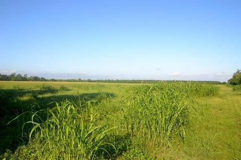
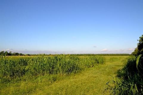
Agriculturalland
Texas
B and X Area of moderate flood hazard, usually the area between the limits of the 100-year and 500-year floods.
30.85 AC
2024
Northeast Outlier
2025
Houston
251800
NEARBY LISTINGS FOR SALE OR LEASE
DEMOGRAPHICS near 0 Peters Rd
1 mile
3 mile
5 mile
2025 Total Population
322
6,619
37,834
2030 Population
349
7,190
41,066
Pop Growth 2025-2030
+ 8.39%
+ 8.63%
+ 8.54%
Average Age
40
39
38
2025 Total Households
115
2,310
12,854
HH Growth 2025-2030
+ 7.83%
+ 8.70%
+ 8.63%
Median Household Inc
$70,833
$88,604
$92,646
Avg Household Size
2.80
2.80
2.90
2025 Avg HH Vehicles
2.00
2.00
2.00
Median Home Value
$278,571
$297,462
$281,525
Median Year Built
1996
2001
2001
Nearby Places
Map Layers
Map Styles
 Street
 Aerial
Transit
 Traffic
 Biking
Places
Listings with unknown addresses are not visible on the map
- Restaurants
- Banks
- Shops
- Fitness
- Groceries
PUBLIC TRANSPORTATION
AIRPORT
George Bush Intcntl/Houston
Drive
Walk
Distance
George Bush Intcntl/Houston
41 min
25.4 mi
William P Hobby
Drive
Walk
Distance
William P Hobby
56 min
34.4 mi
Freight Ports
Port of Houston
Drive
Walk
Distance
Port of Houston
43 min
26.3 mi
SALE & LEASE HISTORY
LISTING DATE
SALE/LEASE

Jul 11, 2019
For Sale
Nearby Properties
Address
Land Use
TOTAL SIZE
Lot Size
Zoning
Address
Land Use
TOTAL SIZE
Lot Size
Zoning
333.18 AC
Address
Land Use
TOTAL SIZE
Lot Size
Zoning
62,322 SF
35.59 AC
Address
Land Use
TOTAL SIZE
Lot Size
Zoning
1,505.43 AC
Address
Land Use
TOTAL SIZE
Lot Size
Zoning
58,784 SF
4 AC
Address
Land Use
TOTAL SIZE
Lot Size
Zoning
131,390 SF
9.79 AC
Address
Land Use
TOTAL SIZE
Lot Size
Zoning
9,840 SF
7.99 AC
Address
Land Use
TOTAL SIZE
Lot Size
Zoning
25,064 SF
5.46 AC
Address
Land Use
TOTAL SIZE
Lot Size
Zoning
27,500 SF
4.50 AC
Address
Land Use
TOTAL SIZE
Lot Size
Zoning
237.60 AC
Address
Land Use
TOTAL SIZE
Lot Size
Zoning
116.80 AC
Address
Land Use
TOTAL SIZE
Lot Size
Zoning
635.13 AC
Address
Land Use
TOTAL SIZE
Lot Size
Zoning
50.74 AC
Address
Land Use
TOTAL SIZE
Lot Size
Zoning
361.25 AC
Address
Land Use
TOTAL SIZE
Lot Size
Zoning
19,740 SF
3 AC
Address
Land Use
TOTAL SIZE
Lot Size
Zoning
62.97 AC
Address
Land Use
TOTAL SIZE
Lot Size
Zoning
62.97 AC
Address
Land Use
TOTAL SIZE
Lot Size
Zoning
225.57 AC
Address
Land Use
TOTAL SIZE
Lot Size
Zoning
29,276 SF
4.01 AC
Address
Land Use
TOTAL SIZE
Lot Size
Zoning
51,836 SF
3.51 AC
Address
Land Use
TOTAL SIZE
Lot Size
Zoning
30,000 SF
3.14 AC
Address
Land Use
TOTAL SIZE
Lot Size
Zoning
10,076 SF
12.26 AC
Address
Land Use
TOTAL SIZE
Lot Size
Zoning
197.56 AC
Address
Land Use
TOTAL SIZE
Lot Size
Zoning
380.55 AC
Address
Land Use
TOTAL SIZE
Lot Size
Zoning
9,360 SF
4.09 AC
Address
Land Use
TOTAL SIZE
Lot Size
Zoning
21,120 SF
5 AC
Address
Land Use
TOTAL SIZE
Lot Size
Zoning
7.95 AC
Address
Land Use
TOTAL SIZE
Lot Size
Zoning
206.81 AC
Address
Land Use
TOTAL SIZE
Lot Size
Zoning
233.89 AC
Address
Land Use
TOTAL SIZE
Lot Size
Zoning
4,000 SF
5.09 AC
Address
Land Use
TOTAL SIZE
Lot Size
Zoning
9,956 SF
3 AC
The World's #1 Commercial Real Estate Marketplace
Connect with us
© 2026 CoStar Group
The information above has been obtained from sources believed reliable. While we do not doubt its accuracy we have not verified it and make no guarantee, warranty or representation about it. It is your responsibility to independently confirm its accuracy and completeness. Any projections, opinions, assumptions, or estimates used are for example only and do not represent the current or future performance of the property. The value of this transaction to you depends on tax and other factors which should be evaluated by your tax, financial, and legal advisors. You and your advisors should conduct a careful, independent investigation of the property to determine to your satisfaction the suitability of the property for your needs.