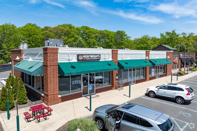
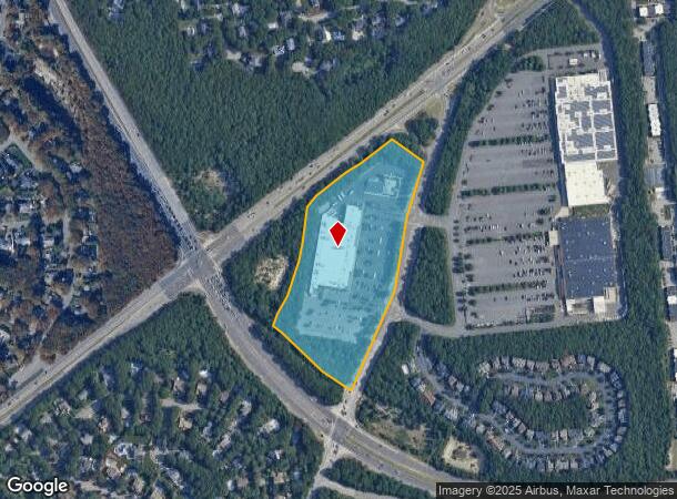
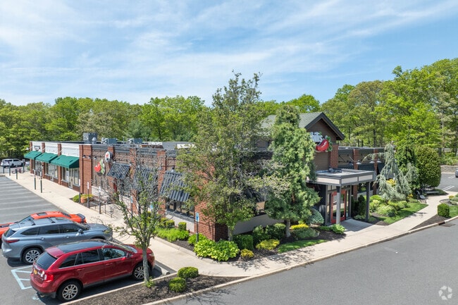
Property Record
0 Pond Path Rd, East Setauket, NY 11733
NEARBY LISTINGS FOR SALE OR LEASE
Property Detail
0 Pond Path Rd
Nassau County-Suffolk County, NY
Setauket
0200-388-00-01-00-001-000
N NESCONSET PJ HWY E POND PATH S NI
Regionalshoppingcenterormallwithanchorstore
Suffolk
X
New York
36103C0390H
1
2024
13.31 AC
2024
Central Suffolk
159700
Long Island (New York)
DEMOGRAPHICS near 0 Pond Path Rd
1 Mile
3 Mile
5 Mile
2024 Total Population
8,851
93,300
223,224
2029 Population
8,690
91,783
219,967
Pop Growth 2024-2029
(1.82%)
(1.63%)
(1.46%)
Average Age
41
40
41
2024 Total Households
2,962
27,355
71,739
HH Growth 2024-2029
(2.06%)
(1.96%)
(1.68%)
Median Household Inc
$141,693
$124,557
$120,439
Avg Household Size
2.90
2.90
2.80
2024 Avg HH Vehicles
2.00
2.00
2.00
Median Home Value
$499,653
$482,132
$472,765
Median Year Built
1969
1969
1970
Nearby Places
Map Layers
Map Styles
 Street
 Aerial
- Restaurants
- Banks
- Shops
- Fitness
- Groceries
PUBLIC TRANSPORTATION
COMMUTER RAIL
Stony Brook Station (Port Jefferson Branch - Long Island Rail Road)
DRIVE
WALK
Distance
Stony Brook Station (Port Jefferson Branch - Long Island Rail Road)
9 min
4.1 mi
St James Station (Port Jefferson Branch - Long Island Rail Road)
DRIVE
WALK
Distance
St James Station (Port Jefferson Branch - Long Island Rail Road)
9 min
4.2 mi
AIRPORT
Long Island MacArthur
DRIVE
WALK
Distance
Long Island MacArthur
21 min
8.5 mi
Tweed/New Haven
DRIVE
WALK
Distance
Tweed/New Haven
124 min
46.1 mi
SALE & LEASE HISTORY
LISTING DATE
SALE/LEASE

May 04, 2017
For Lease
Feb 17, 2022
For Sale
Nearby Properties
Address
Land Use
TOTAL SIZE
Lot Size
Zoning
Address
Land Use
TOTAL SIZE
Lot Size
Zoning
Address
Land Use
TOTAL SIZE
Lot Size
Zoning
200 AC
Address
Land Use
TOTAL SIZE
Lot Size
Zoning
Address
Land Use
TOTAL SIZE
Lot Size
Zoning
6,522 SF
0.32 AC
VILLA
Address
Land Use
TOTAL SIZE
Lot Size
Zoning
16.30 AC
Address
Land Use
TOTAL SIZE
Lot Size
Zoning
1.55 AC
Address
Land Use
TOTAL SIZE
Lot Size
Zoning
39.56 AC
Address
Land Use
TOTAL SIZE
Lot Size
Zoning
Address
Land Use
TOTAL SIZE
Lot Size
Zoning
Address
Land Use
TOTAL SIZE
Lot Size
Zoning
71.46 AC
Address
Land Use
TOTAL SIZE
Lot Size
Zoning
Address
Land Use
TOTAL SIZE
Lot Size
Zoning
18.80 AC
Address
Land Use
TOTAL SIZE
Lot Size
Zoning
64.80 AC
Address
Land Use
TOTAL SIZE
Lot Size
Zoning
17.50 AC
Address
Land Use
TOTAL SIZE
Lot Size
Zoning
20.04 AC
Address
Land Use
TOTAL SIZE
Lot Size
Zoning
Address
Land Use
TOTAL SIZE
Lot Size
Zoning
19.28 AC
Address
Land Use
TOTAL SIZE
Lot Size
Zoning
Address
Land Use
TOTAL SIZE
Lot Size
Zoning
49.83 AC
Address
Land Use
TOTAL SIZE
Lot Size
Zoning
38.30 AC
Address
Land Use
TOTAL SIZE
Lot Size
Zoning
18.57 AC
Address
Land Use
TOTAL SIZE
Lot Size
Zoning
22.52 AC
Address
Land Use
TOTAL SIZE
Lot Size
Zoning
Address
Land Use
TOTAL SIZE
Lot Size
Zoning
15.37 AC
Address
Land Use
TOTAL SIZE
Lot Size
Zoning
Address
Land Use
TOTAL SIZE
Lot Size
Zoning
13.90 AC
Address
Land Use
TOTAL SIZE
Lot Size
Zoning
Address
Land Use
TOTAL SIZE
Lot Size
Zoning
Address
Land Use
TOTAL SIZE
Lot Size
Zoning
10.90 AC
Address
Land Use
TOTAL SIZE
Lot Size
Zoning
11.62 AC
The World's #1 Commercial Real Estate Marketplace
Connect with us
© 2025 CoStar Group
The information above has been obtained from sources believed reliable. While we do not doubt its accuracy we have not verified it and make no guarantee, warranty or representation about it. It is your responsibility to independently confirm its accuracy and completeness. Any projections, opinions, assumptions, or estimates used are for example only and do not represent the current or future performance of the property. The value of this transaction to you depends on tax and other factors which should be evaluated by your tax, financial, and legal advisors. You and your advisors should conduct a careful, independent investigation of the property to determine to your satisfaction the suitability of the property for your needs.