Property Record
0 Porter Rd, Katy, TX 77433

Save to a Folder
{{folder.Name}}
{{folder.ListingIds.length}} Properties
{{folder.ListingIds.length}} Property
Create a New Folder
Property Detail
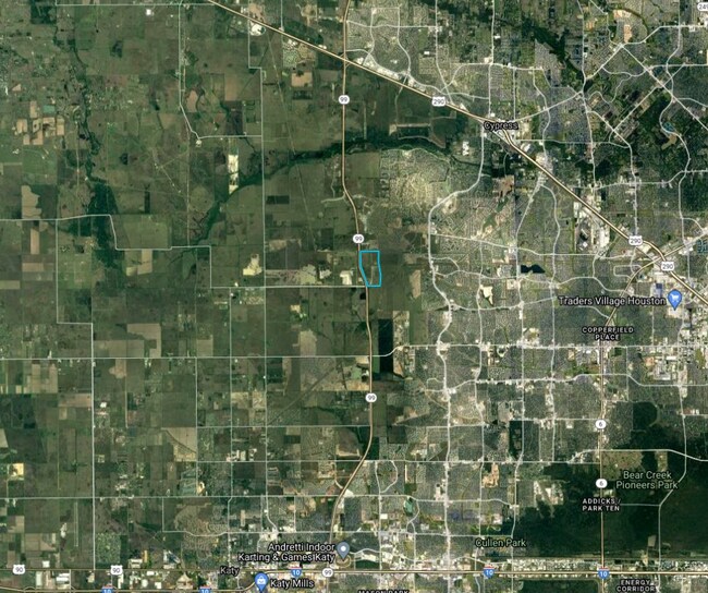
0 Porter Rd
Houston-Pasadena-The Woodlands, TX
TR 2E DIRECTORS LT 5 ABST 426 H&TCRR SEC 27 BLK 2
0471110000009
HARRIS
Agriculturalland
Texas
AE The base floodplain where base flood elevations are provided. AE Zones are now used on new format FIRMs instead of A1-A30 Zones.
5
2025
6.14 AC
2025
Northwest Outlier
543005
Houston
NEARBY LISTINGS FOR SALE OR LEASE
DEMOGRAPHICS near 0 Porter Rd
1 mile
3 mile
5 mile
2025 Total Population
1,230
28,601
112,399
2030 Population
1,394
31,927
122,792
Pop Growth 2025-2030
+ 13.33%
+ 11.63%
+ 9.25%
Average Age
33
34
35
2025 Total Households
386
8,637
33,454
HH Growth 2025-2030
+ 13.47%
+ 11.87%
+ 9.45%
Median Household Inc
$199,509
$172,382
$127,220
Avg Household Size
3.20
3.30
3.30
2025 Avg HH Vehicles
2.00
2.00
2.00
Median Home Value
$494,347
$450,644
$381,190
Median Year Built
2011
2011
2010
Nearby Places
Map Layers
Map Styles
 Street
 Aerial
Layers
 Traffic
 Biking
Places
Listings with unknown addresses are not visible on the map
- Restaurants
- Banks
- Shops
- Fitness
- Groceries
PUBLIC TRANSPORTATION
AIRPORT
George Bush Intcntl/Houston
Drive
Walk
Distance
George Bush Intcntl/Houston
52 min
33.2 mi
Freight Ports
Port of Houston
Drive
Walk
Distance
Port of Houston
62 min
41.9 mi
SALE & LEASE HISTORY
LISTING DATE
SALE/LEASE

Mar 07, 2018
For Sale
Feb 20, 2019
For Sale
Nearby Properties
Address
Land Use
TOTAL SIZE
Lot Size
Zoning
Address
Land Use
TOTAL SIZE
Lot Size
Zoning
851,991 SF
229.30 AC
Address
Land Use
TOTAL SIZE
Lot Size
Zoning
483,699 SF
13 AC
Address
Land Use
TOTAL SIZE
Lot Size
Zoning
427,211 SF
15.20 AC
Address
Land Use
TOTAL SIZE
Lot Size
Zoning
327,631 SF
28.79 AC
Address
Land Use
TOTAL SIZE
Lot Size
Zoning
351,997 SF
13.28 AC
Address
Land Use
TOTAL SIZE
Lot Size
Zoning
406,032 SF
15.01 AC
Address
Land Use
TOTAL SIZE
Lot Size
Zoning
365,784 SF
12.87 AC
Address
Land Use
TOTAL SIZE
Lot Size
Zoning
318,511 SF
16.62 AC
Address
Land Use
TOTAL SIZE
Lot Size
Zoning
128,981 SF
13.45 AC
Address
Land Use
TOTAL SIZE
Lot Size
Zoning
279,000 SF
4.30 AC
Address
Land Use
TOTAL SIZE
Lot Size
Zoning
117,826 SF
15.87 AC
Address
Land Use
TOTAL SIZE
Lot Size
Zoning
107,683 SF
15.77 AC
Address
Land Use
TOTAL SIZE
Lot Size
Zoning
49,195 SF
6.49 AC
Address
Land Use
TOTAL SIZE
Lot Size
Zoning
71,283 SF
13.46 AC
Address
Land Use
TOTAL SIZE
Lot Size
Zoning
201,809 SF
21.18 AC
Address
Land Use
TOTAL SIZE
Lot Size
Zoning
134.10 AC
Address
Land Use
TOTAL SIZE
Lot Size
Zoning
767.31 AC
Address
Land Use
TOTAL SIZE
Lot Size
Zoning
698.98 AC
Address
Land Use
TOTAL SIZE
Lot Size
Zoning
245.16 AC
Address
Land Use
TOTAL SIZE
Lot Size
Zoning
7,900 SF
833.34 AC
Address
Land Use
TOTAL SIZE
Lot Size
Zoning
156.37 AC
Address
Land Use
TOTAL SIZE
Lot Size
Zoning
520.66 AC
Address
Land Use
TOTAL SIZE
Lot Size
Zoning
41.26 AC
Address
Land Use
TOTAL SIZE
Lot Size
Zoning
22,270 SF
2.82 AC
Address
Land Use
TOTAL SIZE
Lot Size
Zoning
136.37 AC
Address
Land Use
TOTAL SIZE
Lot Size
Zoning
168.70 AC
Address
Land Use
TOTAL SIZE
Lot Size
Zoning
329,931 SF
209.45 AC
Address
Land Use
TOTAL SIZE
Lot Size
Zoning
298.56 AC
Address
Land Use
TOTAL SIZE
Lot Size
Zoning
65.15 AC
Address
Land Use
TOTAL SIZE
Lot Size
Zoning
29.25 AC
The World's #1 Commercial Real Estate Marketplace
Connect with us
© 2026 CoStar Group
The information above has been obtained from sources believed reliable. While we do not doubt its accuracy we have not verified it and make no guarantee, warranty or representation about it. It is your responsibility to independently confirm its accuracy and completeness. Any projections, opinions, assumptions, or estimates used are for example only and do not represent the current or future performance of the property. The value of this transaction to you depends on tax and other factors which should be evaluated by your tax, financial, and legal advisors. You and your advisors should conduct a careful, independent investigation of the property to determine to your satisfaction the suitability of the property for your needs.