Property Record
0 Pritchard Rd, Jacksonville, FL 32220

NEARBY LISTINGS FOR SALE OR LEASE
Property Detail
0 Pritchard Rd
Jacksonville, FL
Section Land
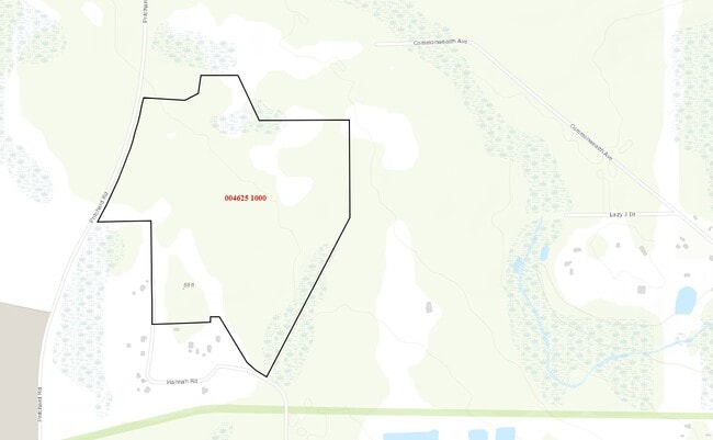
004625-1000
06-2S-25E 170.72 PT SEC 6,7 RECD O/R 21416-1324
Industrialacreage
Duval
X
Florida
12031C0330H
171.06 AC
2024
Northwest Jacksonville
2025
Jacksonville (Florida)
011901
DEMOGRAPHICS near 0 Pritchard Rd
1 Mile
3 Mile
5 Mile
2024 Total Population
47
9,278
39,108
2029 Population
51
9,804
41,297
Pop Growth 2024-2029
+ 8.51%
+ 5.67%
+ 5.60%
Average Age
45
41
40
2024 Total Households
19
3,480
14,135
HH Growth 2024-2029
+ 5.26%
+ 5.78%
+ 5.65%
Median Household Inc
$82,500
$69,314
$67,904
Avg Household Size
2.60
2.60
2.70
2024 Avg HH Vehicles
2.00
2.00
2.00
Median Home Value
$250,000
$226,879
$219,075
Median Year Built
1997
1994
1995
Nearby Places
Map Layers
Map Styles
 Street
 Aerial
- Restaurants
- Banks
- Shops
- Fitness
- Groceries
PUBLIC TRANSPORTATION
AIRPORT
Jacksonville International
DRIVE
WALK
Distance
Jacksonville International
40 min
21.3 mi
Freight Ports
Jacksonville Port
DRIVE
WALK
Distance
Jacksonville Port
33 min
17.6 mi
SALE & LEASE HISTORY
LISTING DATE
SALE/LEASE

Sep 24, 2016
For Sale
Feb 22, 2019
For Lease
Feb 22, 2019
For Sale
Aug 22, 2017
For Sale
Nearby Properties
Address
Land Use
TOTAL SIZE
Lot Size
Zoning
Address
Land Use
TOTAL SIZE
Lot Size
Zoning
1,013,036 SF
51.67 AC
PUD
Address
Land Use
TOTAL SIZE
Lot Size
Zoning
773,806 SF
68.14 AC
PUD
Address
Land Use
TOTAL SIZE
Lot Size
Zoning
548,235 SF
64.22 AC
PUD
Address
Land Use
TOTAL SIZE
Lot Size
Zoning
457,353 SF
250.89 AC
PUD
Address
Land Use
TOTAL SIZE
Lot Size
Zoning
491,247 SF
30.77 AC
PUD
Address
Land Use
TOTAL SIZE
Lot Size
Zoning
435,150 SF
21.92 AC
PUD
Address
Land Use
TOTAL SIZE
Lot Size
Zoning
421,500 SF
43.21 AC
PUD
Address
Land Use
TOTAL SIZE
Lot Size
Zoning
496,042 SF
120 AC
PUD
Address
Land Use
TOTAL SIZE
Lot Size
Zoning
401,680 SF
39.78 AC
PUD
Address
Land Use
TOTAL SIZE
Lot Size
Zoning
505,748 SF
94.71 AC
IL
Address
Land Use
TOTAL SIZE
Lot Size
Zoning
307,322 SF
19.31 AC
PUD
Address
Land Use
TOTAL SIZE
Lot Size
Zoning
273,608 SF
23.15 AC
PUD
Address
Land Use
TOTAL SIZE
Lot Size
Zoning
509,686 SF
43.32 AC
IL
Address
Land Use
TOTAL SIZE
Lot Size
Zoning
235,950 SF
18.10 AC
PUD
Address
Land Use
TOTAL SIZE
Lot Size
Zoning
480,461 SF
43.54 AC
IL
Address
Land Use
TOTAL SIZE
Lot Size
Zoning
1,265.67 AC
PUD
Address
Land Use
TOTAL SIZE
Lot Size
Zoning
187,242 SF
18.73 AC
PUD
Address
Land Use
TOTAL SIZE
Lot Size
Zoning
244,454 SF
11.66 AC
PUD
Address
Land Use
TOTAL SIZE
Lot Size
Zoning
167,992 SF
12.63 AC
PUD
Address
Land Use
TOTAL SIZE
Lot Size
Zoning
214,392 SF
11.29 AC
PUD
Address
Land Use
TOTAL SIZE
Lot Size
Zoning
878.69 AC
PUD
Address
Land Use
TOTAL SIZE
Lot Size
Zoning
128,566 SF
50.24 AC
PUD
Address
Land Use
TOTAL SIZE
Lot Size
Zoning
160,970 SF
25.46 AC
IL
Address
Land Use
TOTAL SIZE
Lot Size
Zoning
130,066 SF
10.24 AC
PUD
Address
Land Use
TOTAL SIZE
Lot Size
Zoning
132,262 SF
58.93 AC
PUD
Address
Land Use
TOTAL SIZE
Lot Size
Zoning
33,424 SF
2.97 AC
PUD
Address
Land Use
TOTAL SIZE
Lot Size
Zoning
76,718 SF
8.89 AC
RR-ACRE
Address
Land Use
TOTAL SIZE
Lot Size
Zoning
51.13 AC
PUD
Address
Land Use
TOTAL SIZE
Lot Size
Zoning
46.49 AC
PUD
The World's #1 Commercial Real Estate Marketplace
Connect with us
© 2025 CoStar Group
The information above has been obtained from sources believed reliable. While we do not doubt its accuracy we have not verified it and make no guarantee, warranty or representation about it. It is your responsibility to independently confirm its accuracy and completeness. Any projections, opinions, assumptions, or estimates used are for example only and do not represent the current or future performance of the property. The value of this transaction to you depends on tax and other factors which should be evaluated by your tax, financial, and legal advisors. You and your advisors should conduct a careful, independent investigation of the property to determine to your satisfaction the suitability of the property for your needs.