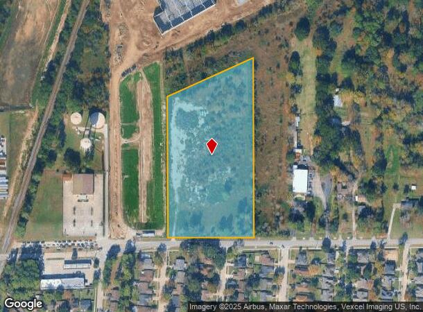
Property Record
0 Rankin Rd, Humble, TX 77396
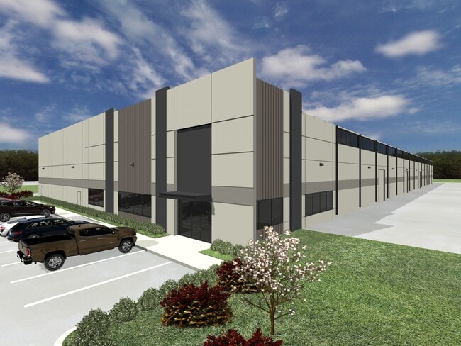
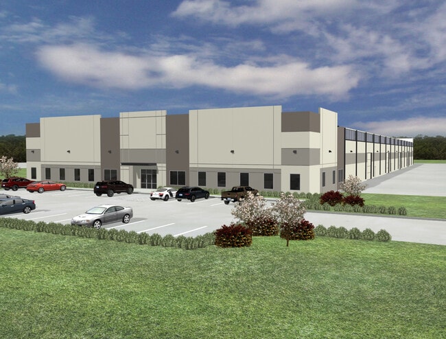
This Property Is For Sale
Current Lease Availabilities
NEARBY LISTINGS FOR SALE OR LEASE
Property Detail
0 Rankin Rd
Houston-Pasadena-The Woodlands, TX
Abst 95 W B Adams
0410510040065
TR 13 ABST 95 W B ADAMS
Commercialacreage
Harris
X
Texas
48201C0485M
7.56 AC
2024
Northeast Hwy 90
2025
Houston
250201
DEMOGRAPHICS near 0 Rankin Rd
1 mile
3 mile
5 mile
2024 Total Population
5,110
59,317
146,236
2029 Population
5,388
62,885
156,305
Pop Growth 2024-2029
+ 5.44%
+ 6.02%
+ 6.89%
Average Age
37
34
35
2024 Total Households
1,662
19,901
47,185
HH Growth 2024-2029
+ 5.60%
+ 6.11%
+ 7.04%
Median Household Inc
$62,293
$65,683
$74,979
Avg Household Size
3.10
2.90
3.00
2024 Avg HH Vehicles
2.00
2.00
2.00
Median Home Value
$210,826
$254,381
$258,428
Median Year Built
1986
1999
2002
Nearby Places
Map Layers
Map Styles
 Street
 Aerial
Transit
 Traffic
 Biking
Places
Listings with unknown addresses are not visible on the map
- Restaurants
- Banks
- Shops
- Fitness
- Groceries
PUBLIC TRANSPORTATION
AIRPORT
George Bush Intcntl/Houston
Drive
Walk
Distance
George Bush Intcntl/Houston
10 min
6.2 mi
William P Hobby
Drive
Walk
Distance
William P Hobby
43 min
27.9 mi
Freight Ports
Port of Houston
Drive
Walk
Distance
Port of Houston
32 min
21.5 mi
Nearby Properties
Address
Land Use
TOTAL SIZE
Lot Size
Zoning
Address
Land Use
TOTAL SIZE
Lot Size
Zoning
785,390 SF
66.02 AC
Address
Land Use
TOTAL SIZE
Lot Size
Zoning
685,400 SF
38.82 AC
Address
Land Use
TOTAL SIZE
Lot Size
Zoning
514,500 SF
40.85 AC
Address
Land Use
TOTAL SIZE
Lot Size
Zoning
567,528 SF
76.97 AC
Address
Land Use
TOTAL SIZE
Lot Size
Zoning
306,652 SF
10.67 AC
Address
Land Use
TOTAL SIZE
Lot Size
Zoning
429,750 SF
24.74 AC
Address
Land Use
TOTAL SIZE
Lot Size
Zoning
320,798 SF
14.25 AC
Address
Land Use
TOTAL SIZE
Lot Size
Zoning
391,060 SF
32.42 AC
Address
Land Use
TOTAL SIZE
Lot Size
Zoning
382,632 SF
22.14 AC
Address
Land Use
TOTAL SIZE
Lot Size
Zoning
432,617 SF
19.41 AC
Address
Land Use
TOTAL SIZE
Lot Size
Zoning
361,919 SF
23.59 AC
Address
Land Use
TOTAL SIZE
Lot Size
Zoning
260,427 SF
4.50 AC
Address
Land Use
TOTAL SIZE
Lot Size
Zoning
334,510 SF
23.54 AC
Address
Land Use
TOTAL SIZE
Lot Size
Zoning
320,200 SF
19.56 AC
Address
Land Use
TOTAL SIZE
Lot Size
Zoning
73,500 SF
115.96 AC
Address
Land Use
TOTAL SIZE
Lot Size
Zoning
449,858 SF
22.20 AC
Address
Land Use
TOTAL SIZE
Lot Size
Zoning
207,720 SF
12.33 AC
Address
Land Use
TOTAL SIZE
Lot Size
Zoning
321,604 SF
16.68 AC
Address
Land Use
TOTAL SIZE
Lot Size
Zoning
246,712 SF
13.33 AC
Address
Land Use
TOTAL SIZE
Lot Size
Zoning
309,744 SF
21.50 AC
Address
Land Use
TOTAL SIZE
Lot Size
Zoning
276,464 SF
18.79 AC
Address
Land Use
TOTAL SIZE
Lot Size
Zoning
315,434 SF
13.16 AC
Address
Land Use
TOTAL SIZE
Lot Size
Zoning
252,320 SF
22.14 AC
Address
Land Use
TOTAL SIZE
Lot Size
Zoning
205,040 SF
10.51 AC
Address
Land Use
TOTAL SIZE
Lot Size
Zoning
262,010 SF
12.64 AC
Address
Land Use
TOTAL SIZE
Lot Size
Zoning
242,788 SF
14.72 AC
Address
Land Use
TOTAL SIZE
Lot Size
Zoning
304,671 SF
14.77 AC
Address
Land Use
TOTAL SIZE
Lot Size
Zoning
196,468 SF
9.51 AC
Address
Land Use
TOTAL SIZE
Lot Size
Zoning
259,500 SF
12.28 AC
Address
Land Use
TOTAL SIZE
Lot Size
Zoning
207,432 SF
15.12 AC
The World's #1 Commercial Real Estate Marketplace
Connect with us
© 2026 CoStar Group
The information above has been obtained from sources believed reliable. While we do not doubt its accuracy we have not verified it and make no guarantee, warranty or representation about it. It is your responsibility to independently confirm its accuracy and completeness. Any projections, opinions, assumptions, or estimates used are for example only and do not represent the current or future performance of the property. The value of this transaction to you depends on tax and other factors which should be evaluated by your tax, financial, and legal advisors. You and your advisors should conduct a careful, independent investigation of the property to determine to your satisfaction the suitability of the property for your needs.