Property Record
0 Rinker Pointe Ct, , OH


Property Detail
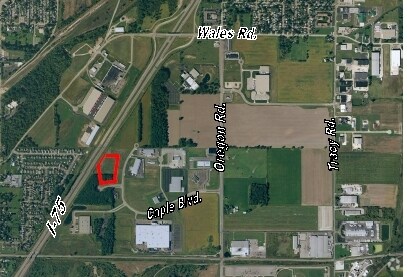
0 Rinker Pointe Ct
Toledo, OH
RINKER POINTE LOT 5
T68-300-230409005000
WOOD
Commercialacreage
Ohio
B and X Area of moderate flood hazard, usually the area between the limits of the 100-year and 500-year floods.
5
2025
2.58 AC
2025
Perrysburg/Northwood
000002
Toledo
NEARBY LISTINGS FOR SALE OR LEASE
DEMOGRAPHICS near 0 Rinker Pointe Ct
1 mile
3 mile
5 mile
2024 Total Population
3,233
44,669
148,426
2029 Population
3,214
44,895
149,584
Pop Growth 2024-2029
(0.59%)
+ 0.51%
+ 0.78%
Average Age
40
39
39
2024 Total Households
1,338
18,666
64,291
HH Growth 2024-2029
(0.60%)
+ 0.40%
+ 0.70%
Median Household Inc
$70,958
$54,240
$48,929
Avg Household Size
2.30
2.30
2.20
2024 Avg HH Vehicles
2.00
2.00
2.00
Median Home Value
$171,191
$107,504
$126,268
Median Year Built
1970
1950
1956
Nearby Places
Map Layers
Map Styles
 Street
 Aerial
Transit
 Traffic
 Biking
Places
Listings with unknown addresses are not visible on the map
- Restaurants
- Banks
- Shops
- Fitness
- Groceries
PUBLIC TRANSPORTATION
COMMUTER RAIL
Toledo (Capitol Limited - Amtrak, Lake Shore Limited - Amtrak)
Drive
Walk
Distance
Toledo (Capitol Limited - Amtrak, Lake Shore Limited - Amtrak)
12 min
5.4 mi
AIRPORT
Eugene F Kranz Toledo Express
Drive
Walk
Distance
Eugene F Kranz Toledo Express
39 min
23.1 mi
Freight Ports
Port of Toledo
Drive
Walk
Distance
Port of Toledo
21 min
8.9 mi
SALE & LEASE HISTORY
LISTING DATE
SALE/LEASE

Sep 24, 2016
For Sale
Nearby Properties
Address
Land Use
TOTAL SIZE
Lot Size
Zoning
Address
Land Use
TOTAL SIZE
Lot Size
Zoning
1,243,593 SF
42.25 AC
10-MX
Address
Land Use
TOTAL SIZE
Lot Size
Zoning
1,445,856 SF
73.62 AC
Address
Land Use
TOTAL SIZE
Lot Size
Zoning
1,085,620 SF
76.95 AC
Address
Land Use
TOTAL SIZE
Lot Size
Zoning
505,362 SF
111.51 AC
Address
Land Use
TOTAL SIZE
Lot Size
Zoning
598,713 SF
59.75 AC
Address
Land Use
TOTAL SIZE
Lot Size
Zoning
788,541 SF
45.02 AC
Address
Land Use
TOTAL SIZE
Lot Size
Zoning
497,181 SF
50.37 AC
Address
Land Use
TOTAL SIZE
Lot Size
Zoning
261,715 SF
32.11 AC
Address
Land Use
TOTAL SIZE
Lot Size
Zoning
393,343 SF
62.48 AC
10-IC
Address
Land Use
TOTAL SIZE
Lot Size
Zoning
165,710 SF
21.61 AC
Address
Land Use
TOTAL SIZE
Lot Size
Zoning
196,330 SF
7.30 AC
Address
Land Use
TOTAL SIZE
Lot Size
Zoning
211,020 SF
13.19 AC
Address
Land Use
TOTAL SIZE
Lot Size
Zoning
184,765 SF
12.91 AC
Address
Land Use
TOTAL SIZE
Lot Size
Zoning
486,615 SF
45.39 AC
Address
Land Use
TOTAL SIZE
Lot Size
Zoning
71,040 SF
34.93 AC
Address
Land Use
TOTAL SIZE
Lot Size
Zoning
92,702 SF
4.61 AC
Address
Land Use
TOTAL SIZE
Lot Size
Zoning
316,351 SF
30.65 AC
10-IC
Address
Land Use
TOTAL SIZE
Lot Size
Zoning
392,037 SF
21.94 AC
Address
Land Use
TOTAL SIZE
Lot Size
Zoning
431,435 SF
13.74 AC
Address
Land Use
TOTAL SIZE
Lot Size
Zoning
170,760 SF
51.98 AC
Address
Land Use
TOTAL SIZE
Lot Size
Zoning
226,046 SF
17.15 AC
Address
Land Use
TOTAL SIZE
Lot Size
Zoning
372,803 SF
51.86 AC
Address
Land Use
TOTAL SIZE
Lot Size
Zoning
69,007 SF
15.93 AC
Address
Land Use
TOTAL SIZE
Lot Size
Zoning
75,770 SF
2.55 AC
Address
Land Use
TOTAL SIZE
Lot Size
Zoning
75,882 SF
19.08 AC
Address
Land Use
TOTAL SIZE
Lot Size
Zoning
228,251 SF
43.08 AC
10-RD6
Address
Land Use
TOTAL SIZE
Lot Size
Zoning
145,549 SF
3.07 AC
Address
Land Use
TOTAL SIZE
Lot Size
Zoning
351,114 SF
26.32 AC
10-MX
Address
Land Use
TOTAL SIZE
Lot Size
Zoning
46,528 SF
1.75 AC
Address
Land Use
TOTAL SIZE
Lot Size
Zoning
65,683 SF
5.02 AC
10-MX
The World's #1 Commercial Real Estate Marketplace
Connect with us
© 2026 CoStar Group
The information above has been obtained from sources believed reliable. While we do not doubt its accuracy we have not verified it and make no guarantee, warranty or representation about it. It is your responsibility to independently confirm its accuracy and completeness. Any projections, opinions, assumptions, or estimates used are for example only and do not represent the current or future performance of the property. The value of this transaction to you depends on tax and other factors which should be evaluated by your tax, financial, and legal advisors. You and your advisors should conduct a careful, independent investigation of the property to determine to your satisfaction the suitability of the property for your needs.