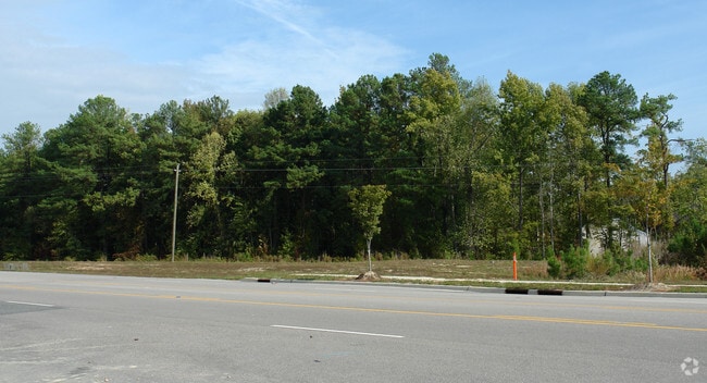
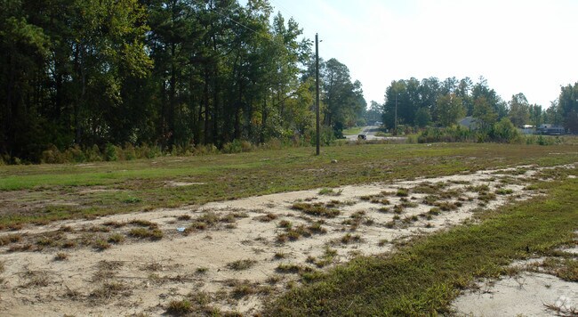
Property Record
0 Rogers Rd, Wake Forest, NC 27587

NEARBY LISTINGS FOR SALE OR LEASE
Property Detail
0 Rogers Rd
Raleigh-Cary, NC
Exempt Subdivision Plat Heritage South T
1759.01-05-3627-000
FREEMAN LD
Taxexempt
Wake
AE
North Carolina
3720175900K
23.29 AC
2025
Route 1
2025
Raleigh/Durham
054206
DEMOGRAPHICS near 0 Rogers Rd
1 mile
3 mile
5 mile
2024 Total Population
5,149
31,116
85,654
2029 Population
5,642
34,039
93,685
Pop Growth 2024-2029
+ 9.57%
+ 9.39%
+ 9.38%
Average Age
38
38
39
2024 Total Households
1,681
10,181
30,440
HH Growth 2024-2029
+ 9.64%
+ 9.37%
+ 9.38%
Median Household Inc
$127,367
$124,530
$104,452
Avg Household Size
3.00
3.00
2.80
2024 Avg HH Vehicles
2.00
2.00
2.00
Median Home Value
$424,545
$401,516
$355,859
Median Year Built
2010
2009
2006
Nearby Places
Map Layers
Map Styles
 Street
 Aerial
Transit
 Traffic
 Biking
Places
Listings with unknown addresses are not visible on the map
- Restaurants
- Banks
- Shops
- Fitness
- Groceries
PUBLIC TRANSPORTATION
AIRPORT
Raleigh-Durham International
Drive
Walk
Distance
Raleigh-Durham International
34 min
22.0 mi
Freight Ports
Virginia Port Authority - Richmond
Drive
Walk
Distance
Virginia Port Authority - Richmond
169 min
139.6 mi
Nearby Properties
Address
Land Use
TOTAL SIZE
Lot Size
Zoning
Address
Land Use
TOTAL SIZE
Lot Size
Zoning
378,421 SF
19.06 AC
RMX
Address
Land Use
TOTAL SIZE
Lot Size
Zoning
283,870 SF
11.39 AC
RMX
Address
Land Use
TOTAL SIZE
Lot Size
Zoning
263,777 SF
93.84 AC
GR3
Address
Land Use
TOTAL SIZE
Lot Size
Zoning
232,734 SF
57.28 AC
GR3
Address
Land Use
TOTAL SIZE
Lot Size
Zoning
306,050 SF
30.45 AC
GR10
Address
Land Use
TOTAL SIZE
Lot Size
Zoning
243,797 SF
22.57 AC
GR10
Address
Land Use
TOTAL SIZE
Lot Size
Zoning
248,945 SF
16.41 AC
GR10
Address
Land Use
TOTAL SIZE
Lot Size
Zoning
225,390 SF
14.95 AC
GR10
Address
Land Use
TOTAL SIZE
Lot Size
Zoning
227,653 SF
10.84 AC
TC
Address
Land Use
TOTAL SIZE
Lot Size
Zoning
162,909 SF
9.84 AC
RMX
Address
Land Use
TOTAL SIZE
Lot Size
Zoning
196,091 SF
37.21 AC
RL
Address
Land Use
TOTAL SIZE
Lot Size
Zoning
186,546 SF
6.84 AC
RMX
Address
Land Use
TOTAL SIZE
Lot Size
Zoning
166,192 SF
13.59 AC
GR10
Address
Land Use
TOTAL SIZE
Lot Size
Zoning
139,600 SF
23.64 AC
LI
Address
Land Use
TOTAL SIZE
Lot Size
Zoning
137,650 SF
36.63 AC
GR5
Address
Land Use
TOTAL SIZE
Lot Size
Zoning
100,625 SF
16.39 AC
RL
Address
Land Use
TOTAL SIZE
Lot Size
Zoning
111,616 SF
4.69 AC
NMX
Address
Land Use
TOTAL SIZE
Lot Size
Zoning
129,612 SF
42.06 AC
ICD
Address
Land Use
TOTAL SIZE
Lot Size
Zoning
115,800 SF
19.15 AC
LI
Address
Land Use
TOTAL SIZE
Lot Size
Zoning
107,082 SF
4.17 AC
RMX
Address
Land Use
TOTAL SIZE
Lot Size
Zoning
209,548 SF
31.80 AC
HB
Address
Land Use
TOTAL SIZE
Lot Size
Zoning
51,125 SF
18.99 AC
HB
Address
Land Use
TOTAL SIZE
Lot Size
Zoning
210,619 SF
18.73 AC
HB
Address
Land Use
TOTAL SIZE
Lot Size
Zoning
88,053 SF
12.16 AC
GR10
Address
Land Use
TOTAL SIZE
Lot Size
Zoning
101,307 SF
21 AC
HB
Address
Land Use
TOTAL SIZE
Lot Size
Zoning
60,618 SF
5.06 AC
HB
Address
Land Use
TOTAL SIZE
Lot Size
Zoning
71,351 SF
9.83 AC
NB
Address
Land Use
TOTAL SIZE
Lot Size
Zoning
100,813 SF
12.76 AC
NB
Address
Land Use
TOTAL SIZE
Lot Size
Zoning
74,000 SF
20 AC
R-30
Address
Land Use
TOTAL SIZE
Lot Size
Zoning
146,406 SF
30.96 AC
HI
The World's #1 Commercial Real Estate Marketplace
Connect with us
© 2026 CoStar Group
The information above has been obtained from sources believed reliable. While we do not doubt its accuracy we have not verified it and make no guarantee, warranty or representation about it. It is your responsibility to independently confirm its accuracy and completeness. Any projections, opinions, assumptions, or estimates used are for example only and do not represent the current or future performance of the property. The value of this transaction to you depends on tax and other factors which should be evaluated by your tax, financial, and legal advisors. You and your advisors should conduct a careful, independent investigation of the property to determine to your satisfaction the suitability of the property for your needs.