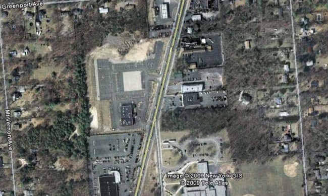
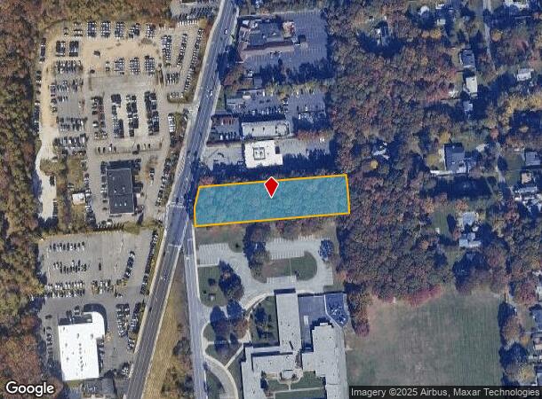
Property Record
0 Route 112, Medford, NY 11763
NEARBY LISTINGS FOR SALE OR LEASE
Property Detail
0 Route 112
Nassau County-Suffolk County, NY
Schwencke O L
0200-838-00-03-00-024-000
O L S 27 583 51 S HLF ALL 52 N 51 S
Residentialacreage
Suffolk
X
New York
36103C0695H
24
0
1.50 AC
2024
Central Suffolk
158712
Long Island (New York)
DEMOGRAPHICS near 0 Route 112
1 Mile
3 Mile
5 Mile
2024 Total Population
6,888
75,530
186,419
2029 Population
6,797
74,648
184,087
Pop Growth 2024-2029
(1.32%)
(1.17%)
(1.25%)
Average Age
41
41
41
2024 Total Households
2,043
26,210
65,298
HH Growth 2024-2029
(1.66%)
(1.45%)
(1.45%)
Median Household Inc
$118,630
$104,205
$105,459
Avg Household Size
3.10
2.70
2.70
2024 Avg HH Vehicles
2.00
2.00
2.00
Median Home Value
$419,537
$413,308
$430,074
Median Year Built
1975
1974
1974
Nearby Places
- Restaurants
- Banks
- Shops
- Fitness
- Groceries
PUBLIC TRANSPORTATION
COMMUTER RAIL
Medford Station (Greenport Branch - Long Island Rail Road)
DRIVE
WALK
Distance
Medford Station (Greenport Branch - Long Island Rail Road)
2 min
16 min
0.9 mi
Patchogue Station (Montauk Branch - Long Island Rail Road)
DRIVE
WALK
Distance
Patchogue Station (Montauk Branch - Long Island Rail Road)
8 min
3.6 mi
AIRPORT
Long Island MacArthur
DRIVE
WALK
Distance
Long Island MacArthur
15 min
7.8 mi
Freight Ports
Port of New Haven
DRIVE
WALK
Distance
Port of New Haven
130 min
48.4 mi
Nearby Properties
Address
Land Use
TOTAL SIZE
Lot Size
Zoning
Address
Land Use
TOTAL SIZE
Lot Size
Zoning
30.25 AC
CA
Address
Land Use
TOTAL SIZE
Lot Size
Zoning
42.37 AC
Address
Land Use
TOTAL SIZE
Lot Size
Zoning
19.70 AC
AA
Address
Land Use
TOTAL SIZE
Lot Size
Zoning
3,278 SF
0.51 AC
VILLA
Address
Land Use
TOTAL SIZE
Lot Size
Zoning
3,942 SF
0.45 AC
VILLA
Address
Land Use
TOTAL SIZE
Lot Size
Zoning
8.10 AC
GSC
Address
Land Use
TOTAL SIZE
Lot Size
Zoning
6,486 SF
0.55 AC
VILLA
Address
Land Use
TOTAL SIZE
Lot Size
Zoning
3,960 SF
0.72 AC
R40
Address
Land Use
TOTAL SIZE
Lot Size
Zoning
8.60 AC
IND1
Address
Land Use
TOTAL SIZE
Lot Size
Zoning
28.97 AC
Address
Land Use
TOTAL SIZE
Lot Size
Zoning
1 AC
R40
Address
Land Use
TOTAL SIZE
Lot Size
Zoning
26.20 AC
Address
Land Use
TOTAL SIZE
Lot Size
Zoning
2,880 SF
0.40 AC
VB
Address
Land Use
TOTAL SIZE
Lot Size
Zoning
Address
Land Use
TOTAL SIZE
Lot Size
Zoning
0.80 AC
CR80
Address
Land Use
TOTAL SIZE
Lot Size
Zoning
4.48 AC
IND1
Address
Land Use
TOTAL SIZE
Lot Size
Zoning
0.98 AC
CR80
Address
Land Use
TOTAL SIZE
Lot Size
Zoning
28.20 AC
AA278
Address
Land Use
TOTAL SIZE
Lot Size
Zoning
36 AC
AA
Address
Land Use
TOTAL SIZE
Lot Size
Zoning
24.50 AC
AA
Address
Land Use
TOTAL SIZE
Lot Size
Zoning
0.57 AC
CR200
Address
Land Use
TOTAL SIZE
Lot Size
Zoning
Address
Land Use
TOTAL SIZE
Lot Size
Zoning
20.30 AC
B278
Address
Land Use
TOTAL SIZE
Lot Size
Zoning
1,828 SF
0.18 AC
VILLA
Address
Land Use
TOTAL SIZE
Lot Size
Zoning
19.20 AC
AA278
Address
Land Use
TOTAL SIZE
Lot Size
Zoning
12.47 AC
Address
Land Use
TOTAL SIZE
Lot Size
Zoning
3 AC
BUS1
Address
Land Use
TOTAL SIZE
Lot Size
Zoning
38.42 AC
Address
Land Use
TOTAL SIZE
Lot Size
Zoning
16.99 AC
B278
Address
Land Use
TOTAL SIZE
Lot Size
Zoning
0.99 AC
The World's #1 Commercial Real Estate Marketplace
Connect with us
© 2025 CoStar Group
The information above has been obtained from sources believed reliable. While we do not doubt its accuracy we have not verified it and make no guarantee, warranty or representation about it. It is your responsibility to independently confirm its accuracy and completeness. Any projections, opinions, assumptions, or estimates used are for example only and do not represent the current or future performance of the property. The value of this transaction to you depends on tax and other factors which should be evaluated by your tax, financial, and legal advisors. You and your advisors should conduct a careful, independent investigation of the property to determine to your satisfaction the suitability of the property for your needs.