Property Record
6605 Santa Rosa Rd, Camarillo, CA 93012


NEARBY LISTINGS FOR SALE OR LEASE
Property Detail
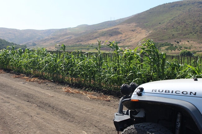
6605 Santa Rosa Rd
Oxnard-Thousand Oaks-Ventura, CA
Parcel Map
172-0-040-085
LOT: 2 REF: 016PM 048
Sfr
Ventura
X
California
06111C0951E
2
2024
1 AC
2025
Camarillo/Point Mugu
005306
Los Angeles
3,660 SF
DEMOGRAPHICS near 6605 Santa Rosa Rd
1 mile
3 mile
5 mile
2024 Total Population
8,423
38,462
106,283
2029 Population
8,355
37,954
104,486
Pop Growth 2024-2029
(0.81%)
(1.32%)
(1.69%)
Average Age
52
45
43
2024 Total Households
3,593
14,544
38,152
HH Growth 2024-2029
(0.97%)
(1.42%)
(1.81%)
Median Household Inc
$112,237
$113,089
$115,923
Avg Household Size
2.30
2.60
2.70
2024 Avg HH Vehicles
2.00
2.00
2.00
Median Home Value
$779,264
$747,258
$780,527
Median Year Built
1979
1981
1978
Nearby Places
Map Layers
Map Styles
 Street
 Aerial
Transit
 Traffic
 Biking
Places
Listings with unknown addresses are not visible on the map
- Restaurants
- Banks
- Shops
- Fitness
- Groceries
PUBLIC TRANSPORTATION
COMMUTER RAIL
Camarillo (Ventura County Line - Southern California Regional Rail Authority (Metrolink))
Drive
Walk
Distance
Camarillo (Ventura County Line - Southern California Regional Rail Authority (Metrolink))
7 min
4.1 mi
Freight Ports
The Port of Hueneme
Drive
Walk
Distance
The Port of Hueneme
26 min
15.2 mi
SALE & LEASE HISTORY
LISTING DATE
SALE/LEASE

Aug 03, 2023
For Sale
Nearby Properties
Address
Land Use
TOTAL SIZE
Lot Size
Zoning
Address
Land Use
TOTAL SIZE
Lot Size
Zoning
9.66 AC
PO
Address
Land Use
TOTAL SIZE
Lot Size
Zoning
67,766 SF
19.31 AC
M2
Address
Land Use
TOTAL SIZE
Lot Size
Zoning
45,587 SF
18.30 AC
Address
Land Use
TOTAL SIZE
Lot Size
Zoning
191,193 SF
31.89 AC
M1
Address
Land Use
TOTAL SIZE
Lot Size
Zoning
98,344 SF
7.40 AC
RPD3
Address
Land Use
TOTAL SIZE
Lot Size
Zoning
3.12 AC
Address
Land Use
TOTAL SIZE
Lot Size
Zoning
9.76 AC
Address
Land Use
TOTAL SIZE
Lot Size
Zoning
3.72 AC
CPD
Address
Land Use
TOTAL SIZE
Lot Size
Zoning
69,560 SF
3.47 AC
Address
Land Use
TOTAL SIZE
Lot Size
Zoning
Address
Land Use
TOTAL SIZE
Lot Size
Zoning
29.13 AC
Address
Land Use
TOTAL SIZE
Lot Size
Zoning
48,546 SF
4.01 AC
M1
Address
Land Use
TOTAL SIZE
Lot Size
Zoning
120,688 SF
6.44 AC
Address
Land Use
TOTAL SIZE
Lot Size
Zoning
66,716 SF
1.79 AC
Address
Land Use
TOTAL SIZE
Lot Size
Zoning
117,342 SF
7.20 AC
Address
Land Use
TOTAL SIZE
Lot Size
Zoning
134,311 SF
7.15 AC
M1
Address
Land Use
TOTAL SIZE
Lot Size
Zoning
76,037 SF
6 AC
M2
Address
Land Use
TOTAL SIZE
Lot Size
Zoning
117,112 SF
9.03 AC
M-1
Address
Land Use
TOTAL SIZE
Lot Size
Zoning
Address
Land Use
TOTAL SIZE
Lot Size
Zoning
8.49 AC
Address
Land Use
TOTAL SIZE
Lot Size
Zoning
4.79 AC
Address
Land Use
TOTAL SIZE
Lot Size
Zoning
1,455 SF
4.27 AC
L-M
Address
Land Use
TOTAL SIZE
Lot Size
Zoning
86,502 SF
5.69 AC
RPD3
Address
Land Use
TOTAL SIZE
Lot Size
Zoning
414 SF
3.18 AC
Address
Land Use
TOTAL SIZE
Lot Size
Zoning
3,397 SF
9.22 AC
Address
Land Use
TOTAL SIZE
Lot Size
Zoning
76,883 SF
3.97 AC
Address
Land Use
TOTAL SIZE
Lot Size
Zoning
6.70 AC
Address
Land Use
TOTAL SIZE
Lot Size
Zoning
110,408 SF
5.09 AC
Address
Land Use
TOTAL SIZE
Lot Size
Zoning
45,480 SF
3.15 AC
CPD
Address
Land Use
TOTAL SIZE
Lot Size
Zoning
83,104 SF
4.85 AC
M1
The World's #1 Commercial Real Estate Marketplace
Connect with us
© 2026 CoStar Group
The information above has been obtained from sources believed reliable. While we do not doubt its accuracy we have not verified it and make no guarantee, warranty or representation about it. It is your responsibility to independently confirm its accuracy and completeness. Any projections, opinions, assumptions, or estimates used are for example only and do not represent the current or future performance of the property. The value of this transaction to you depends on tax and other factors which should be evaluated by your tax, financial, and legal advisors. You and your advisors should conduct a careful, independent investigation of the property to determine to your satisfaction the suitability of the property for your needs.