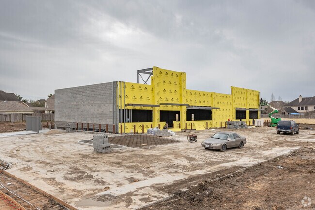
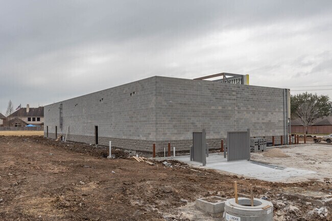
Property Record
0 Scarsdale Blvd, Houston, TX 77089
NEARBY LISTINGS FOR SALE OR LEASE
Property Detail
0 Scarsdale Blvd
Houston-The Woodlands-Sugar Land, TX
Meadows Of Clear Creek Sec 3 R/P
1240730010024
RES H BLK 1 MEADOWS OF CLEAR CREEK SEC 3 R/P
Commercialacreage
Harris
X
Texas
48167C0005G
0.77 AC
2024
Southeast Outlier
2025
Houston
350201
DEMOGRAPHICS near 0 Scarsdale Blvd
1 Mile
3 Mile
5 Mile
2024 Total Population
15,836
91,659
236,142
2029 Population
15,951
93,924
243,188
Pop Growth 2024-2029
+ 0.73%
+ 2.47%
+ 2.98%
Average Age
38
37
37
2024 Total Households
4,899
30,862
80,984
HH Growth 2024-2029
+ 0.65%
+ 2.57%
+ 3.04%
Median Household Inc
$74,999
$80,239
$73,954
Avg Household Size
3.10
2.90
2.80
2024 Avg HH Vehicles
2.00
2.00
2.00
Median Home Value
$220,946
$231,324
$225,960
Median Year Built
1981
1988
1986
Nearby Places
Map Layers
Map Styles
 Street
 Aerial
- Restaurants
- Banks
- Shops
- Fitness
- Groceries
PUBLIC TRANSPORTATION
AIRPORT
William P Hobby
DRIVE
WALK
Distance
William P Hobby
18 min
7.7 mi
George Bush Intcntl/Houston
DRIVE
WALK
Distance
George Bush Intcntl/Houston
48 min
38.3 mi
Freight Ports
Port of Houston
DRIVE
WALK
Distance
Port of Houston
24 min
15.1 mi
Nearby Properties
Address
Land Use
TOTAL SIZE
Lot Size
Zoning
Address
Land Use
TOTAL SIZE
Lot Size
Zoning
6,478,017 SF
135.61 AC
Address
Land Use
TOTAL SIZE
Lot Size
Zoning
511,000 SF
31.20 AC
Address
Land Use
TOTAL SIZE
Lot Size
Zoning
135.61 AC
Address
Land Use
TOTAL SIZE
Lot Size
Zoning
131,584 SF
25.37 AC
Address
Land Use
TOTAL SIZE
Lot Size
Zoning
334,780 SF
13.48 AC
Address
Land Use
TOTAL SIZE
Lot Size
Zoning
331,734 SF
15.82 AC
Address
Land Use
TOTAL SIZE
Lot Size
Zoning
279,627 SF
15.98 AC
Address
Land Use
TOTAL SIZE
Lot Size
Zoning
311,591 SF
13.87 AC
Address
Land Use
TOTAL SIZE
Lot Size
Zoning
277,465 SF
11.80 AC
Address
Land Use
TOTAL SIZE
Lot Size
Zoning
227,864 SF
9.83 AC
Address
Land Use
TOTAL SIZE
Lot Size
Zoning
245,028 SF
12.44 AC
Address
Land Use
TOTAL SIZE
Lot Size
Zoning
102,056 SF
5.59 AC
Address
Land Use
TOTAL SIZE
Lot Size
Zoning
262,774 SF
10.87 AC
Address
Land Use
TOTAL SIZE
Lot Size
Zoning
800,000 SF
135.61 AC
Address
Land Use
TOTAL SIZE
Lot Size
Zoning
219,424 SF
7.25 AC
Address
Land Use
TOTAL SIZE
Lot Size
Zoning
125,028 SF
5.59 AC
Address
Land Use
TOTAL SIZE
Lot Size
Zoning
203,158 SF
10 AC
Address
Land Use
TOTAL SIZE
Lot Size
Zoning
241,245 SF
9 AC
Address
Land Use
TOTAL SIZE
Lot Size
Zoning
242,528 SF
9.61 AC
Address
Land Use
TOTAL SIZE
Lot Size
Zoning
224,598 SF
11 AC
Address
Land Use
TOTAL SIZE
Lot Size
Zoning
273,091 SF
10.75 AC
Address
Land Use
TOTAL SIZE
Lot Size
Zoning
48,708 SF
3.73 AC
Address
Land Use
TOTAL SIZE
Lot Size
Zoning
152,047 SF
7.02 AC
Address
Land Use
TOTAL SIZE
Lot Size
Zoning
233,622 SF
8.60 AC
Address
Land Use
TOTAL SIZE
Lot Size
Zoning
74,952 SF
13.46 AC
Address
Land Use
TOTAL SIZE
Lot Size
Zoning
111,642 SF
9.53 AC
Address
Land Use
TOTAL SIZE
Lot Size
Zoning
173,324 SF
7.09 AC
Address
Land Use
TOTAL SIZE
Lot Size
Zoning
293,411 SF
12.46 AC
Address
Land Use
TOTAL SIZE
Lot Size
Zoning
99,042 SF
13 AC
MFRM
Address
Land Use
TOTAL SIZE
Lot Size
Zoning
173,718 SF
7.74 AC
The World's #1 Commercial Real Estate Marketplace
Connect with us
© 2025 CoStar Group
The information above has been obtained from sources believed reliable. While we do not doubt its accuracy we have not verified it and make no guarantee, warranty or representation about it. It is your responsibility to independently confirm its accuracy and completeness. Any projections, opinions, assumptions, or estimates used are for example only and do not represent the current or future performance of the property. The value of this transaction to you depends on tax and other factors which should be evaluated by your tax, financial, and legal advisors. You and your advisors should conduct a careful, independent investigation of the property to determine to your satisfaction the suitability of the property for your needs.