Property Record
Spring Valley Rd, Winterville, GA 30683

NEARBY LISTINGS FOR SALE OR LEASE
Property Detail
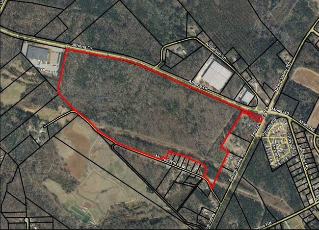
Spring Valley Rd
Athens-Clarke County, GA
Com-St-030->00-03
224C1-D-001
3.326 AC TRACT PB J/138
Industrialacreage
Clarke
X
Georgia
13059C0027E
3.33 AC
2025
Eastside Athens
2025
Other Market Areas
960204
DEMOGRAPHICS near Spring Valley Rd
1 Mile
3 Mile
5 Mile
2024 Total Population
1,616
29,262
89,481
2029 Population
1,628
29,324
90,266
Pop Growth 2024-2029
+ 0.74%
+ 0.21%
+ 0.88%
Average Age
37
34
33
2024 Total Households
576
12,096
34,580
HH Growth 2024-2029
+ 0.69%
+ 0.12%
+ 0.82%
Median Household Inc
$32,702
$40,088
$47,508
Avg Household Size
2.60
2.30
2.20
2024 Avg HH Vehicles
2.00
2.00
2.00
Median Home Value
$128,261
$174,398
$214,586
Median Year Built
1985
1989
1984
Nearby Places
- Restaurants
- Banks
- Shops
- Fitness
- Groceries
SALE & LEASE HISTORY
LISTING DATE
SALE/LEASE

Sep 24, 2016
For Sale
Nearby Properties
Address
Land Use
TOTAL SIZE
Lot Size
Zoning
Address
Land Use
TOTAL SIZE
Lot Size
Zoning
104,964 SF
40.38 AC
RM-2
Address
Land Use
TOTAL SIZE
Lot Size
Zoning
225,000 SF
98.91 AC
G
Address
Land Use
TOTAL SIZE
Lot Size
Zoning
1,403 SF
21.64 AC
C-G
Address
Land Use
TOTAL SIZE
Lot Size
Zoning
3.16 AC
E-I
Address
Land Use
TOTAL SIZE
Lot Size
Zoning
986 SF
40.54 AC
RM-1
Address
Land Use
TOTAL SIZE
Lot Size
Zoning
2,856 SF
39.78 AC
C-G
Address
Land Use
TOTAL SIZE
Lot Size
Zoning
15.29 AC
G
Address
Land Use
TOTAL SIZE
Lot Size
Zoning
2,062 SF
24.33 AC
RM-1
Address
Land Use
TOTAL SIZE
Lot Size
Zoning
28.91 AC
G
Address
Land Use
TOTAL SIZE
Lot Size
Zoning
1,624 SF
20.04 AC
RM-1
Address
Land Use
TOTAL SIZE
Lot Size
Zoning
143,200 SF
19.44 AC
RM-1
Address
Land Use
TOTAL SIZE
Lot Size
Zoning
124,959 SF
20.54 AC
E-I
Address
Land Use
TOTAL SIZE
Lot Size
Zoning
2,880 SF
36.84 AC
RM-1
Address
Land Use
TOTAL SIZE
Lot Size
Zoning
3,628 SF
6.57 AC
RM-2
Address
Land Use
TOTAL SIZE
Lot Size
Zoning
140,375 SF
26.15 AC
E-I
Address
Land Use
TOTAL SIZE
Lot Size
Zoning
46.26 AC
G
Address
Land Use
TOTAL SIZE
Lot Size
Zoning
Address
Land Use
TOTAL SIZE
Lot Size
Zoning
9,600 SF
12.71 AC
RM-2
Address
Land Use
TOTAL SIZE
Lot Size
Zoning
14,000 SF
42.62 AC
E-I
Address
Land Use
TOTAL SIZE
Lot Size
Zoning
4,392 SF
11.79 AC
C-G
Address
Land Use
TOTAL SIZE
Lot Size
Zoning
26,100 SF
18.59 AC
C-G
Address
Land Use
TOTAL SIZE
Lot Size
Zoning
71,472 SF
43.36 AC
E-I
Address
Land Use
TOTAL SIZE
Lot Size
Zoning
3,339 SF
5.91 AC
C-N
Address
Land Use
TOTAL SIZE
Lot Size
Zoning
262,387 SF
16.45 AC
E-I
Address
Land Use
TOTAL SIZE
Lot Size
Zoning
47,928 SF
80.47 AC
E-I
Address
Land Use
TOTAL SIZE
Lot Size
Zoning
16,800 SF
454.45 AC
G
Address
Land Use
TOTAL SIZE
Lot Size
Zoning
27,918 SF
16.01 AC
RM-1
Address
Land Use
TOTAL SIZE
Lot Size
Zoning
36.93 AC
G
Address
Land Use
TOTAL SIZE
Lot Size
Zoning
11,520 SF
5.03 AC
RM-2
Address
Land Use
TOTAL SIZE
Lot Size
Zoning
11,700 SF
12.05 AC
RM-2
The World's #1 Commercial Real Estate Marketplace
Connect with us
© 2025 CoStar Group
The information above has been obtained from sources believed reliable. While we do not doubt its accuracy we have not verified it and make no guarantee, warranty or representation about it. It is your responsibility to independently confirm its accuracy and completeness. Any projections, opinions, assumptions, or estimates used are for example only and do not represent the current or future performance of the property. The value of this transaction to you depends on tax and other factors which should be evaluated by your tax, financial, and legal advisors. You and your advisors should conduct a careful, independent investigation of the property to determine to your satisfaction the suitability of the property for your needs.