Property Record
0 State Highway 3, Webster, TX 77598
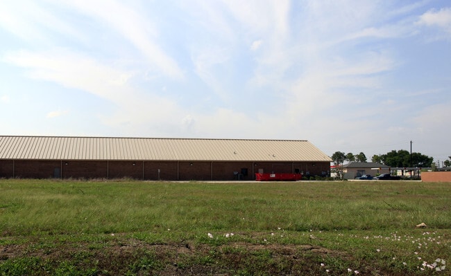

Property Detail
0 State Highway 3
1258010010001
RES A BLK 1 GATEWAY COMMUNITY CHURCH
Warehouse
HARRIS
B and X Area of moderate flood hazard, usually the area between the limits of the 100-year and 500-year floods.
Texas
0
1.92 AC
2025
NASA/Clear Lake
340900
Houston
22,026 SF
Houston-Pasadena-The Woodlands, TX
NEARBY LISTINGS FOR SALE OR LEASE
DEMOGRAPHICS near 0 State Highway 3
1 mile
3 mile
5 mile
2025 Total Population
5,660
71,763
212,607
2030 Population
5,973
76,170
225,097
Pop Growth 2025-2030
+ 5.53%
+ 6.14%
+ 5.87%
Average Age
39
39
39
2025 Total Households
2,367
28,465
80,621
HH Growth 2025-2030
+ 5.53%
+ 6.44%
+ 6.13%
Median Household Inc
$71,819
$83,695
$86,596
Avg Household Size
2.30
2.50
2.60
2025 Avg HH Vehicles
2.00
2.00
2.00
Median Home Value
$306,214
$281,533
$290,190
Median Year Built
1986
1984
1986
Nearby Places
Map Layers
Map Styles
 Street
 Aerial
Layers
 Traffic
 Biking
Places
Listings with unknown addresses are not visible on the map
- Restaurants
- Banks
- Shops
- Fitness
- Groceries
PUBLIC TRANSPORTATION
AIRPORT
William P Hobby
Drive
Walk
Distance
William P Hobby
21 min
10.4 mi
George Bush Intcntl/Houston
Drive
Walk
Distance
George Bush Intcntl/Houston
50 min
39.9 mi
Freight Ports
Port of Houston
Drive
Walk
Distance
Port of Houston
26 min
16.9 mi
Nearby Properties
Address
Land Use
TOTAL SIZE
Lot Size
Zoning
Address
Land Use
TOTAL SIZE
Lot Size
Zoning
6,478,017 SF
135.61 AC
Address
Land Use
TOTAL SIZE
Lot Size
Zoning
481,152 SF
22.69 AC
Address
Land Use
TOTAL SIZE
Lot Size
Zoning
645,535 SF
4.40 AC
Address
Land Use
TOTAL SIZE
Lot Size
Zoning
417,465 SF
61.39 AC
Address
Land Use
TOTAL SIZE
Lot Size
Zoning
585,632 SF
7.24 AC
Address
Land Use
TOTAL SIZE
Lot Size
Zoning
614,377 SF
26.06 AC
Address
Land Use
TOTAL SIZE
Lot Size
Zoning
363,876 SF
11.74 AC
Address
Land Use
TOTAL SIZE
Lot Size
Zoning
541,172 SF
25.61 AC
Address
Land Use
TOTAL SIZE
Lot Size
Zoning
511,000 SF
31.20 AC
Address
Land Use
TOTAL SIZE
Lot Size
Zoning
323,638 SF
25.17 AC
Address
Land Use
TOTAL SIZE
Lot Size
Zoning
345,470 SF
9.06 AC
Address
Land Use
TOTAL SIZE
Lot Size
Zoning
282,860 SF
8.67 AC
Address
Land Use
TOTAL SIZE
Lot Size
Zoning
185,172 SF
4.15 AC
Address
Land Use
TOTAL SIZE
Lot Size
Zoning
166,816 SF
18.55 AC
Address
Land Use
TOTAL SIZE
Lot Size
Zoning
298,296 SF
13.31 AC
Address
Land Use
TOTAL SIZE
Lot Size
Zoning
135.61 AC
Address
Land Use
TOTAL SIZE
Lot Size
Zoning
335,315 SF
20 AC
Address
Land Use
TOTAL SIZE
Lot Size
Zoning
131,584 SF
25.37 AC
Address
Land Use
TOTAL SIZE
Lot Size
Zoning
232,156 SF
22.84 AC
Address
Land Use
TOTAL SIZE
Lot Size
Zoning
376,153 SF
40.01 AC
Address
Land Use
TOTAL SIZE
Lot Size
Zoning
114,538 SF
4.65 AC
Address
Land Use
TOTAL SIZE
Lot Size
Zoning
129,764 SF
14.85 AC
Address
Land Use
TOTAL SIZE
Lot Size
Zoning
275,775 SF
8.54 AC
Address
Land Use
TOTAL SIZE
Lot Size
Zoning
311,591 SF
13.87 AC
Address
Land Use
TOTAL SIZE
Lot Size
Zoning
277,465 SF
11.80 AC
Address
Land Use
TOTAL SIZE
Lot Size
Zoning
233,324 SF
9.71 AC
Address
Land Use
TOTAL SIZE
Lot Size
Zoning
102,056 SF
5.59 AC
Address
Land Use
TOTAL SIZE
Lot Size
Zoning
108,292 SF
12.81 AC
Address
Land Use
TOTAL SIZE
Lot Size
Zoning
81,413 SF
4.84 AC
Address
Land Use
TOTAL SIZE
Lot Size
Zoning
800,000 SF
135.61 AC
The World's #1 Commercial Real Estate Marketplace
Connect with us
© 2026 CoStar Group
The information above has been obtained from sources believed reliable. While we do not doubt its accuracy we have not verified it and make no guarantee, warranty or representation about it. It is your responsibility to independently confirm its accuracy and completeness. Any projections, opinions, assumptions, or estimates used are for example only and do not represent the current or future performance of the property. The value of this transaction to you depends on tax and other factors which should be evaluated by your tax, financial, and legal advisors. You and your advisors should conduct a careful, independent investigation of the property to determine to your satisfaction the suitability of the property for your needs.