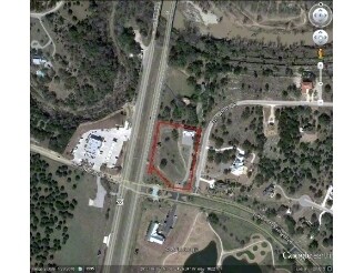
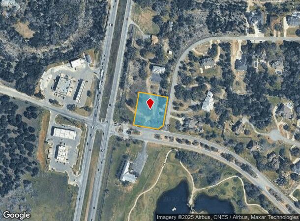
Property Record
0 Tbd, Spring Branch, TX 78070

NEARBY LISTINGS FOR SALE OR LEASE
Property Detail
0 Tbd
San Antonio-New Braunfels, TX
River Crossing 5
45-0712-0874-00
RIVER CROSSING 5, LOT 874
Vacantlandnec
Comal
X
Texas
48259C0475F
874
2024
1.05 AC
2025
Comal County
310610
San Antonio
DEMOGRAPHICS near 0 Tbd
1 Mile
3 Mile
5 Mile
2024 Total Population
856
6,813
15,874
2029 Population
1,170
9,315
21,765
Pop Growth 2024-2029
+ 36.68%
+ 36.72%
+ 37.11%
Average Age
44
43
43
2024 Total Households
312
2,460
5,771
HH Growth 2024-2029
+ 36.54%
+ 36.50%
+ 36.94%
Median Household Inc
$156,111
$127,935
$115,610
Avg Household Size
2.70
2.70
2.70
2024 Avg HH Vehicles
3.00
3.00
2.00
Median Home Value
$608,024
$549,207
$492,525
Median Year Built
2006
2004
2004
Nearby Places
Map Layers
Map Styles
 Street
 Aerial
- Restaurants
- Banks
- Shops
- Fitness
- Groceries
PUBLIC TRANSPORTATION
AIRPORT
San Antonio International
DRIVE
WALK
Distance
San Antonio International
29 min
24.1 mi
Freight Ports
Calhoun Port
DRIVE
WALK
Distance
Calhoun Port
206 min
172.8 mi
Nearby Properties
Address
Land Use
TOTAL SIZE
Lot Size
Zoning
Address
Land Use
TOTAL SIZE
Lot Size
Zoning
53,381 SF
15.01 AC
Address
Land Use
TOTAL SIZE
Lot Size
Zoning
1,800 SF
6.12 AC
Address
Land Use
TOTAL SIZE
Lot Size
Zoning
3,200 SF
2.26 AC
Address
Land Use
TOTAL SIZE
Lot Size
Zoning
99,412 SF
8.01 AC
Address
Land Use
TOTAL SIZE
Lot Size
Zoning
30,398 SF
5.49 AC
Address
Land Use
TOTAL SIZE
Lot Size
Zoning
23,561 SF
122.24 AC
Address
Land Use
TOTAL SIZE
Lot Size
Zoning
1,792 SF
5 AC
Address
Land Use
TOTAL SIZE
Lot Size
Zoning
10,968 SF
20 AC
Address
Land Use
TOTAL SIZE
Lot Size
Zoning
8,470 SF
6.17 AC
Address
Land Use
TOTAL SIZE
Lot Size
Zoning
9,796 SF
2.81 AC
Address
Land Use
TOTAL SIZE
Lot Size
Zoning
20,000 SF
12.24 AC
Address
Land Use
TOTAL SIZE
Lot Size
Zoning
153.87 AC
Address
Land Use
TOTAL SIZE
Lot Size
Zoning
10,881 SF
2.94 AC
Address
Land Use
TOTAL SIZE
Lot Size
Zoning
3,828 SF
5.02 AC
Address
Land Use
TOTAL SIZE
Lot Size
Zoning
40.32 AC
Address
Land Use
TOTAL SIZE
Lot Size
Zoning
10,238 SF
4.99 AC
Address
Land Use
TOTAL SIZE
Lot Size
Zoning
17,121 SF
5.03 AC
Address
Land Use
TOTAL SIZE
Lot Size
Zoning
5,118 SF
2.93 AC
Address
Land Use
TOTAL SIZE
Lot Size
Zoning
17,500 SF
2.83 AC
Address
Land Use
TOTAL SIZE
Lot Size
Zoning
3,040 SF
9.10 AC
Address
Land Use
TOTAL SIZE
Lot Size
Zoning
1,488 SF
51.22 AC
Address
Land Use
TOTAL SIZE
Lot Size
Zoning
21,334 SF
2 AC
Address
Land Use
TOTAL SIZE
Lot Size
Zoning
9,856 SF
1.90 AC
Address
Land Use
TOTAL SIZE
Lot Size
Zoning
18,027 SF
4 AC
Address
Land Use
TOTAL SIZE
Lot Size
Zoning
16,123 SF
1.79 AC
Address
Land Use
TOTAL SIZE
Lot Size
Zoning
10,128 SF
1.61 AC
Address
Land Use
TOTAL SIZE
Lot Size
Zoning
6,638 SF
1.70 AC
Address
Land Use
TOTAL SIZE
Lot Size
Zoning
Address
Land Use
TOTAL SIZE
Lot Size
Zoning
4,958 SF
2.13 AC
Address
Land Use
TOTAL SIZE
Lot Size
Zoning
10,560 SF
0.51 AC
The World's #1 Commercial Real Estate Marketplace
Connect with us
© 2026 CoStar Group
The information above has been obtained from sources believed reliable. While we do not doubt its accuracy we have not verified it and make no guarantee, warranty or representation about it. It is your responsibility to independently confirm its accuracy and completeness. Any projections, opinions, assumptions, or estimates used are for example only and do not represent the current or future performance of the property. The value of this transaction to you depends on tax and other factors which should be evaluated by your tax, financial, and legal advisors. You and your advisors should conduct a careful, independent investigation of the property to determine to your satisfaction the suitability of the property for your needs.