Property Record
0 Unknown, Airway Heights, WA 99001
NEARBY LISTINGS FOR SALE OR LEASE
-
-
-
-
-
-
Hwy 2 Between Russell St & Garfield Rd
Airway Heights, WA 99001
$1,055,530 - $5,917,250
4.85 - 8.72 AC Lot
Land
-
-
-
-
-
View all Airway Heights listings for sale on LoopNet.com
Property Detail
0 Unknown
15232.0903
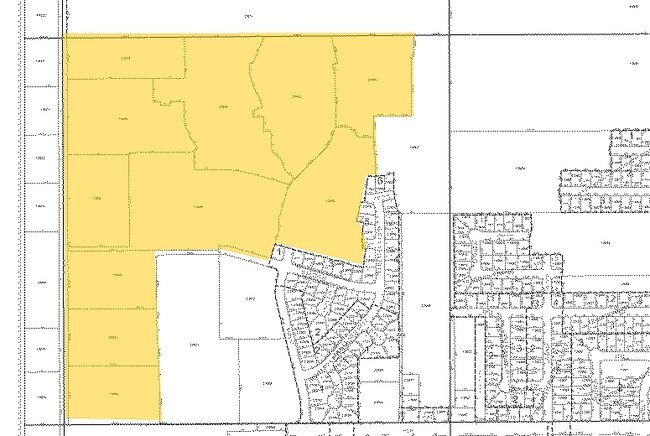
23-25-41 PTN OF NW1/4 DAF: COMMENCING AT CTR 1/4 COR TH N895837W 1960.49FT ALG N ROW LN OF 6TH AVE TO TRUE POB TH N895837W 653.51FT TO PT OF INTER W/ E ROW LN OF CRAIG RD TH N001305E 404.04FT TH S895837E 618.91FT TO PT OF NON-TANGENT CURVE TO RIGHT T
Vacantlandnec
Spokane
X
Washington
53063C0525D
4.91 AC
2025
West Plains
2025
Spokane
010401
Spokane-Spokane Valley, WA
DEMOGRAPHICS near 0 Unknown
1 Mile
3 Mile
5 Mile
2024 Total Population
6,202
16,544
22,300
2029 Population
6,825
17,795
23,977
Pop Growth 2024-2029
+ 10.05%
+ 7.56%
+ 7.52%
Average Age
34
36
36
2024 Total Households
2,255
5,247
7,293
HH Growth 2024-2029
+ 9.93%
+ 8.02%
+ 7.87%
Median Household Inc
$63,739
$60,437
$63,650
Avg Household Size
2.80
2.60
2.60
2024 Avg HH Vehicles
2.00
2.00
2.00
Median Home Value
$286,745
$323,125
$346,624
Median Year Built
2010
2004
2002
Nearby Places
Map Layers
Map Styles
 Street
 Aerial
- Restaurants
- Banks
- Shops
- Fitness
- Groceries
PUBLIC TRANSPORTATION
AIRPORT
Spokane International
DRIVE
WALK
Distance
Spokane International
16 min
7.0 mi
Freight Ports
Port of Everett
DRIVE
WALK
Distance
Port of Everett
340 min
299.7 mi
Nearby Properties
Address
Land Use
TOTAL SIZE
Lot Size
Zoning
Address
Land Use
TOTAL SIZE
Lot Size
Zoning
884,262 SF
152.68 AC
PUBLIC
Address
Land Use
TOTAL SIZE
Lot Size
Zoning
1,180,186 SF
22.94 AC
TRIBAL
Address
Land Use
TOTAL SIZE
Lot Size
Zoning
534,093 SF
113 AC
TRIBAL
Address
Land Use
TOTAL SIZE
Lot Size
Zoning
375,237 SF
138.63 AC
TRIBAL
Address
Land Use
TOTAL SIZE
Lot Size
Zoning
274,308 SF
13 AC
R-3
Address
Land Use
TOTAL SIZE
Lot Size
Zoning
191,286 SF
10.81 AC
R-3
Address
Land Use
TOTAL SIZE
Lot Size
Zoning
218,400 SF
14.69 AC
Address
Land Use
TOTAL SIZE
Lot Size
Zoning
187,000 SF
12.43 AC
I-2
Address
Land Use
TOTAL SIZE
Lot Size
Zoning
80,000 SF
637.27 AC
Address
Land Use
TOTAL SIZE
Lot Size
Zoning
149,942 SF
8.27 AC
R-3
Address
Land Use
TOTAL SIZE
Lot Size
Zoning
164,522 SF
19.37 AC
Address
Land Use
TOTAL SIZE
Lot Size
Zoning
59,171 SF
10.12 AC
Address
Land Use
TOTAL SIZE
Lot Size
Zoning
104,889 SF
21.60 AC
LI
Address
Land Use
TOTAL SIZE
Lot Size
Zoning
80,000 SF
95.50 AC
Address
Land Use
TOTAL SIZE
Lot Size
Zoning
183,750 SF
21.40 AC
I-2
Address
Land Use
TOTAL SIZE
Lot Size
Zoning
387,963 SF
49.93 AC
LI
Address
Land Use
TOTAL SIZE
Lot Size
Zoning
46,520 SF
70 AC
I-1
Address
Land Use
TOTAL SIZE
Lot Size
Zoning
58,548 SF
107.94 AC
Address
Land Use
TOTAL SIZE
Lot Size
Zoning
80,000 SF
28.64 AC
Address
Land Use
TOTAL SIZE
Lot Size
Zoning
80,000 SF
25.91 AC
Address
Land Use
TOTAL SIZE
Lot Size
Zoning
287,334 SF
39.24 AC
I-2
Address
Land Use
TOTAL SIZE
Lot Size
Zoning
152,130 SF
35.26 AC
I-2
Address
Land Use
TOTAL SIZE
Lot Size
Zoning
80,000 SF
49.70 AC
Address
Land Use
TOTAL SIZE
Lot Size
Zoning
150,267 SF
8.13 AC
LI
Address
Land Use
TOTAL SIZE
Lot Size
Zoning
112,672 SF
4.43 AC
Address
Land Use
TOTAL SIZE
Lot Size
Zoning
77,515 SF
4.70 AC
Address
Land Use
TOTAL SIZE
Lot Size
Zoning
86,361 SF
4.85 AC
R-3
Address
Land Use
TOTAL SIZE
Lot Size
Zoning
70,404 SF
61.69 AC
Address
Land Use
TOTAL SIZE
Lot Size
Zoning
41,340 SF
6.88 AC
Address
Land Use
TOTAL SIZE
Lot Size
Zoning
38,832 SF
6.75 AC
The World's #1 Commercial Real Estate Marketplace
Connect with us
© 2025 CoStar Group
The information above has been obtained from sources believed reliable. While we do not doubt its accuracy we have not verified it and make no guarantee, warranty or representation about it. It is your responsibility to independently confirm its accuracy and completeness. Any projections, opinions, assumptions, or estimates used are for example only and do not represent the current or future performance of the property. The value of this transaction to you depends on tax and other factors which should be evaluated by your tax, financial, and legal advisors. You and your advisors should conduct a careful, independent investigation of the property to determine to your satisfaction the suitability of the property for your needs.