Property Record
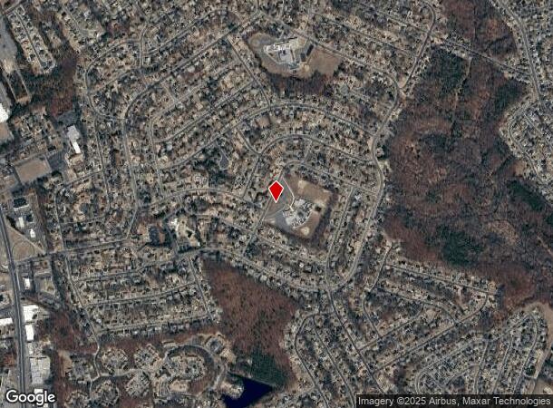
Us Highway 9, Howell, NJ 07731
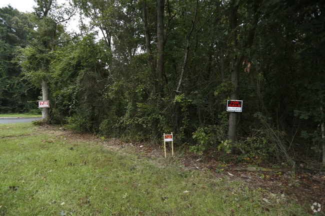
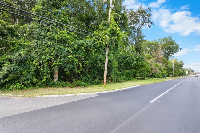
This Property Is For Sale
NEARBY LISTINGS FOR SALE OR LEASE
Property Detail
Us Highway 9
Lakewood-New Brunswick, NJ
Freewood Acres Sec #1
21-00110-0000-00003
Monmouth
Vacantlandnec
New Jersey
X
3
34025C0311F
0.46 AC
2024
Western Monmouth
2025
Northern New Jersey
811402
DEMOGRAPHICS near Us Highway 9
1 mile
3 mile
5 mile
2024 Total Population
3,904
41,171
94,867
2029 Population
3,882
41,207
96,188
Pop Growth 2024-2029
(0.56%)
+ 0.09%
+ 1.39%
Average Age
42
41
39
2024 Total Households
1,373
14,052
31,707
HH Growth 2024-2029
(0.66%)
(0.43%)
+ 0.82%
Median Household Inc
$97,880
$117,334
$103,781
Avg Household Size
2.70
2.80
2.80
2024 Avg HH Vehicles
2.00
2.00
2.00
Median Home Value
$417,114
$397,942
$409,462
Median Year Built
1985
1982
1982
Nearby Places
Map Layers
Map Styles
 Street
 Aerial
Transit
 Traffic
 Biking
Places
Listings with unknown addresses are not visible on the map
- Restaurants
- Banks
- Shops
- Fitness
- Groceries
Nearby Properties
Address
Land Use
TOTAL SIZE
Lot Size
Zoning
Address
Land Use
TOTAL SIZE
Lot Size
Zoning
24.15 AC
MF
Address
Land Use
TOTAL SIZE
Lot Size
Zoning
36,678 SF
38.75 AC
MFAH
Address
Land Use
TOTAL SIZE
Lot Size
Zoning
105.04 AC
SED
Address
Land Use
TOTAL SIZE
Lot Size
Zoning
161,340 SF
35.35 AC
HD-1
Address
Land Use
TOTAL SIZE
Lot Size
Zoning
25.63 AC
HD-1
Address
Land Use
TOTAL SIZE
Lot Size
Zoning
21,876 SF
22.26 AC
B3
Address
Land Use
TOTAL SIZE
Lot Size
Zoning
14.90 AC
PFE
Address
Land Use
TOTAL SIZE
Lot Size
Zoning
28.99 AC
HD-1
Address
Land Use
TOTAL SIZE
Lot Size
Zoning
14.73 AC
R-5
Address
Land Use
TOTAL SIZE
Lot Size
Zoning
37,202 SF
14.79 AC
B3
Address
Land Use
TOTAL SIZE
Lot Size
Zoning
8,784 SF
16.16 AC
R-LM
Address
Land Use
TOTAL SIZE
Lot Size
Zoning
360,400 SF
35.98 AC
SED
Address
Land Use
TOTAL SIZE
Lot Size
Zoning
98,731 SF
13.65 AC
HD
Address
Land Use
TOTAL SIZE
Lot Size
Zoning
83,396 SF
9.51 AC
R15
Address
Land Use
TOTAL SIZE
Lot Size
Zoning
141,437 SF
13.35 AC
HD-1
Address
Land Use
TOTAL SIZE
Lot Size
Zoning
125,379 SF
22.16 AC
HD
Address
Land Use
TOTAL SIZE
Lot Size
Zoning
51,531 SF
13.30 AC
HD
Address
Land Use
TOTAL SIZE
Lot Size
Zoning
24,630 SF
6.93 AC
HD-1
Address
Land Use
TOTAL SIZE
Lot Size
Zoning
1,124 SF
7.80 AC
B4
Address
Land Use
TOTAL SIZE
Lot Size
Zoning
13,350 SF
71.10 AC
ARE6
Address
Land Use
TOTAL SIZE
Lot Size
Zoning
94,480 SF
11.11 AC
HD-1
Address
Land Use
TOTAL SIZE
Lot Size
Zoning
5.08 AC
NC
Address
Land Use
TOTAL SIZE
Lot Size
Zoning
123,578 SF
9.28 AC
HD-1
Address
Land Use
TOTAL SIZE
Lot Size
Zoning
66,768 SF
10.90 AC
ARE2
Address
Land Use
TOTAL SIZE
Lot Size
Zoning
8.96 AC
HD
Address
Land Use
TOTAL SIZE
Lot Size
Zoning
6.59 AC
B3
Address
Land Use
TOTAL SIZE
Lot Size
Zoning
52,985 SF
20.92 AC
HD-1
Address
Land Use
TOTAL SIZE
Lot Size
Zoning
52,692 SF
4.67 AC
B3
Address
Land Use
TOTAL SIZE
Lot Size
Zoning
46,490 SF
3.72 AC
B3
Address
Land Use
TOTAL SIZE
Lot Size
Zoning
35.06 AC
HD-1
The World's #1 Commercial Real Estate Marketplace
Connect with us
© 2026 CoStar Group
The information above has been obtained from sources believed reliable. While we do not doubt its accuracy we have not verified it and make no guarantee, warranty or representation about it. It is your responsibility to independently confirm its accuracy and completeness. Any projections, opinions, assumptions, or estimates used are for example only and do not represent the current or future performance of the property. The value of this transaction to you depends on tax and other factors which should be evaluated by your tax, financial, and legal advisors. You and your advisors should conduct a careful, independent investigation of the property to determine to your satisfaction the suitability of the property for your needs.