Property Record
122 Valley Ridge Blvd, Ponte Vedra, FL 32081

NEARBY LISTINGS FOR SALE OR LEASE
Property Detail
122 Valley Ridge Blvd
Jacksonville, FL
Greenleaf Village At Nocatee Phase 3
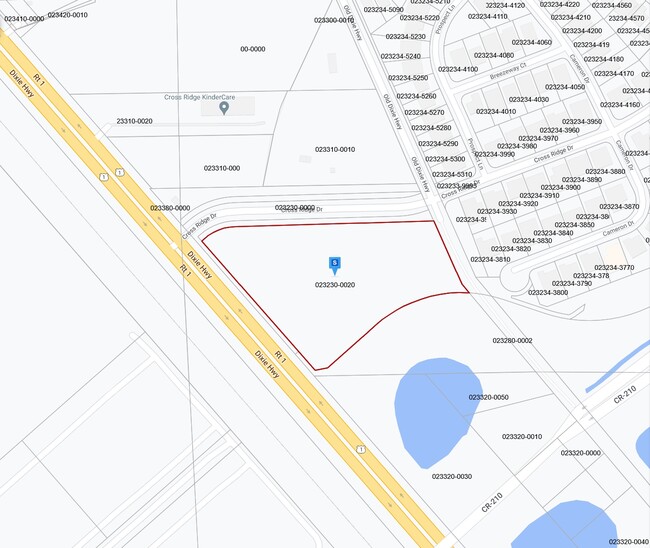
023230-0020
2-2 PTS OF SECS 1 2 & 3 LYING N OF VALLEY RIDGE BLVD E OF US 1 & S OF NOCATEE PKWY - BEING SANDY RIDGE VILLAGE & SANDY RIDGE VILLAGE PARCELS 2A & 2B (EX GREENLEAF RDWY TO CDD IN OR3339/228) (EX PT OR3365/ 454) (EX PT PLAT MB66/58-65 GREENLEAF VILLAGE
Marshland
St. Johns
X
Florida
12109C0180J
137
2023
2.71 AC
2025
St Johns County
020605
Jacksonville (Florida)
DEMOGRAPHICS near 122 Valley Ridge Blvd
1 Mile
3 Mile
5 Mile
2024 Total Population
3,405
28,484
80,031
2029 Population
4,531
36,675
101,057
Pop Growth 2024-2029
+ 33.07%
+ 28.76%
+ 26.27%
Average Age
35
38
38
2024 Total Households
1,093
10,002
28,675
HH Growth 2024-2029
+ 33.12%
+ 28.58%
+ 25.13%
Median Household Inc
$126,596
$119,952
$116,972
Avg Household Size
3.10
2.80
2.80
2024 Avg HH Vehicles
2.00
2.00
2.00
Median Home Value
$420,454
$417,340
$420,322
Median Year Built
2010
2011
2011
Nearby Places
Map Layers
Map Styles
 Street
 Aerial
- Restaurants
- Banks
- Shops
- Fitness
- Groceries
PUBLIC TRANSPORTATION
AIRPORT
Jacksonville International
DRIVE
WALK
Distance
Jacksonville International
50 min
36.4 mi
Freight Ports
Jacksonville Port
DRIVE
WALK
Distance
Jacksonville Port
40 min
26.6 mi
Nearby Properties
Address
Land Use
TOTAL SIZE
Lot Size
Zoning
Address
Land Use
TOTAL SIZE
Lot Size
Zoning
357,256 SF
16.28 AC
PUD
Address
Land Use
TOTAL SIZE
Lot Size
Zoning
663,789 SF
70.22 AC
Address
Land Use
TOTAL SIZE
Lot Size
Zoning
211,499 SF
74.05 AC
Address
Land Use
TOTAL SIZE
Lot Size
Zoning
246,901 SF
14.02 AC
PUD
Address
Land Use
TOTAL SIZE
Lot Size
Zoning
300,726 SF
11.99 AC
Address
Land Use
TOTAL SIZE
Lot Size
Zoning
378,384 SF
21 AC
Address
Land Use
TOTAL SIZE
Lot Size
Zoning
141,912 SF
5.02 AC
PUD
Address
Land Use
TOTAL SIZE
Lot Size
Zoning
117,288 SF
6.69 AC
PUD
Address
Land Use
TOTAL SIZE
Lot Size
Zoning
265,356 SF
23.72 AC
PUD
Address
Land Use
TOTAL SIZE
Lot Size
Zoning
159,391 SF
36.52 AC
PUD
Address
Land Use
TOTAL SIZE
Lot Size
Zoning
283,584 SF
22.06 AC
Address
Land Use
TOTAL SIZE
Lot Size
Zoning
270,101 SF
20.03 AC
Address
Land Use
TOTAL SIZE
Lot Size
Zoning
10.63 AC
Address
Land Use
TOTAL SIZE
Lot Size
Zoning
176,798 SF
6.53 AC
Address
Land Use
TOTAL SIZE
Lot Size
Zoning
67,092 SF
10.31 AC
PUD
Address
Land Use
TOTAL SIZE
Lot Size
Zoning
156,099 SF
18.52 AC
Address
Land Use
TOTAL SIZE
Lot Size
Zoning
226,903 SF
90.16 AC
OR
Address
Land Use
TOTAL SIZE
Lot Size
Zoning
172,450 SF
24.12 AC
PUD
Address
Land Use
TOTAL SIZE
Lot Size
Zoning
90,443 SF
11.99 AC
Address
Land Use
TOTAL SIZE
Lot Size
Zoning
90,186 SF
16.13 AC
PUD
Address
Land Use
TOTAL SIZE
Lot Size
Zoning
58,601 SF
8.56 AC
Address
Land Use
TOTAL SIZE
Lot Size
Zoning
77,667 SF
4.64 AC
Address
Land Use
TOTAL SIZE
Lot Size
Zoning
33,606 SF
35.56 AC
PUD
Address
Land Use
TOTAL SIZE
Lot Size
Zoning
62,706 SF
9.85 AC
PUD
Address
Land Use
TOTAL SIZE
Lot Size
Zoning
64,525 SF
6.91 AC
PUD
Address
Land Use
TOTAL SIZE
Lot Size
Zoning
62,706 SF
4.62 AC
PUD
Address
Land Use
TOTAL SIZE
Lot Size
Zoning
71,205 SF
9.45 AC
PUD
Address
Land Use
TOTAL SIZE
Lot Size
Zoning
53,805 SF
5.37 AC
Address
Land Use
TOTAL SIZE
Lot Size
Zoning
38,250 SF
21.99 AC
PUD
Address
Land Use
TOTAL SIZE
Lot Size
Zoning
12.58 AC
PUD
The World's #1 Commercial Real Estate Marketplace
Connect with us
© 2026 CoStar Group
The information above has been obtained from sources believed reliable. While we do not doubt its accuracy we have not verified it and make no guarantee, warranty or representation about it. It is your responsibility to independently confirm its accuracy and completeness. Any projections, opinions, assumptions, or estimates used are for example only and do not represent the current or future performance of the property. The value of this transaction to you depends on tax and other factors which should be evaluated by your tax, financial, and legal advisors. You and your advisors should conduct a careful, independent investigation of the property to determine to your satisfaction the suitability of the property for your needs.