Property Record
Airport Rd, Andrews, NC 28901
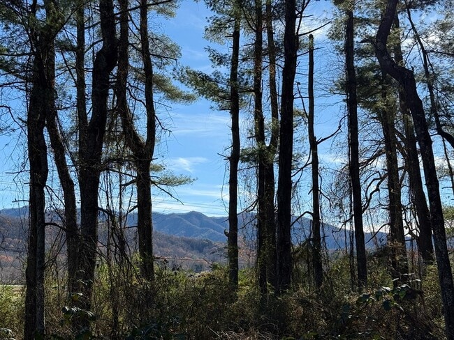
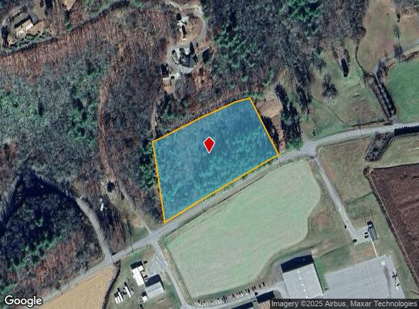
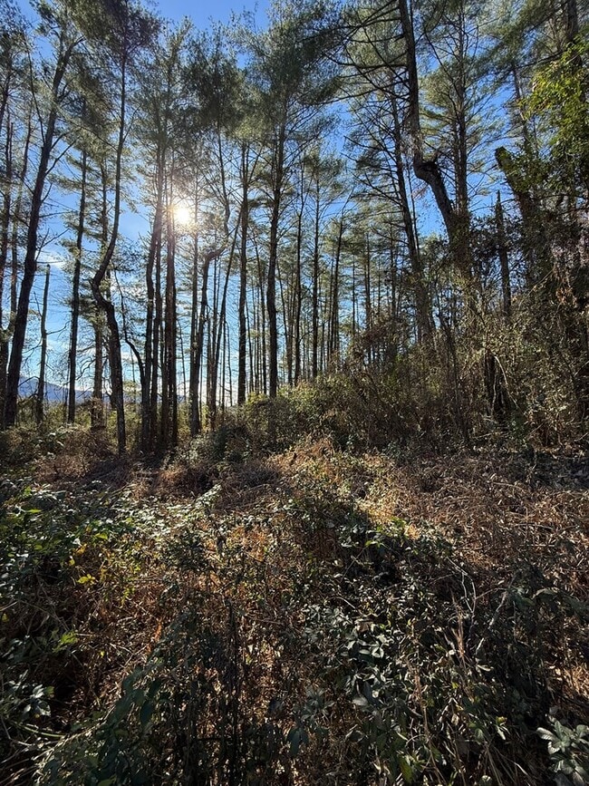
This Property Is For Sale
NEARBY LISTINGS FOR SALE OR LEASE
Property Detail
Airport Rd
5546-04-82-0948-000
Burnt Branch Subdivision
Residentialacreage
FR HEATON 1387/958 1578/607
X
Cherokee
3700554600J
North Carolina
2025
4.34 AC
2025
North Carolina West/Cherokee Area
930101
Other Market Areas
DEMOGRAPHICS near Airport Rd
1 Mile
3 Mile
5 Mile
2024 Total Population
118
3,518
5,313
2029 Population
117
3,563
5,361
Pop Growth 2024-2029
(0.85%)
+ 1.28%
+ 0.90%
Average Age
45
44
44
2024 Total Households
50
1,469
2,210
HH Growth 2024-2029
(2.00%)
+ 1.09%
+ 0.77%
Median Household Inc
$48,749
$45,268
$45,078
Avg Household Size
2.40
2.30
2.30
2024 Avg HH Vehicles
2.00
2.00
2.00
Median Home Value
$207,143
$169,413
$177,593
Median Year Built
1989
1986
1985
Nearby Places
- Restaurants
- Banks
- Shops
- Fitness
- Groceries
Nearby Properties
Address
Land Use
TOTAL SIZE
Lot Size
Zoning
Address
Land Use
TOTAL SIZE
Lot Size
Zoning
81.11 AC
Address
Land Use
TOTAL SIZE
Lot Size
Zoning
19,068 SF
54.78 AC
Address
Land Use
TOTAL SIZE
Lot Size
Zoning
23,272 SF
6.13 AC
GR
Address
Land Use
TOTAL SIZE
Lot Size
Zoning
3,000 SF
30 AC
Address
Land Use
TOTAL SIZE
Lot Size
Zoning
24,796 SF
8.06 AC
SF
Address
Land Use
TOTAL SIZE
Lot Size
Zoning
51,383 SF
7.52 AC
SF
Address
Land Use
TOTAL SIZE
Lot Size
Zoning
11,232 SF
11.04 AC
HB
Address
Land Use
TOTAL SIZE
Lot Size
Zoning
10,307 SF
1.38 AC
HB
Address
Land Use
TOTAL SIZE
Lot Size
Zoning
1,040 SF
85.94 AC
Address
Land Use
TOTAL SIZE
Lot Size
Zoning
8,646 SF
0.64 AC
CB
Address
Land Use
TOTAL SIZE
Lot Size
Zoning
17.15 AC
Address
Land Use
TOTAL SIZE
Lot Size
Zoning
34,056 SF
8.66 AC
HB
Address
Land Use
TOTAL SIZE
Lot Size
Zoning
23,348 SF
7.50 AC
GR
Address
Land Use
TOTAL SIZE
Lot Size
Zoning
7,676 SF
4.88 AC
GR
Address
Land Use
TOTAL SIZE
Lot Size
Zoning
93,677 SF
57.85 AC
HC-I
Address
Land Use
TOTAL SIZE
Lot Size
Zoning
22,874 SF
3.05 AC
HB
Address
Land Use
TOTAL SIZE
Lot Size
Zoning
9,600 SF
0.99 AC
CB
Address
Land Use
TOTAL SIZE
Lot Size
Zoning
29.27 AC
Address
Land Use
TOTAL SIZE
Lot Size
Zoning
12,540 SF
18.12 AC
Address
Land Use
TOTAL SIZE
Lot Size
Zoning
2,400 SF
44.58 AC
Address
Land Use
TOTAL SIZE
Lot Size
Zoning
12,746 SF
1.43 AC
CB
Address
Land Use
TOTAL SIZE
Lot Size
Zoning
38,880 SF
6.99 AC
HB
Address
Land Use
TOTAL SIZE
Lot Size
Zoning
8,640 SF
11.05 AC
Address
Land Use
TOTAL SIZE
Lot Size
Zoning
5,588 SF
0.69 AC
HB
Address
Land Use
TOTAL SIZE
Lot Size
Zoning
12,000 SF
8.19 AC
HB
Address
Land Use
TOTAL SIZE
Lot Size
Zoning
3,776 SF
0.63 AC
CB
Address
Land Use
TOTAL SIZE
Lot Size
Zoning
6,476 SF
0.31 AC
CB
Address
Land Use
TOTAL SIZE
Lot Size
Zoning
8,800 SF
4.11 AC
Address
Land Use
TOTAL SIZE
Lot Size
Zoning
7,087 SF
1.35 AC
HB
Address
Land Use
TOTAL SIZE
Lot Size
Zoning
3,042 SF
1.59 AC
HB
The World's #1 Commercial Real Estate Marketplace
Connect with us
© 2025 CoStar Group
The information above has been obtained from sources believed reliable. While we do not doubt its accuracy we have not verified it and make no guarantee, warranty or representation about it. It is your responsibility to independently confirm its accuracy and completeness. Any projections, opinions, assumptions, or estimates used are for example only and do not represent the current or future performance of the property. The value of this transaction to you depends on tax and other factors which should be evaluated by your tax, financial, and legal advisors. You and your advisors should conduct a careful, independent investigation of the property to determine to your satisfaction the suitability of the property for your needs.