Property Record
Hampton Branch Rd, Topton, NC 28781
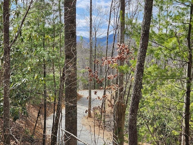
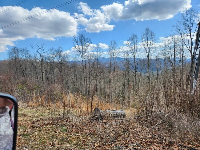
This Property Is For Sale
NEARBY LISTINGS FOR SALE OR LEASE
-
-
View all Topton listings for sale on LoopNet.com
Property Detail
Hampton Branch Rd
Other Market Areas
LOT 2 HAMPTON BRANCH RD
6518669100
Macon
Residentialacreage
North Carolina
2025
2
2025
5.01 AC
970200
North Carolina West/Cherokee Area
DEMOGRAPHICS near Hampton Branch Rd
1 Mile
3 Mile
5 Mile
2024 Total Population
155
655
1,441
2029 Population
174
730
1,582
Pop Growth 2024-2029
+ 12.26%
+ 11.45%
+ 9.78%
Average Age
50
49
49
2024 Total Households
72
298
642
HH Growth 2024-2029
+ 12.50%
+ 11.74%
+ 10.12%
Median Household Inc
$51,667
$53,214
$51,667
Avg Household Size
2.20
2.20
2.20
2024 Avg HH Vehicles
2.00
2.00
2.00
Median Home Value
$278,571
$268,181
$258,749
Median Year Built
1988
1987
1986
Nearby Places
Map Layers
Map Styles
 Street
 Aerial
- Restaurants
- Banks
- Shops
- Fitness
- Groceries
Nearby Properties
Address
Land Use
TOTAL SIZE
Lot Size
Zoning
Address
Land Use
TOTAL SIZE
Lot Size
Zoning
3,024 SF
5 AC
EX
Address
Land Use
TOTAL SIZE
Lot Size
Zoning
400 SF
8.50 AC
Address
Land Use
TOTAL SIZE
Lot Size
Zoning
Address
Land Use
TOTAL SIZE
Lot Size
Zoning
5,840 SF
2 AC
EX
Address
Land Use
TOTAL SIZE
Lot Size
Zoning
262 AC
Address
Land Use
TOTAL SIZE
Lot Size
Zoning
1,296 SF
1.81 AC
EX
Address
Land Use
TOTAL SIZE
Lot Size
Zoning
93.48 AC
R
Address
Land Use
TOTAL SIZE
Lot Size
Zoning
3,048 SF
4.32 AC
Address
Land Use
TOTAL SIZE
Lot Size
Zoning
93.90 AC
R
Address
Land Use
TOTAL SIZE
Lot Size
Zoning
4,042 SF
4.52 AC
Address
Land Use
TOTAL SIZE
Lot Size
Zoning
1,701 SF
2.97 AC
Address
Land Use
TOTAL SIZE
Lot Size
Zoning
130.22 AC
Address
Land Use
TOTAL SIZE
Lot Size
Zoning
3,080 SF
23.28 AC
EX
Address
Land Use
TOTAL SIZE
Lot Size
Zoning
100.78 AC
Address
Land Use
TOTAL SIZE
Lot Size
Zoning
3.66 AC
R
Address
Land Use
TOTAL SIZE
Lot Size
Zoning
0.30 AC
Address
Land Use
TOTAL SIZE
Lot Size
Zoning
0.25 AC
Address
Land Use
TOTAL SIZE
Lot Size
Zoning
Address
Land Use
TOTAL SIZE
Lot Size
Zoning
19.91 AC
R
Address
Land Use
TOTAL SIZE
Lot Size
Zoning
1,362 SF
0.18 AC
EX
Address
Land Use
TOTAL SIZE
Lot Size
Zoning
3.12 AC
R
Address
Land Use
TOTAL SIZE
Lot Size
Zoning
57 AC
R
Address
Land Use
TOTAL SIZE
Lot Size
Zoning
75 AC
R
Address
Land Use
TOTAL SIZE
Lot Size
Zoning
0.29 AC
Address
Land Use
TOTAL SIZE
Lot Size
Zoning
62.25 AC
A
Address
Land Use
TOTAL SIZE
Lot Size
Zoning
2,000 SF
1.68 AC
EX
Address
Land Use
TOTAL SIZE
Lot Size
Zoning
83.55 AC
R
Address
Land Use
TOTAL SIZE
Lot Size
Zoning
47.86 AC
R
Address
Land Use
TOTAL SIZE
Lot Size
Zoning
1.38 AC
R
Address
Land Use
TOTAL SIZE
Lot Size
Zoning
0.36 AC
The World's #1 Commercial Real Estate Marketplace
Connect with us
© 2026 CoStar Group
The information above has been obtained from sources believed reliable. While we do not doubt its accuracy we have not verified it and make no guarantee, warranty or representation about it. It is your responsibility to independently confirm its accuracy and completeness. Any projections, opinions, assumptions, or estimates used are for example only and do not represent the current or future performance of the property. The value of this transaction to you depends on tax and other factors which should be evaluated by your tax, financial, and legal advisors. You and your advisors should conduct a careful, independent investigation of the property to determine to your satisfaction the suitability of the property for your needs.