Property Record
Chapman Rd, Spartanburg, SC 29303


NEARBY LISTINGS FOR SALE OR LEASE
Property Detail
Chapman Rd
Spartanburg, SC
Hj Park Llc
7-04-00-117.02
TRACT 2 HJ PARK LLC SUR PB 86-77 PB 170-792
Commercialacreage
Spartanburg
X
South Carolina
45083C0168D
a
2024
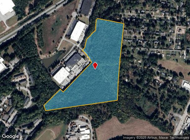
33.23 AC
2025
East Side
021600
Greenville/Spartanburg
DEMOGRAPHICS near Chapman Rd
1 Mile
3 Mile
5 Mile
2024 Total Population
2,424
23,182
85,744
2029 Population
2,782
26,157
97,117
Pop Growth 2024-2029
+ 14.77%
+ 12.83%
+ 13.26%
Average Age
38
39
38
2024 Total Households
1,071
9,248
33,566
HH Growth 2024-2029
+ 15.03%
+ 13.57%
+ 13.79%
Median Household Inc
$46,282
$49,561
$48,718
Avg Household Size
2.20
2.30
2.30
2024 Avg HH Vehicles
2.00
2.00
2.00
Median Home Value
$150,899
$150,055
$170,175
Median Year Built
1974
1979
1980
Nearby Places
Map Layers
Map Styles
 Street
 Aerial
- Restaurants
- Banks
- Shops
- Fitness
- Groceries
PUBLIC TRANSPORTATION
COMMUTER RAIL
Spartanburg Amtrak Station (Crescent - Amtrak)
DRIVE
WALK
Distance
Spartanburg Amtrak Station (Crescent - Amtrak)
11 min
4.7 mi
AIRPORT
Greenville Spartanburg International
DRIVE
WALK
Distance
Greenville Spartanburg International
33 min
21.9 mi
Freight Ports
North Charleston Terminal
DRIVE
WALK
Distance
North Charleston Terminal
230 min
201.9 mi
SALE & LEASE HISTORY
LISTING DATE
SALE/LEASE

Nov 28, 2017
For Sale
Mar 08, 2024
For Sale
Jul 09, 2020
For Sale
Nearby Properties
Address
Land Use
TOTAL SIZE
Lot Size
Zoning
Address
Land Use
TOTAL SIZE
Lot Size
Zoning
9,312 SF
9.06 AC
Address
Land Use
TOTAL SIZE
Lot Size
Zoning
5,672 SF
10.20 AC
Address
Land Use
TOTAL SIZE
Lot Size
Zoning
27,491 SF
2.95 AC
Address
Land Use
TOTAL SIZE
Lot Size
Zoning
141,112 SF
3.38 AC
Address
Land Use
TOTAL SIZE
Lot Size
Zoning
15,108 SF
16.27 AC
Address
Land Use
TOTAL SIZE
Lot Size
Zoning
18,600 SF
3.41 AC
Address
Land Use
TOTAL SIZE
Lot Size
Zoning
19,876 SF
0.03 AC
Address
Land Use
TOTAL SIZE
Lot Size
Zoning
12,740 SF
1.48 AC
Address
Land Use
TOTAL SIZE
Lot Size
Zoning
13,160 SF
1.62 AC
Address
Land Use
TOTAL SIZE
Lot Size
Zoning
106,100 SF
24.56 AC
Address
Land Use
TOTAL SIZE
Lot Size
Zoning
12,069 SF
0.03 AC
Address
Land Use
TOTAL SIZE
Lot Size
Zoning
44,301 SF
7.47 AC
Address
Land Use
TOTAL SIZE
Lot Size
Zoning
9,146 SF
51.62 AC
Address
Land Use
TOTAL SIZE
Lot Size
Zoning
8,872 SF
0.03 AC
Address
Land Use
TOTAL SIZE
Lot Size
Zoning
6,798 SF
31.44 AC
Address
Land Use
TOTAL SIZE
Lot Size
Zoning
83,698 SF
18.14 AC
Address
Land Use
TOTAL SIZE
Lot Size
Zoning
89,435 SF
5.33 AC
Address
Land Use
TOTAL SIZE
Lot Size
Zoning
6,816 SF
14.16 AC
Address
Land Use
TOTAL SIZE
Lot Size
Zoning
9,649 SF
9.67 AC
Address
Land Use
TOTAL SIZE
Lot Size
Zoning
16.45 AC
Address
Land Use
TOTAL SIZE
Lot Size
Zoning
5,693 SF
0.03 AC
Address
Land Use
TOTAL SIZE
Lot Size
Zoning
3,648 SF
20.77 AC
Address
Land Use
TOTAL SIZE
Lot Size
Zoning
11,402 SF
7.21 AC
Address
Land Use
TOTAL SIZE
Lot Size
Zoning
27,608 SF
17.61 AC
Address
Land Use
TOTAL SIZE
Lot Size
Zoning
36,047 SF
0.60 AC
Address
Land Use
TOTAL SIZE
Lot Size
Zoning
156,683 SF
11.23 AC
Address
Land Use
TOTAL SIZE
Lot Size
Zoning
6,454 SF
0.70 AC
Address
Land Use
TOTAL SIZE
Lot Size
Zoning
25,214 SF
4.48 AC
Address
Land Use
TOTAL SIZE
Lot Size
Zoning
4,256 SF
20.70 AC
Address
Land Use
TOTAL SIZE
Lot Size
Zoning
77,960 SF
2.44 AC
The World's #1 Commercial Real Estate Marketplace
Connect with us
© 2025 CoStar Group
The information above has been obtained from sources believed reliable. While we do not doubt its accuracy we have not verified it and make no guarantee, warranty or representation about it. It is your responsibility to independently confirm its accuracy and completeness. Any projections, opinions, assumptions, or estimates used are for example only and do not represent the current or future performance of the property. The value of this transaction to you depends on tax and other factors which should be evaluated by your tax, financial, and legal advisors. You and your advisors should conduct a careful, independent investigation of the property to determine to your satisfaction the suitability of the property for your needs.