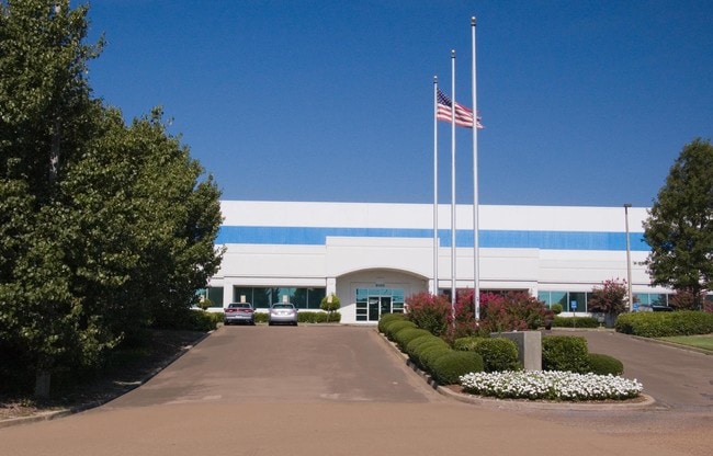
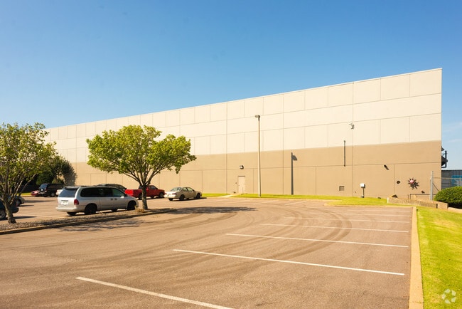
Property Record
9105 Hacks Cross Rd, Olive Branch, MS 38654


Property Detail
9105 Hacks Cross Rd
1066140000000103
WILLIAMS INDUSTRIAL S-D RESUB LOT 1 LOT 1A
Warehouse
Desoto
M-2
Mississippi
B and X Area of moderate flood hazard, usually the area between the limits of the 100-year and 500-year floods.
1
2025
43.20 AC
2025
DeSoto
070812
Memphis
596,400 SF
Memphis, TN-MS-AR
NEARBY LISTINGS FOR SALE OR LEASE
DEMOGRAPHICS near 9105 Hacks Cross Rd
1 mile
3 mile
5 mile
2025 Total Population
2,005
46,538
112,947
2030 Population
1,971
45,981
111,941
Pop Growth 2025-2030
(1.70%)
(1.20%)
(0.89%)
Average Age
35
38
37
2025 Total Households
783
17,072
42,495
HH Growth 2025-2030
(1.79%)
(1.18%)
(0.92%)
Median Household Inc
$47,500
$86,515
$83,929
Avg Household Size
2.60
2.70
2.60
2025 Avg HH Vehicles
2.00
2.00
2.00
Median Home Value
$323,392
$253,943
$258,117
Median Year Built
1997
1996
1993
Nearby Places
Map Layers
Map Styles
 Street
 Aerial
Transit
 Traffic
 Biking
Places
Listings with unknown addresses are not visible on the map
- Restaurants
- Banks
- Shops
- Fitness
- Groceries
PUBLIC TRANSPORTATION
AIRPORT
Memphis International
Drive
Walk
Distance
Memphis International
24 min
14.3 mi
Freight Ports
Port of Shreveport
Drive
Walk
Distance
Port of Shreveport
429 min
388.1 mi
SALE & LEASE HISTORY
LISTING DATE
SALE/LEASE

Sep 25, 2016
For Lease
Oct 12, 2018
For Lease
Oct 12, 2018
For Lease
Mar 12, 2024
For Lease
Feb 15, 2024
For Lease
Dec 09, 2020
For Lease
Nearby Properties
Address
Land Use
TOTAL SIZE
Lot Size
Zoning
Address
Land Use
TOTAL SIZE
Lot Size
Zoning
1,059,729 SF
74.33 AC
M-2
Address
Land Use
TOTAL SIZE
Lot Size
Zoning
929,880 SF
41.14 AC
M-1
Address
Land Use
TOTAL SIZE
Lot Size
Zoning
52,688 SF
24.38 AC
CA
Address
Land Use
TOTAL SIZE
Lot Size
Zoning
38,566 SF
27.90 AC
CA
Address
Land Use
TOTAL SIZE
Lot Size
Zoning
10,128 SF
23.35 AC
CA
Address
Land Use
TOTAL SIZE
Lot Size
Zoning
1,150,296 SF
68.41 AC
M-1
Address
Land Use
TOTAL SIZE
Lot Size
Zoning
1,093,788 SF
60.98 AC
M-1
Address
Land Use
TOTAL SIZE
Lot Size
Zoning
990,952 SF
60.30 AC
PUD
Address
Land Use
TOTAL SIZE
Lot Size
Zoning
1,299,800 SF
50.22 AC
M-1
Address
Land Use
TOTAL SIZE
Lot Size
Zoning
990,080 SF
55.79 AC
M-1
Address
Land Use
TOTAL SIZE
Lot Size
Zoning
622,675 SF
67.55 AC
M-1
Address
Land Use
TOTAL SIZE
Lot Size
Zoning
761,349 SF
57.62 AC
M-1
Address
Land Use
TOTAL SIZE
Lot Size
Zoning
722,560 SF
66.85 AC
M-1
Address
Land Use
TOTAL SIZE
Lot Size
Zoning
65,282 SF
15.92 AC
CA
Address
Land Use
TOTAL SIZE
Lot Size
Zoning
615,853 SF
39.07 AC
M-1
Address
Land Use
TOTAL SIZE
Lot Size
Zoning
869,020 SF
43.85 AC
M-1
Address
Land Use
TOTAL SIZE
Lot Size
Zoning
813,440 SF
38.72 AC
PB
Address
Land Use
TOTAL SIZE
Lot Size
Zoning
58,235 SF
7.62 AC
CA
Address
Land Use
TOTAL SIZE
Lot Size
Zoning
616,191 SF
61.92 AC
PUD
Address
Land Use
TOTAL SIZE
Lot Size
Zoning
860,040 SF
43.13 AC
M-1
Address
Land Use
TOTAL SIZE
Lot Size
Zoning
28,120 SF
12.75 AC
CA
Address
Land Use
TOTAL SIZE
Lot Size
Zoning
927,742 SF
42.73 AC
PB
Address
Land Use
TOTAL SIZE
Lot Size
Zoning
416,000 SF
40.66 AC
M-1
Address
Land Use
TOTAL SIZE
Lot Size
Zoning
210,161 SF
14.86 AC
R-6
Address
Land Use
TOTAL SIZE
Lot Size
Zoning
447,008 SF
28.41 AC
PB
Address
Land Use
TOTAL SIZE
Lot Size
Zoning
689,628 SF
43.78 AC
M-1
Address
Land Use
TOTAL SIZE
Lot Size
Zoning
599,752 SF
40.17 AC
M-1
Address
Land Use
TOTAL SIZE
Lot Size
Zoning
1,082,465 SF
57.74 AC
PB
Address
Land Use
TOTAL SIZE
Lot Size
Zoning
52,723 SF
7.68 AC
CA
The World's #1 Commercial Real Estate Marketplace
Connect with us
© 2026 CoStar Group
The information above has been obtained from sources believed reliable. While we do not doubt its accuracy we have not verified it and make no guarantee, warranty or representation about it. It is your responsibility to independently confirm its accuracy and completeness. Any projections, opinions, assumptions, or estimates used are for example only and do not represent the current or future performance of the property. The value of this transaction to you depends on tax and other factors which should be evaluated by your tax, financial, and legal advisors. You and your advisors should conduct a careful, independent investigation of the property to determine to your satisfaction the suitability of the property for your needs.