Property Record
Peach Pkwy, Fort Valley, GA 31030
NEARBY LISTINGS FOR SALE OR LEASE
Property Detail
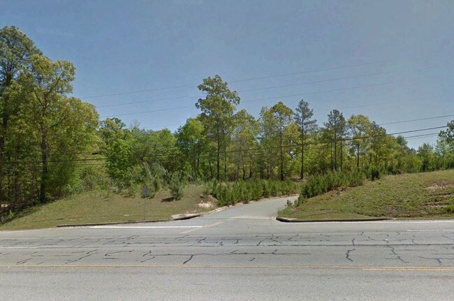
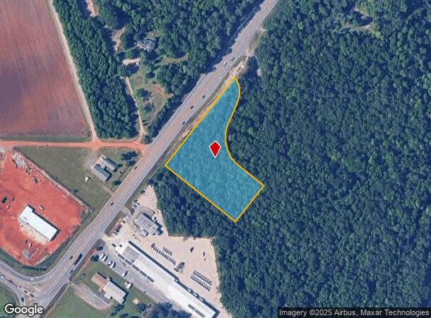
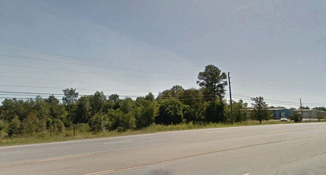
Peach Pkwy
Warner Robins, GA
Fv Commercial 201
F09B-012-A
LOT B \ 2.83 AC LL146 & 175-176 LD9
Commercialacreage
Peach
X
Georgia
13225C0103C
b
2024
2.83 AC
2024
Perry/Warner Robins
040200
Other Market Areas
DEMOGRAPHICS near Peach Pkwy
1 Mile
3 Mile
5 Mile
2024 Total Population
730
9,216
15,690
2029 Population
775
9,731
16,534
Pop Growth 2024-2029
+ 6.16%
+ 5.59%
+ 5.38%
Average Age
39
38
38
2024 Total Households
253
3,527
5,699
HH Growth 2024-2029
+ 5.93%
+ 5.70%
+ 5.54%
Median Household Inc
$43,749
$39,714
$45,920
Avg Household Size
2.60
2.50
2.50
2024 Avg HH Vehicles
2.00
2.00
2.00
Median Home Value
$139,091
$110,914
$137,259
Median Year Built
1980
1973
1977
Nearby Places
Map Layers
Map Styles
 Street
 Aerial
- Restaurants
- Banks
- Shops
- Fitness
- Groceries
SALE & LEASE HISTORY
LISTING DATE
SALE/LEASE

May 09, 2017
For Sale
Nearby Properties
Address
Land Use
TOTAL SIZE
Lot Size
Zoning
Address
Land Use
TOTAL SIZE
Lot Size
Zoning
193,391 SF
170 AC
R-AG
Address
Land Use
TOTAL SIZE
Lot Size
Zoning
807,629 SF
82.01 AC
I
Address
Land Use
TOTAL SIZE
Lot Size
Zoning
188,166 SF
13.87 AC
R-1
Address
Land Use
TOTAL SIZE
Lot Size
Zoning
45,430 SF
91.16 AC
R-1
Address
Land Use
TOTAL SIZE
Lot Size
Zoning
95,554 SF
55.59 AC
MULTI
Address
Land Use
TOTAL SIZE
Lot Size
Zoning
92,016 SF
10.26 AC
R-2
Address
Land Use
TOTAL SIZE
Lot Size
Zoning
27,615 SF
43.78 AC
R-2
Address
Land Use
TOTAL SIZE
Lot Size
Zoning
75,809 SF
8.86 AC
R-AG
Address
Land Use
TOTAL SIZE
Lot Size
Zoning
10,226 SF
15 AC
R-2
Address
Land Use
TOTAL SIZE
Lot Size
Zoning
8,060 SF
9.16 AC
R-2
Address
Land Use
TOTAL SIZE
Lot Size
Zoning
77,447 SF
7.60 AC
C-2
Address
Land Use
TOTAL SIZE
Lot Size
Zoning
35,622 SF
2.61 AC
C-3
Address
Land Use
TOTAL SIZE
Lot Size
Zoning
40,167 SF
3.26 AC
C-2
Address
Land Use
TOTAL SIZE
Lot Size
Zoning
11,106 SF
10.96 AC
R-2
Address
Land Use
TOTAL SIZE
Lot Size
Zoning
20,600 SF
2.62 AC
C-3
Address
Land Use
TOTAL SIZE
Lot Size
Zoning
136.77 AC
R-AG
Address
Land Use
TOTAL SIZE
Lot Size
Zoning
45,430 SF
20 AC
R-1
Address
Land Use
TOTAL SIZE
Lot Size
Zoning
4,520 SF
9.86 AC
R-2
Address
Land Use
TOTAL SIZE
Lot Size
Zoning
4,944 SF
5 AC
R-2
Address
Land Use
TOTAL SIZE
Lot Size
Zoning
33,555 SF
3.60 AC
R-2
Address
Land Use
TOTAL SIZE
Lot Size
Zoning
21,150 SF
7.01 AC
MULTI
Address
Land Use
TOTAL SIZE
Lot Size
Zoning
11,576 SF
10.01 AC
R-2
Address
Land Use
TOTAL SIZE
Lot Size
Zoning
12,731 SF
0.87 AC
I-N
Address
Land Use
TOTAL SIZE
Lot Size
Zoning
3,946 SF
3.10 AC
R-2
Address
Land Use
TOTAL SIZE
Lot Size
Zoning
20,250 SF
1.95 AC
C-2
Address
Land Use
TOTAL SIZE
Lot Size
Zoning
7,817 SF
6.49 AC
RR-1
Address
Land Use
TOTAL SIZE
Lot Size
Zoning
15,076 SF
2.14 AC
C-2
Address
Land Use
TOTAL SIZE
Lot Size
Zoning
20,626 SF
5.73 AC
I-N
Address
Land Use
TOTAL SIZE
Lot Size
Zoning
13,600 SF
5.35 AC
C-2
Address
Land Use
TOTAL SIZE
Lot Size
Zoning
16,059 SF
1.15 AC
R-2
The World's #1 Commercial Real Estate Marketplace
Connect with us
© 2025 CoStar Group
The information above has been obtained from sources believed reliable. While we do not doubt its accuracy we have not verified it and make no guarantee, warranty or representation about it. It is your responsibility to independently confirm its accuracy and completeness. Any projections, opinions, assumptions, or estimates used are for example only and do not represent the current or future performance of the property. The value of this transaction to you depends on tax and other factors which should be evaluated by your tax, financial, and legal advisors. You and your advisors should conduct a careful, independent investigation of the property to determine to your satisfaction the suitability of the property for your needs.