Property Record
909 Lemoyne Rd, Northwood, OH 43619

Save to a Folder
{{folder.Name}}
{{folder.ListingIds.length}} Properties
{{folder.ListingIds.length}} Property
Create a New Folder
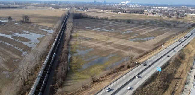
Property Detail
909 Lemoyne Rd
Toledo, OH
EPT NPT NEFR E OF RR LESSPT E OF HWY
H28-712-040201002000
Wood
Recreationalacreage
Ohio
B and X Area of moderate flood hazard, usually the area between the limits of the 100-year and 500-year floods.
6.84 AC
2025
Perrysburg/Northwood
2025
Toledo
020100
NEARBY LISTINGS FOR SALE OR LEASE
DEMOGRAPHICS near 909 Lemoyne Rd
1 mile
3 mile
5 mile
2025 Total Population
3,359
25,646
81,922
2030 Population
3,422
25,548
82,468
Pop Growth 2025-2030
+ 1.88%
(0.38%)
+ 0.67%
Average Age
46
42
40
2025 Total Households
1,610
10,895
34,292
HH Growth 2025-2030
+ 1.99%
(0.39%)
+ 0.60%
Median Household Inc
$66,552
$66,470
$53,801
Avg Household Size
2.00
2.30
2.30
2025 Avg HH Vehicles
2.00
2.00
2.00
Median Home Value
$140,039
$156,826
$140,103
Median Year Built
1973
1964
1960
Nearby Places
Map Layers
Map Styles
 Street
 Aerial
Layers
 Traffic
 Biking
Places
Listings with unknown addresses are not visible on the map
- Restaurants
- Banks
- Shops
- Fitness
- Groceries
PUBLIC TRANSPORTATION
COMMUTER RAIL
Toledo (Capitol Limited - Amtrak, Lake Shore Limited - Amtrak)
Drive
Walk
Distance
Toledo (Capitol Limited - Amtrak, Lake Shore Limited - Amtrak)
12 min
5.4 mi
AIRPORT
Eugene F Kranz Toledo Express
Drive
Walk
Distance
Eugene F Kranz Toledo Express
42 min
23.5 mi
Freight Ports
Port of Toledo
Drive
Walk
Distance
Port of Toledo
17 min
7.1 mi
SALE & LEASE HISTORY
LISTING DATE
SALE/LEASE

Feb 09, 2024
For Sale
Nearby Properties
Address
Land Use
TOTAL SIZE
Lot Size
Zoning
Address
Land Use
TOTAL SIZE
Lot Size
Zoning
605,609 SF
9.66 AC
40-C4
Address
Land Use
TOTAL SIZE
Lot Size
Zoning
304,392 SF
17.38 AC
Address
Land Use
TOTAL SIZE
Lot Size
Zoning
313,004 SF
44.54 AC
40-C2
Address
Land Use
TOTAL SIZE
Lot Size
Zoning
136,090 SF
4 AC
Address
Land Use
TOTAL SIZE
Lot Size
Zoning
127,658 SF
9.01 AC
40-C4
Address
Land Use
TOTAL SIZE
Lot Size
Zoning
73,802 SF
22.50 AC
40-R1
Address
Land Use
TOTAL SIZE
Lot Size
Zoning
214,312 SF
35.35 AC
40-C5
Address
Land Use
TOTAL SIZE
Lot Size
Zoning
372,803 SF
51.86 AC
Address
Land Use
TOTAL SIZE
Lot Size
Zoning
102,535 SF
20 AC
40-R2
Address
Land Use
TOTAL SIZE
Lot Size
Zoning
228,251 SF
43.08 AC
10-RD6
Address
Land Use
TOTAL SIZE
Lot Size
Zoning
145,549 SF
3.07 AC
Address
Land Use
TOTAL SIZE
Lot Size
Zoning
34 AC
40-C5
Address
Land Use
TOTAL SIZE
Lot Size
Zoning
230,074 SF
142.89 AC
40-M2
Address
Land Use
TOTAL SIZE
Lot Size
Zoning
181,347 SF
14.12 AC
40-R4
Address
Land Use
TOTAL SIZE
Lot Size
Zoning
65,683 SF
5.02 AC
10-MX
Address
Land Use
TOTAL SIZE
Lot Size
Zoning
331,416 SF
30.56 AC
Address
Land Use
TOTAL SIZE
Lot Size
Zoning
199,768 SF
16.15 AC
40-C2
Address
Land Use
TOTAL SIZE
Lot Size
Zoning
77,079 SF
3.87 AC
40-R3
Address
Land Use
TOTAL SIZE
Lot Size
Zoning
229,500 SF
9.97 AC
Address
Land Use
TOTAL SIZE
Lot Size
Zoning
91,261 SF
5.47 AC
40-C2
Address
Land Use
TOTAL SIZE
Lot Size
Zoning
180,900 SF
5 AC
Address
Land Use
TOTAL SIZE
Lot Size
Zoning
106,525 SF
18.90 AC
Address
Land Use
TOTAL SIZE
Lot Size
Zoning
58,281 SF
2.60 AC
40-C2
Address
Land Use
TOTAL SIZE
Lot Size
Zoning
46,267 SF
3.22 AC
40-R3
Address
Land Use
TOTAL SIZE
Lot Size
Zoning
69,259 SF
13.65 AC
40-R2
Address
Land Use
TOTAL SIZE
Lot Size
Zoning
44.33 AC
40-C2
Address
Land Use
TOTAL SIZE
Lot Size
Zoning
93,191 SF
11.13 AC
40-C4
Address
Land Use
TOTAL SIZE
Lot Size
Zoning
104,012 SF
7.14 AC
40-R3
Address
Land Use
TOTAL SIZE
Lot Size
Zoning
42,888 SF
3.99 AC
40-C5
Address
Land Use
TOTAL SIZE
Lot Size
Zoning
59,212 SF
3.02 AC
40-C2
The World's #1 Commercial Real Estate Marketplace
Connect with us
© 2026 CoStar Group
The information above has been obtained from sources believed reliable. While we do not doubt its accuracy we have not verified it and make no guarantee, warranty or representation about it. It is your responsibility to independently confirm its accuracy and completeness. Any projections, opinions, assumptions, or estimates used are for example only and do not represent the current or future performance of the property. The value of this transaction to you depends on tax and other factors which should be evaluated by your tax, financial, and legal advisors. You and your advisors should conduct a careful, independent investigation of the property to determine to your satisfaction the suitability of the property for your needs.