Property Record
5089 Slanting Bridge Rd, Denver, NC 28037


NEARBY LISTINGS FOR SALE OR LEASE
Property Detail
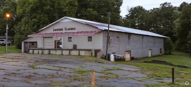
5089 Slanting Bridge Rd
Hickory-Lenoir-Morganton, NC
A Recombination Survey For Mainely Me In
4606047205660000
LOT 4 PLAT 85-7
Warehouse
Catawba
X
North Carolina
3710460600K
4
2024
2.03 AC
2025
Catawba County
011506
Charlotte
18,560 SF
DEMOGRAPHICS near 5089 Slanting Bridge Rd
1 mile
3 mile
5 mile
2024 Total Population
1,839
19,150
40,254
2029 Population
2,034
21,930
46,096
Pop Growth 2024-2029
+ 10.60%
+ 14.52%
+ 14.51%
Average Age
46
44
43
2024 Total Households
757
7,486
15,510
HH Growth 2024-2029
+ 10.44%
+ 14.39%
+ 14.50%
Median Household Inc
$93,877
$108,655
$110,494
Avg Household Size
2.40
2.50
2.60
2024 Avg HH Vehicles
3.00
2.00
2.00
Median Home Value
$477,516
$459,920
$487,719
Median Year Built
1996
2002
2002
Nearby Places
Map Layers
Map Styles
 Street
 Aerial
Transit
 Traffic
 Biking
Places
Listings with unknown addresses are not visible on the map
- Restaurants
- Banks
- Shops
- Fitness
- Groceries
PUBLIC TRANSPORTATION
AIRPORT
Charlotte/Douglas International
Drive
Walk
Distance
Charlotte/Douglas International
48 min
29.3 mi
Concord-Padgett Regional
Drive
Walk
Distance
Concord-Padgett Regional
48 min
34.7 mi
SALE & LEASE HISTORY
LISTING DATE
SALE/LEASE

Aug 06, 2018
For Sale
Nearby Properties
Address
Land Use
TOTAL SIZE
Lot Size
Zoning
Address
Land Use
TOTAL SIZE
Lot Size
Zoning
31,198 SF
26.01 AC
PD-CD
Address
Land Use
TOTAL SIZE
Lot Size
Zoning
1,288 SF
16.04 AC
PD-CD
Address
Land Use
TOTAL SIZE
Lot Size
Zoning
6,264 SF
24.64 AC
ELDD B-G
Address
Land Use
TOTAL SIZE
Lot Size
Zoning
60,860 SF
9.81 AC
PD-CD
Address
Land Use
TOTAL SIZE
Lot Size
Zoning
66,136 SF
18.10 AC
ELDD B-N &
Address
Land Use
TOTAL SIZE
Lot Size
Zoning
1,341 SF
0.46 AC
PD-CD
Address
Land Use
TOTAL SIZE
Lot Size
Zoning
251,009 SF
20.46 AC
ELDD I-G
Address
Land Use
TOTAL SIZE
Lot Size
Zoning
12,948 SF
28.37 AC
R-SF
Address
Land Use
TOTAL SIZE
Lot Size
Zoning
79,137 SF
6.34 AC
HC
Address
Land Use
TOTAL SIZE
Lot Size
Zoning
81,228 SF
26.89 AC
ELDD B-N C
Address
Land Use
TOTAL SIZE
Lot Size
Zoning
20,595 SF
2.65 AC
PD-CD
Address
Land Use
TOTAL SIZE
Lot Size
Zoning
9,718 SF
1.64 AC
R-20
Address
Land Use
TOTAL SIZE
Lot Size
Zoning
33,342 SF
9.79 AC
RC
Address
Land Use
TOTAL SIZE
Lot Size
Zoning
1,500 SF
11.02 AC
PD
Address
Land Use
TOTAL SIZE
Lot Size
Zoning
7,615 SF
1.30 AC
R-SF
Address
Land Use
TOTAL SIZE
Lot Size
Zoning
20,923 SF
2.83 AC
R-S CU
Address
Land Use
TOTAL SIZE
Lot Size
Zoning
2,000 SF
33.70 AC
R-30
Address
Land Use
TOTAL SIZE
Lot Size
Zoning
9,550 SF
0.75 AC
R-20
Address
Land Use
TOTAL SIZE
Lot Size
Zoning
9,759 SF
0.67 AC
RR
Address
Land Use
TOTAL SIZE
Lot Size
Zoning
18,316 SF
3.61 AC
PD-CD
Address
Land Use
TOTAL SIZE
Lot Size
Zoning
12,000 SF
7.87 AC
ELDD B-G C
Address
Land Use
TOTAL SIZE
Lot Size
Zoning
6,928 SF
1.29 AC
R20
Address
Land Use
TOTAL SIZE
Lot Size
Zoning
12,500 SF
2.53 AC
ELDD B-G
Address
Land Use
TOTAL SIZE
Lot Size
Zoning
37,999 SF
3.41 AC
HC
Address
Land Use
TOTAL SIZE
Lot Size
Zoning
6,889 SF
1.75 AC
PD-CD
Address
Land Use
TOTAL SIZE
Lot Size
Zoning
20,000 SF
2.60 AC
ELDD I-G
Address
Land Use
TOTAL SIZE
Lot Size
Zoning
16,000 SF
3.12 AC
ELDD B-G
Address
Land Use
TOTAL SIZE
Lot Size
Zoning
23,940 SF
3.63 AC
I-G
Address
Land Use
TOTAL SIZE
Lot Size
Zoning
6,174 SF
0.52 AC
R-30
Address
Land Use
TOTAL SIZE
Lot Size
Zoning
13,512 SF
2.23 AC
ELDD B-G C
The World's #1 Commercial Real Estate Marketplace
Connect with us
© 2026 CoStar Group
The information above has been obtained from sources believed reliable. While we do not doubt its accuracy we have not verified it and make no guarantee, warranty or representation about it. It is your responsibility to independently confirm its accuracy and completeness. Any projections, opinions, assumptions, or estimates used are for example only and do not represent the current or future performance of the property. The value of this transaction to you depends on tax and other factors which should be evaluated by your tax, financial, and legal advisors. You and your advisors should conduct a careful, independent investigation of the property to determine to your satisfaction the suitability of the property for your needs.