Property Record
975 S Point Rd, Belmont, NC 28012


NEARBY LISTINGS FOR SALE OR LEASE
Property Detail
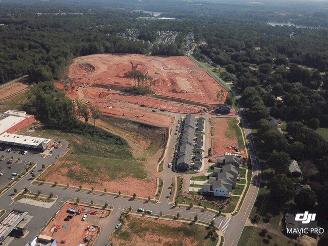
975 S Point Rd
Charlotte-Concord-Gastonia, NC-SC
Subdivision Plat Belmont Town Center Pha
225540
BELMONT TOWN CENTER OUTPARCEL F 15 053 009 00 000
Commercialnec
Gaston
X
North Carolina
3710359400M
1.14 AC
2025
Gaston County
2025
Charlotte
032404
DEMOGRAPHICS near 975 S Point Rd
1 Mile
3 Mile
5 Mile
2024 Total Population
5,725
28,887
71,373
2029 Population
6,266
31,496
77,071
Pop Growth 2024-2029
+ 9.45%
+ 9.03%
+ 7.98%
Average Age
39
41
40
2024 Total Households
2,152
12,005
28,608
HH Growth 2024-2029
+ 9.62%
+ 9.20%
+ 8.12%
Median Household Inc
$95,760
$77,253
$72,836
Avg Household Size
2.60
2.40
2.40
2024 Avg HH Vehicles
2.00
2.00
2.00
Median Home Value
$287,679
$298,476
$271,851
Median Year Built
2000
1997
1993
Nearby Places
Map Layers
Map Styles
 Street
 Aerial
- Restaurants
- Banks
- Shops
- Fitness
- Groceries
PUBLIC TRANSPORTATION
AIRPORT
Charlotte/Douglas International
DRIVE
WALK
Distance
Charlotte/Douglas International
24 min
10.3 mi
Concord-Padgett Regional
DRIVE
WALK
Distance
Concord-Padgett Regional
37 min
26.6 mi
SALE & LEASE HISTORY
LISTING DATE
SALE/LEASE

Sep 24, 2016
For Sale
Oct 22, 2018
For Sale
Nearby Properties
Address
Land Use
TOTAL SIZE
Lot Size
Zoning
Address
Land Use
TOTAL SIZE
Lot Size
Zoning
64,619 SF
15.01 AC
R5
Address
Land Use
TOTAL SIZE
Lot Size
Zoning
37.49 AC
Address
Land Use
TOTAL SIZE
Lot Size
Zoning
41,508 SF
29.70 AC
Address
Land Use
TOTAL SIZE
Lot Size
Zoning
25,137 SF
34.81 AC
Address
Land Use
TOTAL SIZE
Lot Size
Zoning
503,550 SF
59.24 AC
I-1(CD)
Address
Land Use
TOTAL SIZE
Lot Size
Zoning
1,066 SF
70.67 AC
PUB01
Address
Land Use
TOTAL SIZE
Lot Size
Zoning
6.09 AC
Address
Land Use
TOTAL SIZE
Lot Size
Zoning
30,906 SF
14.19 AC
Address
Land Use
TOTAL SIZE
Lot Size
Zoning
23,899 SF
14.57 AC
HC
Address
Land Use
TOTAL SIZE
Lot Size
Zoning
98.12 AC
Address
Land Use
TOTAL SIZE
Lot Size
Zoning
78.54 AC
GR
Address
Land Use
TOTAL SIZE
Lot Size
Zoning
4,552 SF
9.22 AC
R1
Address
Land Use
TOTAL SIZE
Lot Size
Zoning
190,498 SF
20.10 AC
RET05
Address
Land Use
TOTAL SIZE
Lot Size
Zoning
48,452 SF
18.08 AC
PUB03
Address
Land Use
TOTAL SIZE
Lot Size
Zoning
46,998 SF
30.47 AC
HCAR1
Address
Land Use
TOTAL SIZE
Lot Size
Zoning
171,646 SF
13.19 AC
Address
Land Use
TOTAL SIZE
Lot Size
Zoning
2,000 SF
2.19 AC
Address
Land Use
TOTAL SIZE
Lot Size
Zoning
387.93 AC
R-3
Address
Land Use
TOTAL SIZE
Lot Size
Zoning
160,225 SF
9.68 AC
I-2(CD)
Address
Land Use
TOTAL SIZE
Lot Size
Zoning
516,688 SF
36.23 AC
STOR2
Address
Land Use
TOTAL SIZE
Lot Size
Zoning
1,596 SF
5.73 AC
OFF01
Address
Land Use
TOTAL SIZE
Lot Size
Zoning
65,513 SF
3.07 AC
Address
Land Use
TOTAL SIZE
Lot Size
Zoning
139,155 SF
15.13 AC
RET05
Address
Land Use
TOTAL SIZE
Lot Size
Zoning
99.28 AC
BCD
Address
Land Use
TOTAL SIZE
Lot Size
Zoning
118,896 SF
3.98 AC
Address
Land Use
TOTAL SIZE
Lot Size
Zoning
2,500 SF
943.31 AC
Address
Land Use
TOTAL SIZE
Lot Size
Zoning
10,172 SF
33.34 AC
PUB01
Address
Land Use
TOTAL SIZE
Lot Size
Zoning
54,030 SF
5.02 AC
OFF04
Address
Land Use
TOTAL SIZE
Lot Size
Zoning
102,915 SF
39.29 AC
PUB01
Address
Land Use
TOTAL SIZE
Lot Size
Zoning
67,682 SF
8.86 AC
The World's #1 Commercial Real Estate Marketplace
Connect with us
© 2026 CoStar Group
The information above has been obtained from sources believed reliable. While we do not doubt its accuracy we have not verified it and make no guarantee, warranty or representation about it. It is your responsibility to independently confirm its accuracy and completeness. Any projections, opinions, assumptions, or estimates used are for example only and do not represent the current or future performance of the property. The value of this transaction to you depends on tax and other factors which should be evaluated by your tax, financial, and legal advisors. You and your advisors should conduct a careful, independent investigation of the property to determine to your satisfaction the suitability of the property for your needs.