Property Record
N Forest Hills School Rd, , NC


This Property Is For Sale
NEARBY LISTINGS FOR SALE OR LEASE
Property Detail
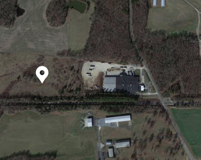
N Forest Hills School Rd
Charlotte
#2 OPCQ260/OPCQ431
Charlotte-Concord-Gastonia, NC-SC
Union
02-211-015-Q
North Carolina
Industrialgeneral
15.05 AC
2025
Union County
2025
DEMOGRAPHICS near N Forest Hills School Rd
1 Mile
3 Mile
5 Mile
2024 Total Population
1,458
9,026
17,137
2029 Population
1,547
9,725
18,869
Pop Growth 2024-2029
+ 6.10%
+ 7.74%
+ 10.11%
Average Age
29
37
38
2024 Total Households
209
2,588
5,425
HH Growth 2024-2029
+ 7.66%
+ 8.38%
+ 10.67%
Median Household Inc
$49,999
$56,131
$58,073
Avg Household Size
2.80
2.70
2.70
2024 Avg HH Vehicles
2.00
2.00
2.00
Median Home Value
$187,142
$198,904
$223,065
Median Year Built
1988
1986
1986
Nearby Places
Map Layers
Map Styles
 Street
 Aerial
- Restaurants
- Banks
- Shops
- Fitness
- Groceries
Nearby Properties
Address
Land Use
TOTAL SIZE
Lot Size
Zoning
Address
Land Use
TOTAL SIZE
Lot Size
Zoning
138,123 SF
113.13 AC
B-1 WINGAT
Address
Land Use
TOTAL SIZE
Lot Size
Zoning
68,870 SF
33.25 AC
HC WINGATE
Address
Land Use
TOTAL SIZE
Lot Size
Zoning
68,258 SF
3.39 AC
R-20 WINGA
Address
Land Use
TOTAL SIZE
Lot Size
Zoning
138,165 SF
135.17 AC
HC UNION C
Address
Land Use
TOTAL SIZE
Lot Size
Zoning
28,468 SF
3.51 AC
B-1 WINGAT
Address
Land Use
TOTAL SIZE
Lot Size
Zoning
88,806 SF
15.72 AC
IND MARSHV
Address
Land Use
TOTAL SIZE
Lot Size
Zoning
69,549 SF
13 AC
IND MARSHV
Address
Land Use
TOTAL SIZE
Lot Size
Zoning
28.93 AC
Address
Land Use
TOTAL SIZE
Lot Size
Zoning
74,070 SF
15.61 AC
CIV MARSHV
Address
Land Use
TOTAL SIZE
Lot Size
Zoning
24.89 AC
Address
Land Use
TOTAL SIZE
Lot Size
Zoning
26,600 SF
161.03 AC
RA-40 UNIO
Address
Land Use
TOTAL SIZE
Lot Size
Zoning
4,575 SF
5.10 AC
TMU MARSHV
Address
Land Use
TOTAL SIZE
Lot Size
Zoning
64,743 SF
13.82 AC
R-20 WINGA
Address
Land Use
TOTAL SIZE
Lot Size
Zoning
10,274 SF
6.24 AC
R-6 WINGAT
Address
Land Use
TOTAL SIZE
Lot Size
Zoning
15,103 SF
2.01 AC
B-1 WINGAT
Address
Land Use
TOTAL SIZE
Lot Size
Zoning
28 AC
IND MARSHV
Address
Land Use
TOTAL SIZE
Lot Size
Zoning
4,252 SF
2.60 AC
R-6 WINGAT
Address
Land Use
TOTAL SIZE
Lot Size
Zoning
73,033 SF
15.12 AC
CIV MARSHV
Address
Land Use
TOTAL SIZE
Lot Size
Zoning
47,416 SF
10.41 AC
TMU MARSHV
Address
Land Use
TOTAL SIZE
Lot Size
Zoning
28,512 SF
13.74 AC
B-1 WINGAT
Address
Land Use
TOTAL SIZE
Lot Size
Zoning
21,804 SF
0.48 AC
R-20 WINGA
Address
Land Use
TOTAL SIZE
Lot Size
Zoning
21,804 SF
0.92 AC
R-6 WINGAT
Address
Land Use
TOTAL SIZE
Lot Size
Zoning
17,304 SF
0.61 AC
B-6 WINGAT
Address
Land Use
TOTAL SIZE
Lot Size
Zoning
25,430 SF
8.59 AC
CIV MARSHV
Address
Land Use
TOTAL SIZE
Lot Size
Zoning
7,000 SF
37.71 AC
LI WINGATE
Address
Land Use
TOTAL SIZE
Lot Size
Zoning
25,794 SF
1.80 AC
R-6 WINGAT
Address
Land Use
TOTAL SIZE
Lot Size
Zoning
67,695 SF
6.24 AC
HC WINGATE
Address
Land Use
TOTAL SIZE
Lot Size
Zoning
115.01 AC
AG MARSHVI
Address
Land Use
TOTAL SIZE
Lot Size
Zoning
1.01 AC
R-6 WINGAT
Address
Land Use
TOTAL SIZE
Lot Size
Zoning
16,000 SF
7.95 AC
IND MARSHV
The World's #1 Commercial Real Estate Marketplace
Connect with us
© 2025 CoStar Group
The information above has been obtained from sources believed reliable. While we do not doubt its accuracy we have not verified it and make no guarantee, warranty or representation about it. It is your responsibility to independently confirm its accuracy and completeness. Any projections, opinions, assumptions, or estimates used are for example only and do not represent the current or future performance of the property. The value of this transaction to you depends on tax and other factors which should be evaluated by your tax, financial, and legal advisors. You and your advisors should conduct a careful, independent investigation of the property to determine to your satisfaction the suitability of the property for your needs.