Property Record
State Highway 59, Loxley, AL 36551


NEARBY LISTINGS FOR SALE OR LEASE
Property Detail
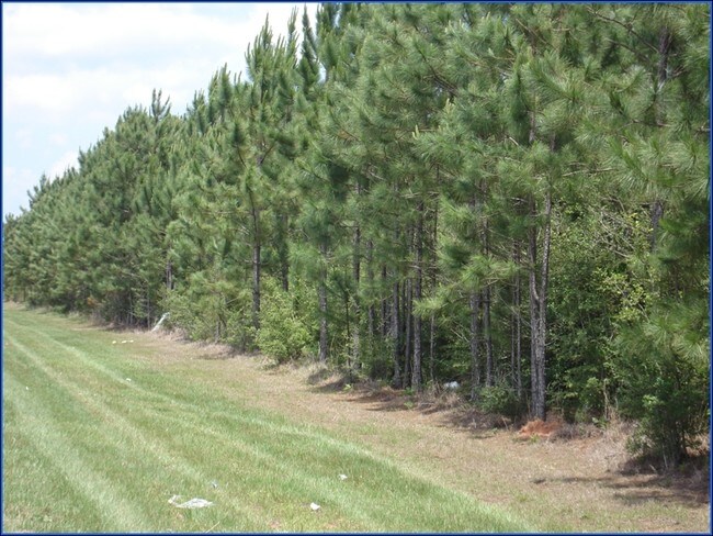
State Highway 59
33-05-16-0-000-001.006
25 AC(C) BEG AT SE COR OF SEC 16 RUN N 360'(S) TO SW LINE OF OLD R/R TH NW ALG SD OLD R/R 1062'(S), TH W 845'(S), TH SE 1076'
Timberlandforesttreesagricultural
Baldwin
X
Alabama
01003C0535M
25 AC
2024
Baldwin County
2024
Mobile
010903
Daphne-Fairhope-Foley, AL
DEMOGRAPHICS near State Highway 59
1 Mile
3 Mile
5 Mile
2024 Total Population
36
2,930
11,845
2029 Population
42
3,338
13,489
Pop Growth 2024-2029
+ 16.67%
+ 13.92%
+ 13.88%
Average Age
43
35
36
2024 Total Households
14
1,082
4,220
HH Growth 2024-2029
+ 14.29%
+ 13.40%
+ 13.39%
Median Household Inc
$39,999
$82,417
$67,500
Avg Household Size
2.50
2.70
2.70
2024 Avg HH Vehicles
3.00
2.00
2.00
Median Home Value
$150,000
$253,301
$227,850
Median Year Built
1992
2010
2004
Nearby Places
Map Layers
Map Styles
 Street
 Aerial
- Restaurants
- Banks
- Shops
- Fitness
- Groceries
PUBLIC TRANSPORTATION
AIRPORT
Mobile International
DRIVE
WALK
Distance
Mobile International
32 min
25.2 mi
Mobile Regional
DRIVE
WALK
Distance
Mobile Regional
55 min
38.8 mi
Freight Ports
Port of Mobile
DRIVE
WALK
Distance
Port of Mobile
27 min
21.8 mi
SALE & LEASE HISTORY
LISTING DATE
SALE/LEASE

Jul 07, 2017
For Sale
Dec 16, 2021
For Sale
Nearby Properties
Address
Land Use
TOTAL SIZE
Lot Size
Zoning
Address
Land Use
TOTAL SIZE
Lot Size
Zoning
583,381 SF
147 AC
Address
Land Use
TOTAL SIZE
Lot Size
Zoning
178,238 SF
15 AC
Address
Land Use
TOTAL SIZE
Lot Size
Zoning
827,037 SF
106 AC
Address
Land Use
TOTAL SIZE
Lot Size
Zoning
234,545 SF
12.20 AC
Address
Land Use
TOTAL SIZE
Lot Size
Zoning
125,294 SF
7 AC
Address
Land Use
TOTAL SIZE
Lot Size
Zoning
66,448 SF
8 AC
Address
Land Use
TOTAL SIZE
Lot Size
Zoning
81,447 SF
6.30 AC
Address
Land Use
TOTAL SIZE
Lot Size
Zoning
180,333 SF
7.60 AC
Address
Land Use
TOTAL SIZE
Lot Size
Zoning
144,122 SF
7.60 AC
Address
Land Use
TOTAL SIZE
Lot Size
Zoning
146,751 SF
7.10 AC
Address
Land Use
TOTAL SIZE
Lot Size
Zoning
10,300 SF
30 AC
Address
Land Use
TOTAL SIZE
Lot Size
Zoning
163,200 SF
7.40 AC
Address
Land Use
TOTAL SIZE
Lot Size
Zoning
144,111 SF
6.90 AC
Address
Land Use
TOTAL SIZE
Lot Size
Zoning
174,174 SF
7 AC
Address
Land Use
TOTAL SIZE
Lot Size
Zoning
48,343 SF
3 AC
Address
Land Use
TOTAL SIZE
Lot Size
Zoning
4,613 SF
6.40 AC
Address
Land Use
TOTAL SIZE
Lot Size
Zoning
8,830 SF
4.40 AC
Address
Land Use
TOTAL SIZE
Lot Size
Zoning
20,000 SF
4.60 AC
Address
Land Use
TOTAL SIZE
Lot Size
Zoning
14,516 SF
25 AC
Address
Land Use
TOTAL SIZE
Lot Size
Zoning
17,000 SF
6.90 AC
Address
Land Use
TOTAL SIZE
Lot Size
Zoning
6.60 AC
Address
Land Use
TOTAL SIZE
Lot Size
Zoning
7,631 SF
0.93 AC
Address
Land Use
TOTAL SIZE
Lot Size
Zoning
73,949 SF
3 AC
Address
Land Use
TOTAL SIZE
Lot Size
Zoning
18,053 SF
4 AC
Address
Land Use
TOTAL SIZE
Lot Size
Zoning
24,640 SF
2.20 AC
Address
Land Use
TOTAL SIZE
Lot Size
Zoning
25,025 SF
2.40 AC
Address
Land Use
TOTAL SIZE
Lot Size
Zoning
34,347 SF
4.30 AC
Address
Land Use
TOTAL SIZE
Lot Size
Zoning
13,555 SF
4.80 AC
Address
Land Use
TOTAL SIZE
Lot Size
Zoning
14,656 SF
17 AC
Address
Land Use
TOTAL SIZE
Lot Size
Zoning
13,521 SF
9.60 AC
The World's #1 Commercial Real Estate Marketplace
Connect with us
© 2026 CoStar Group
The information above has been obtained from sources believed reliable. While we do not doubt its accuracy we have not verified it and make no guarantee, warranty or representation about it. It is your responsibility to independently confirm its accuracy and completeness. Any projections, opinions, assumptions, or estimates used are for example only and do not represent the current or future performance of the property. The value of this transaction to you depends on tax and other factors which should be evaluated by your tax, financial, and legal advisors. You and your advisors should conduct a careful, independent investigation of the property to determine to your satisfaction the suitability of the property for your needs.