Property Record
San Raphael St, Milton, FL
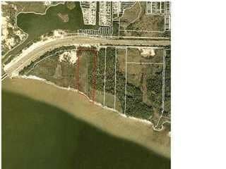

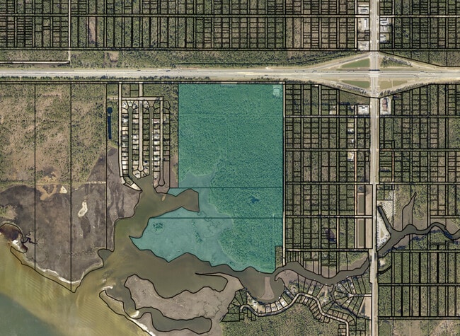
This Property Is For Sale
Property Detail
San Raphael St
05-1S-28-0000-00102-0000
COM NW COR BLK C MONTEREY SHRS TH S 89* E 690.56 FT TO POB TH CONT S 89* E 2044.88 FT TO W LINE OF 26TH AVE TH S ALONG W LINE 2010.16 FT TH S 89* W 2044.85 FT TH N 2025.39 FT TO POB AS D ES IN OR 1151 PG 684
Warehouse
SANTA ROSA
RR1
Florida
AE The base floodplain where base flood elevations are provided. AE Zones are now used on new format FIRMs instead of A1-A30 Zones.
94.72 AC
2024
Avalon Beach/Milton
2025
Pensacola
010702
Pensacola-Ferry Pass-Brent, FL
6,400 SF
NEARBY LISTINGS FOR SALE OR LEASE
DEMOGRAPHICS near San Raphael St
1 mile
3 mile
5 mile
2025 Total Population
171
3,805
37,411
2030 Population
186
4,140
39,126
Pop Growth 2025-2030
+ 8.77%
+ 8.80%
+ 4.58%
Average Age
42
42
41
2025 Total Households
67
1,471
15,338
HH Growth 2025-2030
+ 8.96%
+ 8.50%
+ 4.21%
Median Household Inc
$110,416
$106,375
$86,907
Avg Household Size
2.60
2.60
2.40
2025 Avg HH Vehicles
2.00
2.00
2.00
Median Home Value
$436,363
$377,800
$291,093
Median Year Built
2003
2001
1983
Nearby Places
Map Layers
Map Styles
 Street
 Aerial
Layers
 Traffic
 Biking
Places
Listings with unknown addresses are not visible on the map
- Restaurants
- Banks
- Shops
- Fitness
- Groceries
PUBLIC TRANSPORTATION
AIRPORT
Pensacola International
Drive
Walk
Distance
Pensacola International
22 min
12.8 mi
Freight Ports
Port of Mobile
Drive
Walk
Distance
Port of Mobile
72 min
62.9 mi
Nearby Properties
Address
Land Use
TOTAL SIZE
Lot Size
Zoning
Address
Land Use
TOTAL SIZE
Lot Size
Zoning
615,804 SF
16.46 AC
M2
Address
Land Use
TOTAL SIZE
Lot Size
Zoning
40,026 SF
1.79 AC
HCD
Address
Land Use
TOTAL SIZE
Lot Size
Zoning
37,232 SF
303.14 AC
HCD
Address
Land Use
TOTAL SIZE
Lot Size
Zoning
18,920 SF
3.65 AC
R3
Address
Land Use
TOTAL SIZE
Lot Size
Zoning
5,800 SF
148.82 AC
M2
Address
Land Use
TOTAL SIZE
Lot Size
Zoning
15,370 SF
12.15 AC
M2
Address
Land Use
TOTAL SIZE
Lot Size
Zoning
10,095 SF
1.03 AC
HCD
Address
Land Use
TOTAL SIZE
Lot Size
Zoning
9,081 SF
1.88 AC
HCD
Address
Land Use
TOTAL SIZE
Lot Size
Zoning
40,994 SF
57.36 AC
RR1
Address
Land Use
TOTAL SIZE
Lot Size
Zoning
15,375 SF
1.85 AC
M1
Address
Land Use
TOTAL SIZE
Lot Size
Zoning
10,008 SF
1.10 AC
HCD
Address
Land Use
TOTAL SIZE
Lot Size
Zoning
1,485 SF
3.14 AC
HCD
Address
Land Use
TOTAL SIZE
Lot Size
Zoning
11,241 SF
1.50 AC
HCD
Address
Land Use
TOTAL SIZE
Lot Size
Zoning
25,323 SF
2 AC
HCD
Address
Land Use
TOTAL SIZE
Lot Size
Zoning
627 SF
2.07 AC
HCD
Address
Land Use
TOTAL SIZE
Lot Size
Zoning
21,064 SF
3.10 AC
HCD
Address
Land Use
TOTAL SIZE
Lot Size
Zoning
4,327 SF
0.83 AC
HCD
Address
Land Use
TOTAL SIZE
Lot Size
Zoning
6,006 SF
0.83 AC
HCD
Address
Land Use
TOTAL SIZE
Lot Size
Zoning
12,854 SF
0.14 AC
M2
Address
Land Use
TOTAL SIZE
Lot Size
Zoning
7,500 SF
2.48 AC
M1
Address
Land Use
TOTAL SIZE
Lot Size
Zoning
8,516 SF
18.67 AC
AG-RR
Address
Land Use
TOTAL SIZE
Lot Size
Zoning
1.96 AC
HCD
Address
Land Use
TOTAL SIZE
Lot Size
Zoning
5,166 SF
36.44 AC
AG-RR
Address
Land Use
TOTAL SIZE
Lot Size
Zoning
9,715 SF
1.05 AC
HCD
Address
Land Use
TOTAL SIZE
Lot Size
Zoning
15.95 AC
M2
Address
Land Use
TOTAL SIZE
Lot Size
Zoning
5,523 SF
3 AC
R1
Address
Land Use
TOTAL SIZE
Lot Size
Zoning
5,460 SF
0.86 AC
R2
Address
Land Use
TOTAL SIZE
Lot Size
Zoning
5,575 SF
0.85 AC
M1
The World's #1 Commercial Real Estate Marketplace
Connect with us
© 2026 CoStar Group
The information above has been obtained from sources believed reliable. While we do not doubt its accuracy we have not verified it and make no guarantee, warranty or representation about it. It is your responsibility to independently confirm its accuracy and completeness. Any projections, opinions, assumptions, or estimates used are for example only and do not represent the current or future performance of the property. The value of this transaction to you depends on tax and other factors which should be evaluated by your tax, financial, and legal advisors. You and your advisors should conduct a careful, independent investigation of the property to determine to your satisfaction the suitability of the property for your needs.