Property Record
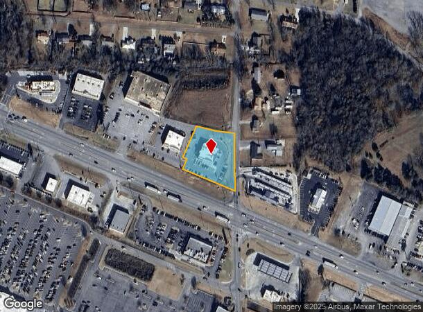
Us Highway 431, Guntersville, AL 35976
NEARBY LISTINGS FOR SALE OR LEASE
Property Detail
Us Highway 431
150736-0-001-015000
Red Barn Commercial Subdivision
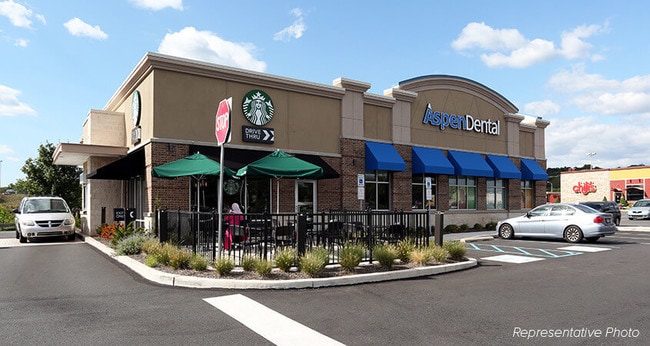
Medicalbuilding
LOT 1 RED BARN COMMERCIAL SUBDIVISION FINAL PLAT PB 08 PG 383 CONT 1.18 AC(D)
X
Marshall
01095C0317D
Alabama
2025
1
2024
1.67 AC
030602
Other Market Areas
5,736 SF
Albertville, AL
DEMOGRAPHICS near Us Highway 431
1 Mile
3 Mile
5 Mile
2024 Total Population
1,103
9,318
30,635
2029 Population
1,136
9,675
31,760
Pop Growth 2024-2029
+ 2.99%
+ 3.83%
+ 3.67%
Average Age
39
40
38
2024 Total Households
435
3,607
11,514
HH Growth 2024-2029
+ 2.99%
+ 3.71%
+ 3.61%
Median Household Inc
$63,529
$47,358
$46,217
Avg Household Size
2.50
2.50
2.60
2024 Avg HH Vehicles
2.00
2.00
2.00
Median Home Value
$155,737
$163,521
$164,117
Median Year Built
1984
1985
1981
Nearby Places
- Restaurants
- Banks
- Shops
- Fitness
- Groceries
SALE & LEASE HISTORY
LISTING DATE
SALE/LEASE

Jan 28, 2019
For Lease
Jan 24, 2019
For Sale
Nearby Properties
Address
Land Use
TOTAL SIZE
Lot Size
Zoning
Address
Land Use
TOTAL SIZE
Lot Size
Zoning
6,000 SF
39.80 AC
Address
Land Use
TOTAL SIZE
Lot Size
Zoning
136,255 SF
25 AC
Address
Land Use
TOTAL SIZE
Lot Size
Zoning
145,638 SF
22.60 AC
Address
Land Use
TOTAL SIZE
Lot Size
Zoning
36,340 SF
11.10 AC
Address
Land Use
TOTAL SIZE
Lot Size
Zoning
21,144 SF
1.86 AC
Address
Land Use
TOTAL SIZE
Lot Size
Zoning
1,428 SF
4.77 AC
Address
Land Use
TOTAL SIZE
Lot Size
Zoning
47,272 SF
3.12 AC
Address
Land Use
TOTAL SIZE
Lot Size
Zoning
55,499 SF
6.16 AC
Address
Land Use
TOTAL SIZE
Lot Size
Zoning
36,684 SF
4.80 AC
Address
Land Use
TOTAL SIZE
Lot Size
Zoning
4,198 SF
3.80 AC
Address
Land Use
TOTAL SIZE
Lot Size
Zoning
36,619 SF
5.97 AC
Address
Land Use
TOTAL SIZE
Lot Size
Zoning
53,752 SF
9.40 AC
Address
Land Use
TOTAL SIZE
Lot Size
Zoning
3,904 SF
5.63 AC
Address
Land Use
TOTAL SIZE
Lot Size
Zoning
124,089 SF
8.60 AC
Address
Land Use
TOTAL SIZE
Lot Size
Zoning
30,658 SF
3.31 AC
Address
Land Use
TOTAL SIZE
Lot Size
Zoning
27,886 SF
7 AC
Address
Land Use
TOTAL SIZE
Lot Size
Zoning
41,204 SF
8 AC
Address
Land Use
TOTAL SIZE
Lot Size
Zoning
22,000 SF
7.10 AC
Address
Land Use
TOTAL SIZE
Lot Size
Zoning
23,816 SF
2.56 AC
Address
Land Use
TOTAL SIZE
Lot Size
Zoning
2,240 SF
1.20 AC
Address
Land Use
TOTAL SIZE
Lot Size
Zoning
21,702 SF
4.96 AC
Address
Land Use
TOTAL SIZE
Lot Size
Zoning
61,269 SF
3.50 AC
Address
Land Use
TOTAL SIZE
Lot Size
Zoning
65,990 SF
5.26 AC
Address
Land Use
TOTAL SIZE
Lot Size
Zoning
7,935 SF
2.31 AC
Address
Land Use
TOTAL SIZE
Lot Size
Zoning
27,056 SF
4 AC
Address
Land Use
TOTAL SIZE
Lot Size
Zoning
22,812 SF
3.05 AC
Address
Land Use
TOTAL SIZE
Lot Size
Zoning
Address
Land Use
TOTAL SIZE
Lot Size
Zoning
31,250 SF
4 AC
Address
Land Use
TOTAL SIZE
Lot Size
Zoning
17,193 SF
2.27 AC
Address
Land Use
TOTAL SIZE
Lot Size
Zoning
10,062 SF
2.31 AC
The World's #1 Commercial Real Estate Marketplace
Connect with us
© 2025 CoStar Group
The information above has been obtained from sources believed reliable. While we do not doubt its accuracy we have not verified it and make no guarantee, warranty or representation about it. It is your responsibility to independently confirm its accuracy and completeness. Any projections, opinions, assumptions, or estimates used are for example only and do not represent the current or future performance of the property. The value of this transaction to you depends on tax and other factors which should be evaluated by your tax, financial, and legal advisors. You and your advisors should conduct a careful, independent investigation of the property to determine to your satisfaction the suitability of the property for your needs.