Property Record
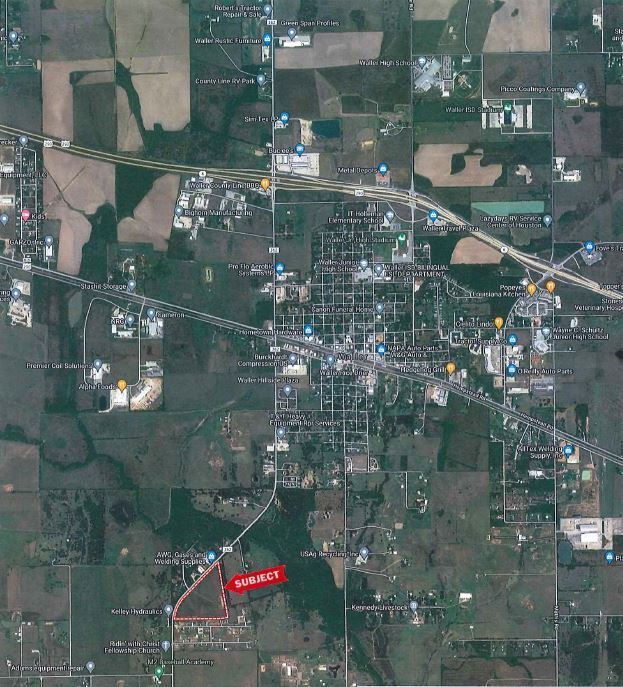
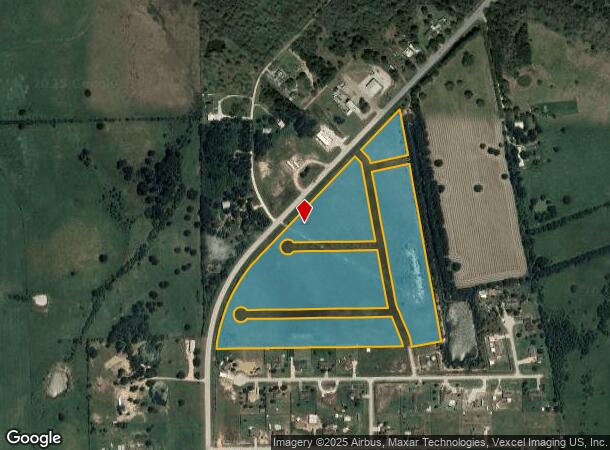
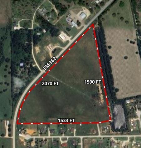
18119 Killings Worth Ln, Waller, TX 77484
NEARBY LISTINGS FOR SALE OR LEASE
Property Detail
18119 Killings Worth Ln
Houston-Pasadena-The Woodlands, TX
Cedar Creek Ranch
209366
S423420 CEDAR CREEK RANCH BLK 1 LOT 1 - 23; BLOCK 4, LOT 6-13; & 4.2814 AC IN ROADS ACRES 32.8565
Pasture
Waller
X
Texas
48473C0165F
1
2024
32.86 AC
2025
Northwest Outlier
556000
Houston
DEMOGRAPHICS near 18119 Killings Worth Ln
1 Mile
3 Mile
5 Mile
2024 Total Population
424
5,978
10,749
2029 Population
534
7,157
12,762
Pop Growth 2024-2029
+ 25.94%
+ 19.72%
+ 18.73%
Average Age
39
38
38
2024 Total Households
147
2,125
3,832
HH Growth 2024-2029
+ 25.17%
+ 19.58%
+ 18.68%
Median Household Inc
$62,500
$39,533
$41,029
Avg Household Size
2.80
2.80
2.80
2024 Avg HH Vehicles
2.00
2.00
2.00
Median Home Value
$248,333
$241,666
$257,963
Median Year Built
1980
1990
1992
Nearby Places
Map Layers
Map Styles
 Street
 Aerial
- Restaurants
- Banks
- Shops
- Fitness
- Groceries
SALE & LEASE HISTORY
LISTING DATE
SALE/LEASE

Nov 02, 2017
For Sale
May 05, 2021
For Sale
Dec 19, 2024
For Sale
Aug 23, 2017
For Sale
Nearby Properties
Address
Land Use
TOTAL SIZE
Lot Size
Zoning
Address
Land Use
TOTAL SIZE
Lot Size
Zoning
512,325 SF
63.88 AC
Address
Land Use
TOTAL SIZE
Lot Size
Zoning
496,333 SF
86.70 AC
Address
Land Use
TOTAL SIZE
Lot Size
Zoning
189,034 SF
9.49 AC
Address
Land Use
TOTAL SIZE
Lot Size
Zoning
239,994 SF
71.50 AC
Address
Land Use
TOTAL SIZE
Lot Size
Zoning
162,668 SF
39.99 AC
Address
Land Use
TOTAL SIZE
Lot Size
Zoning
114,480 SF
49.86 AC
Address
Land Use
TOTAL SIZE
Lot Size
Zoning
68,500 SF
16.73 AC
Address
Land Use
TOTAL SIZE
Lot Size
Zoning
62,388 SF
16.54 AC
Address
Land Use
TOTAL SIZE
Lot Size
Zoning
73,435 SF
94.57 AC
Address
Land Use
TOTAL SIZE
Lot Size
Zoning
111,160 SF
40 AC
Address
Land Use
TOTAL SIZE
Lot Size
Zoning
123,852 SF
7.80 AC
Address
Land Use
TOTAL SIZE
Lot Size
Zoning
96,437 SF
12.86 AC
Address
Land Use
TOTAL SIZE
Lot Size
Zoning
97,294 SF
14.51 AC
Address
Land Use
TOTAL SIZE
Lot Size
Zoning
146,248 SF
14.62 AC
Address
Land Use
TOTAL SIZE
Lot Size
Zoning
8,167 SF
19.47 AC
Address
Land Use
TOTAL SIZE
Lot Size
Zoning
76,920 SF
16 AC
Address
Land Use
TOTAL SIZE
Lot Size
Zoning
66,520 SF
10.15 AC
Address
Land Use
TOTAL SIZE
Lot Size
Zoning
Address
Land Use
TOTAL SIZE
Lot Size
Zoning
30,748 SF
17.20 AC
Address
Land Use
TOTAL SIZE
Lot Size
Zoning
83,411 SF
9.10 AC
Address
Land Use
TOTAL SIZE
Lot Size
Zoning
94,709 SF
20.91 AC
Address
Land Use
TOTAL SIZE
Lot Size
Zoning
57,880 SF
5.23 AC
Address
Land Use
TOTAL SIZE
Lot Size
Zoning
152.84 AC
Address
Land Use
TOTAL SIZE
Lot Size
Zoning
8,827 SF
8.45 AC
Address
Land Use
TOTAL SIZE
Lot Size
Zoning
44,031 SF
2.40 AC
Address
Land Use
TOTAL SIZE
Lot Size
Zoning
80,364 SF
25 AC
Address
Land Use
TOTAL SIZE
Lot Size
Zoning
227,400 SF
14.05 AC
Address
Land Use
TOTAL SIZE
Lot Size
Zoning
31,720 SF
2.26 AC
Address
Land Use
TOTAL SIZE
Lot Size
Zoning
27,860 SF
8.29 AC
Address
Land Use
TOTAL SIZE
Lot Size
Zoning
283,081 SF
16.35 AC
The World's #1 Commercial Real Estate Marketplace
Connect with us
© 2026 CoStar Group
The information above has been obtained from sources believed reliable. While we do not doubt its accuracy we have not verified it and make no guarantee, warranty or representation about it. It is your responsibility to independently confirm its accuracy and completeness. Any projections, opinions, assumptions, or estimates used are for example only and do not represent the current or future performance of the property. The value of this transaction to you depends on tax and other factors which should be evaluated by your tax, financial, and legal advisors. You and your advisors should conduct a careful, independent investigation of the property to determine to your satisfaction the suitability of the property for your needs.