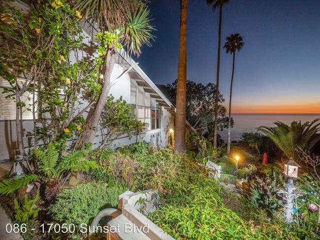
Property Record
0000, Pacific Palisades, CA 00000

NEARBY LISTINGS FOR SALE OR LEASE
-
-
View all Pacific Palisades listings for sale on LoopNet.com
Property Detail
0000
Los Angeles-Long Beach-Glendale, CA
10238
4415-020-009
TRACT # 10238 LOT ON SW LINE OF SUNSET BLVD COM W THEREON 99.50 FT FROM NW COR OF LOT 2 TH NW ON SD SW LINE 60.21 FT TH S 17 5542 W 160.72 FT TH S 63 5018 E 60.63 FT TH N 17 5542 E 164.4 FT TO BEG PART OF LOT 1
Residentialacreage
Los Angeles
X
California
06037C1566G
2
2024
0.11 AC
2025
Pacific Palisades
262704
Los Angeles
DEMOGRAPHICS near 0000
1 Mile
3 Mile
5 Mile
2024 Total Population
7,159
35,068
138,891
2029 Population
7,012
34,424
136,458
Pop Growth 2024-2029
(2.05%)
(1.84%)
(1.75%)
Average Age
47
46
44
2024 Total Households
3,058
15,061
66,931
HH Growth 2024-2029
(2.19%)
(1.78%)
(1.81%)
Median Household Inc
$155,750
$164,876
$122,800
Avg Household Size
2.30
2.30
2.00
2024 Avg HH Vehicles
2.00
2.00
2.00
Median Home Value
$1,136,209
$1,138,426
$1,124,161
Median Year Built
1964
1968
1969
Nearby Places
Map Layers
Map Styles
 Street
 Aerial
- Restaurants
- Banks
- Shops
- Fitness
- Groceries
PUBLIC TRANSPORTATION
AIRPORT
Los Angeles International
DRIVE
WALK
Distance
Los Angeles International
26 min
13.7 mi
Bob Hope
DRIVE
WALK
Distance
Bob Hope
40 min
23.2 mi
Long Beach (Daugherty Field)
DRIVE
WALK
Distance
Long Beach (Daugherty Field)
45 min
33.9 mi
Freight Ports
Port of Los Angeles
DRIVE
WALK
Distance
Port of Los Angeles
52 min
37.1 mi
Nearby Properties
Address
Land Use
TOTAL SIZE
Lot Size
Zoning
Address
Land Use
TOTAL SIZE
Lot Size
Zoning
193,462 SF
64.72 AC
LAA1
Address
Land Use
TOTAL SIZE
Lot Size
Zoning
89,748 SF
2.13 AC
Address
Land Use
TOTAL SIZE
Lot Size
Zoning
92,689 SF
163.94 AC
LAA1
Address
Land Use
TOTAL SIZE
Lot Size
Zoning
37,989 SF
1 AC
SMR4*
Address
Land Use
TOTAL SIZE
Lot Size
Zoning
93,900 SF
1.73 AC
LAC2
Address
Land Use
TOTAL SIZE
Lot Size
Zoning
92,957 SF
0.56 AC
SMR2*
Address
Land Use
TOTAL SIZE
Lot Size
Zoning
58,558 SF
0.69 AC
SMR3
Address
Land Use
TOTAL SIZE
Lot Size
Zoning
22,751 SF
0.43 AC
Address
Land Use
TOTAL SIZE
Lot Size
Zoning
30,954 SF
0.35 AC
SMR3*
Address
Land Use
TOTAL SIZE
Lot Size
Zoning
105,909 SF
2.08 AC
LAC2
Address
Land Use
TOTAL SIZE
Lot Size
Zoning
32,904 SF
5.60 AC
LAA1
Address
Land Use
TOTAL SIZE
Lot Size
Zoning
54,955 SF
0.52 AC
SMR3*
Address
Land Use
TOTAL SIZE
Lot Size
Zoning
44,199 SF
0.50 AC
SMR2*
Address
Land Use
TOTAL SIZE
Lot Size
Zoning
40,412 SF
0.51 AC
SMR2*
Address
Land Use
TOTAL SIZE
Lot Size
Zoning
43,738 SF
0.51 AC
SMR2*
Address
Land Use
TOTAL SIZE
Lot Size
Zoning
32,856 SF
0.35 AC
SMR3*
Address
Land Use
TOTAL SIZE
Lot Size
Zoning
64,344 SF
1.04 AC
LAR3
Address
Land Use
TOTAL SIZE
Lot Size
Zoning
22,426 SF
0.43 AC
SMR4*
Address
Land Use
TOTAL SIZE
Lot Size
Zoning
28,485 SF
0.34 AC
SMR3*
Address
Land Use
TOTAL SIZE
Lot Size
Zoning
41,077 SF
0.51 AC
SMR2*
Address
Land Use
TOTAL SIZE
Lot Size
Zoning
20,490 SF
0.49 AC
SMR2*
Address
Land Use
TOTAL SIZE
Lot Size
Zoning
41,832 SF
0.51 AC
SMR2*
Address
Land Use
TOTAL SIZE
Lot Size
Zoning
25,040 SF
4.19 AC
LAC2
Address
Land Use
TOTAL SIZE
Lot Size
Zoning
4,869 SF
0.45 AC
SMR1*
Address
Land Use
TOTAL SIZE
Lot Size
Zoning
30,486 SF
0.35 AC
SMR3*
Address
Land Use
TOTAL SIZE
Lot Size
Zoning
45,032 SF
0.52 AC
SMR3*
Address
Land Use
TOTAL SIZE
Lot Size
Zoning
89,671 SF
1.34 AC
LAC2
Address
Land Use
TOTAL SIZE
Lot Size
Zoning
2,636 SF
0.29 AC
SMR1*
Address
Land Use
TOTAL SIZE
Lot Size
Zoning
16,200 SF
0.41 AC
LAR3
The World's #1 Commercial Real Estate Marketplace
Connect with us
© 2025 CoStar Group
The information above has been obtained from sources believed reliable. While we do not doubt its accuracy we have not verified it and make no guarantee, warranty or representation about it. It is your responsibility to independently confirm its accuracy and completeness. Any projections, opinions, assumptions, or estimates used are for example only and do not represent the current or future performance of the property. The value of this transaction to you depends on tax and other factors which should be evaluated by your tax, financial, and legal advisors. You and your advisors should conduct a careful, independent investigation of the property to determine to your satisfaction the suitability of the property for your needs.