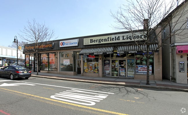
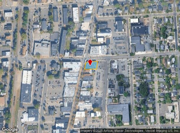
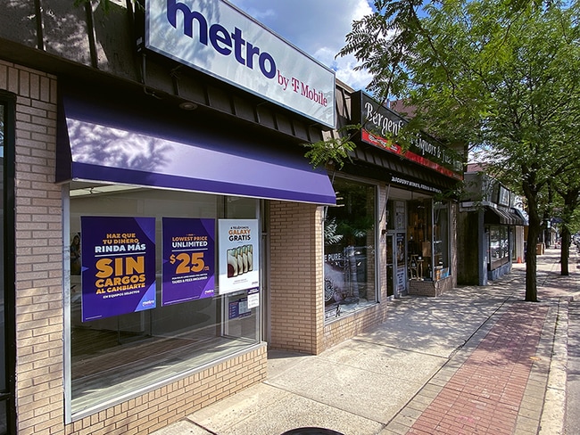
Property Record
15 S Washington Ave, Bergenfield, NJ 07621
Current Lease Availabilities
NEARBY LISTINGS FOR SALE OR LEASE
Property Detail
15 S Washington Ave
New York-Jersey City-White Plains, NY-NJ
70X117
03-00162-0000-00013
Bergen
Commercialnec
New Jersey
X
13
34003C0211H
0.19 AC
2024
Palisades
2025
Northern New Jersey
003200
DEMOGRAPHICS near 15 S Washington Ave
1 Mile
3 Mile
5 Mile
2024 Total Population
28,881
169,083
374,994
2029 Population
28,505
168,780
373,274
Pop Growth 2024-2029
(1.30%)
(0.18%)
(0.46%)
Average Age
41
41
42
2024 Total Households
9,622
57,722
135,027
HH Growth 2024-2029
(1.37%)
(0.17%)
(0.53%)
Median Household Inc
$111,708
$118,244
$107,736
Avg Household Size
2.90
2.80
2.70
2024 Avg HH Vehicles
2.00
2.00
2.00
Median Home Value
$430,522
$499,955
$516,133
Median Year Built
1953
1953
1957
Nearby Places
Map Layers
Map Styles
 Street
 Aerial
- Restaurants
- Banks
- Shops
- Fitness
- Groceries
PUBLIC TRANSPORTATION
COMMUTER RAIL
River Edge (Pascack Valley Line - NJ Transit Commuter Rail (NJ Transit))
DRIVE
WALK
Distance
River Edge (Pascack Valley Line - NJ Transit Commuter Rail (NJ Transit))
4 min
2.2 mi
New Bridge Landing (Pascack Valley Line - NJ Transit Commuter Rail (NJ Transit))
DRIVE
WALK
Distance
New Bridge Landing (Pascack Valley Line - NJ Transit Commuter Rail (NJ Transit))
5 min
3.2 mi
AIRPORT
LaGuardia
DRIVE
WALK
Distance
LaGuardia
29 min
17.5 mi
Newark Liberty International
DRIVE
WALK
Distance
Newark Liberty International
24 min
20.1 mi
Westchester County
DRIVE
WALK
Distance
Westchester County
45 min
30.4 mi
Freight Ports
NY - Red Hook Container Terminal
DRIVE
WALK
Distance
NY - Red Hook Container Terminal
38 min
22.3 mi
Nearby Properties
Address
Land Use
TOTAL SIZE
Lot Size
Zoning
Address
Land Use
TOTAL SIZE
Lot Size
Zoning
1,267 SF
0.14 AC
BML
Address
Land Use
TOTAL SIZE
Lot Size
Zoning
512,862 SF
14.16 AC
Address
Land Use
TOTAL SIZE
Lot Size
Zoning
572,137 SF
14.11 AC
R-D
Address
Land Use
TOTAL SIZE
Lot Size
Zoning
25,620 SF
21.37 AC
Address
Land Use
TOTAL SIZE
Lot Size
Zoning
5.22 AC
APT
Address
Land Use
TOTAL SIZE
Lot Size
Zoning
4.54 AC
R-M3
Address
Land Use
TOTAL SIZE
Lot Size
Zoning
303,434 SF
13.34 AC
Address
Land Use
TOTAL SIZE
Lot Size
Zoning
Address
Land Use
TOTAL SIZE
Lot Size
Zoning
185,878 SF
33.44 AC
B
Address
Land Use
TOTAL SIZE
Lot Size
Zoning
Address
Land Use
TOTAL SIZE
Lot Size
Zoning
65,087 SF
4 AC
Address
Land Use
TOTAL SIZE
Lot Size
Zoning
343,036 SF
8.50 AC
Address
Land Use
TOTAL SIZE
Lot Size
Zoning
Address
Land Use
TOTAL SIZE
Lot Size
Zoning
1.12 AC
Address
Land Use
TOTAL SIZE
Lot Size
Zoning
47,623 SF
88.60 AC
B
Address
Land Use
TOTAL SIZE
Lot Size
Zoning
68,824 SF
34.75 AC
R-D
Address
Land Use
TOTAL SIZE
Lot Size
Zoning
7.34 AC
Address
Land Use
TOTAL SIZE
Lot Size
Zoning
16.76 AC
R3
Address
Land Use
TOTAL SIZE
Lot Size
Zoning
169,514 SF
22.40 AC
Address
Land Use
TOTAL SIZE
Lot Size
Zoning
173,890 SF
23.80 AC
O
Address
Land Use
TOTAL SIZE
Lot Size
Zoning
21,250 SF
2.37 AC
SBD
Address
Land Use
TOTAL SIZE
Lot Size
Zoning
36.90 AC
MU
Address
Land Use
TOTAL SIZE
Lot Size
Zoning
254,512 SF
3 AC
HRO
Address
Land Use
TOTAL SIZE
Lot Size
Zoning
167,896 SF
7.70 AC
Address
Land Use
TOTAL SIZE
Lot Size
Zoning
12.31 AC
R3
Address
Land Use
TOTAL SIZE
Lot Size
Zoning
1.78 AC
L1
Address
Land Use
TOTAL SIZE
Lot Size
Zoning
13.15 AC
P
Address
Land Use
TOTAL SIZE
Lot Size
Zoning
4,000 SF
27.90 AC
B3
Address
Land Use
TOTAL SIZE
Lot Size
Zoning
28 AC
U
Address
Land Use
TOTAL SIZE
Lot Size
Zoning
11.89 AC
U
The World's #1 Commercial Real Estate Marketplace
Connect with us
© 2026 CoStar Group
The information above has been obtained from sources believed reliable. While we do not doubt its accuracy we have not verified it and make no guarantee, warranty or representation about it. It is your responsibility to independently confirm its accuracy and completeness. Any projections, opinions, assumptions, or estimates used are for example only and do not represent the current or future performance of the property. The value of this transaction to you depends on tax and other factors which should be evaluated by your tax, financial, and legal advisors. You and your advisors should conduct a careful, independent investigation of the property to determine to your satisfaction the suitability of the property for your needs.