Property Record
1 Andrews Cir, Brecksville, OH 44141


NEARBY LISTINGS FOR SALE OR LEASE
Property Detail
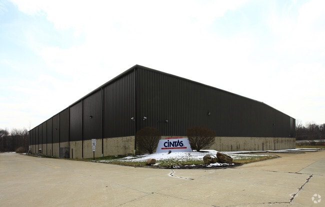
1 Andrews Cir
Cleveland
Andrews Circle
Cleveland-Elyria, OH
PCL D VOL 356 PG 45 FF 204.20 18.598AC OL 66 / 67 ADDITIONAL PARCEL 60425001 AND 006 2009S/R
604-24-003
Cuyahoga
Publicstorage
Ohio
2024
d
2024
18.60 AC
135105
Brecksville/Vly View
209,392 SF
DEMOGRAPHICS near 1 Andrews Cir
1 Mile
3 Mile
5 Mile
2024 Total Population
1,116
14,784
46,079
2029 Population
1,081
14,439
44,970
Pop Growth 2024-2029
(3.14%)
(2.33%)
(2.41%)
Average Age
44
44
44
2024 Total Households
410
5,677
18,828
HH Growth 2024-2029
(3.41%)
(2.54%)
(2.59%)
Median Household Inc
$136,136
$126,692
$102,243
Avg Household Size
2.60
2.50
2.40
2024 Avg HH Vehicles
2.00
2.00
2.00
Median Home Value
$409,091
$349,400
$315,664
Median Year Built
1985
1987
1980
Nearby Places
Map Layers
Map Styles
 Street
 Aerial
- Restaurants
- Banks
- Shops
- Fitness
- Groceries
PUBLIC TRANSPORTATION
COMMUTER RAIL
Boston Mill (National Park Scenic Railway - Cuyahoga Valley Scenic Railroad)
DRIVE
WALK
Distance
Boston Mill (National Park Scenic Railway - Cuyahoga Valley Scenic Railroad)
13 min
5.6 mi
Brecksville (National Park Scenic Railway - Cuyahoga Valley Scenic Railroad)
DRIVE
WALK
Distance
Brecksville (National Park Scenic Railway - Cuyahoga Valley Scenic Railroad)
12 min
6.0 mi
AIRPORT
Cleveland-Hopkins International
DRIVE
WALK
Distance
Cleveland-Hopkins International
35 min
21.5 mi
Akron-Canton Regional
DRIVE
WALK
Distance
Akron-Canton Regional
46 min
35.1 mi
Freight Ports
Port of Toledo
DRIVE
WALK
Distance
Port of Toledo
138 min
117.6 mi
Nearby Properties
Address
Land Use
TOTAL SIZE
Lot Size
Zoning
Address
Land Use
TOTAL SIZE
Lot Size
Zoning
105,027 SF
14.05 AC
O-L
Address
Land Use
TOTAL SIZE
Lot Size
Zoning
118.84 AC
L-B
Address
Land Use
TOTAL SIZE
Lot Size
Zoning
234,688 SF
32.45 AC
Address
Land Use
TOTAL SIZE
Lot Size
Zoning
739,000 SF
67.10 AC
Address
Land Use
TOTAL SIZE
Lot Size
Zoning
67.10 AC
Address
Land Use
TOTAL SIZE
Lot Size
Zoning
496.33 AC
C-F
Address
Land Use
TOTAL SIZE
Lot Size
Zoning
105,106 SF
20.67 AC
C-F
Address
Land Use
TOTAL SIZE
Lot Size
Zoning
306,640 SF
19.15 AC
M-D
Address
Land Use
TOTAL SIZE
Lot Size
Zoning
166,699 SF
65.80 AC
B-5
Address
Land Use
TOTAL SIZE
Lot Size
Zoning
63,282 SF
20.09 AC
O-B
Address
Land Use
TOTAL SIZE
Lot Size
Zoning
196,491 SF
2.56 AC
R-20
Address
Land Use
TOTAL SIZE
Lot Size
Zoning
73.13 AC
C-F
Address
Land Use
TOTAL SIZE
Lot Size
Zoning
6,395 SF
0.23 AC
O-L
Address
Land Use
TOTAL SIZE
Lot Size
Zoning
Address
Land Use
TOTAL SIZE
Lot Size
Zoning
337,568 SF
26.88 AC
O-L
Address
Land Use
TOTAL SIZE
Lot Size
Zoning
55,332 SF
3.01 AC
E-2
Address
Land Use
TOTAL SIZE
Lot Size
Zoning
89,807 SF
7.29 AC
Address
Land Use
TOTAL SIZE
Lot Size
Zoning
49,470 SF
6.61 AC
E-1
Address
Land Use
TOTAL SIZE
Lot Size
Zoning
83,495 SF
9.70 AC
E-1
Address
Land Use
TOTAL SIZE
Lot Size
Zoning
131,001 SF
13.47 AC
Address
Land Use
TOTAL SIZE
Lot Size
Zoning
74,531 SF
19.01 AC
C-F
Address
Land Use
TOTAL SIZE
Lot Size
Zoning
167,857 SF
10.60 AC
M-D
Address
Land Use
TOTAL SIZE
Lot Size
Zoning
11.97 AC
R-8
Address
Land Use
TOTAL SIZE
Lot Size
Zoning
142,510 SF
13.87 AC
E-2
Address
Land Use
TOTAL SIZE
Lot Size
Zoning
183.35 AC
Address
Land Use
TOTAL SIZE
Lot Size
Zoning
6.29 AC
L-B
Address
Land Use
TOTAL SIZE
Lot Size
Zoning
25.06 AC
L-B
Address
Land Use
TOTAL SIZE
Lot Size
Zoning
59,813 SF
5.56 AC
Address
Land Use
TOTAL SIZE
Lot Size
Zoning
The World's #1 Commercial Real Estate Marketplace
Connect with us
© 2025 CoStar Group
The information above has been obtained from sources believed reliable. While we do not doubt its accuracy we have not verified it and make no guarantee, warranty or representation about it. It is your responsibility to independently confirm its accuracy and completeness. Any projections, opinions, assumptions, or estimates used are for example only and do not represent the current or future performance of the property. The value of this transaction to you depends on tax and other factors which should be evaluated by your tax, financial, and legal advisors. You and your advisors should conduct a careful, independent investigation of the property to determine to your satisfaction the suitability of the property for your needs.