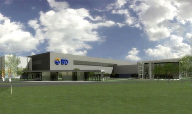
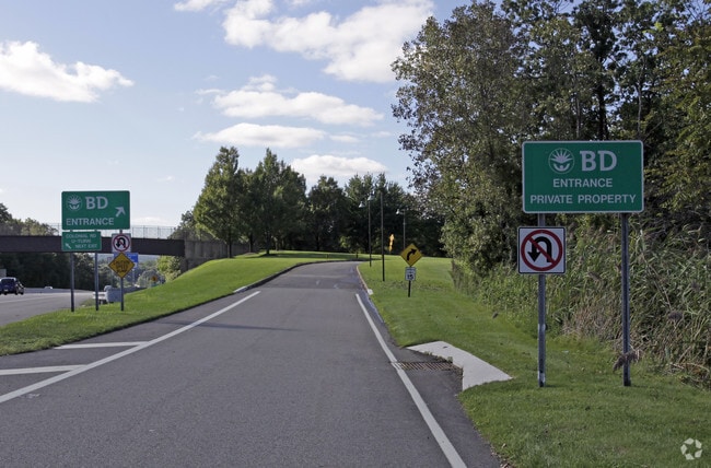
Property Record
1 Becton Dr, Franklin Lakes, NJ 07417

NEARBY LISTINGS FOR SALE OR LEASE
Property Detail
1 Becton Dr
New York-Jersey City-White Plains, NY-NJ
128.12 AC
20-01422-0000-00001
Bergen
Commercialnec
New Jersey
X
1
34003C0064H
128.12 AC
2024
Western Bergen
2025
Northern New Jersey
020100
DEMOGRAPHICS near 1 Becton Dr
1 Mile
3 Mile
5 Mile
2024 Total Population
4,909
44,671
163,082
2029 Population
4,928
44,821
162,314
Pop Growth 2024-2029
+ 0.39%
+ 0.34%
(0.47%)
Average Age
44
43
43
2024 Total Households
1,725
15,237
58,170
HH Growth 2024-2029
+ 0.29%
+ 0.24%
(0.62%)
Median Household Inc
$158,306
$163,318
$131,363
Avg Household Size
2.80
2.80
2.70
2024 Avg HH Vehicles
2.00
2.00
2.00
Median Home Value
$904,053
$762,137
$609,462
Median Year Built
1974
1969
1966
Nearby Places
Map Layers
Map Styles
 Street
 Aerial
- Restaurants
- Banks
- Shops
- Fitness
- Groceries
PUBLIC TRANSPORTATION
COMMUTER RAIL
Waldwick (Bergen County/Port Jervis Line - NJ Transit Commuter Rail (NJ Transit), Main/Port Jervis Line - NJ Transit Commuter Rail (NJ Transit))
DRIVE
WALK
Distance
Waldwick (Bergen County/Port Jervis Line - NJ Transit Commuter Rail (NJ Transit), Main/Port Jervis Line - NJ Transit Commuter Rail (NJ Transit))
13 min
6.2 mi
Allendale (Bergen County/Port Jervis Line - NJ Transit Commuter Rail (NJ Transit), Main/Port Jervis Line - NJ Transit Commuter Rail (NJ Transit))
DRIVE
WALK
Distance
Allendale (Bergen County/Port Jervis Line - NJ Transit Commuter Rail (NJ Transit), Main/Port Jervis Line - NJ Transit Commuter Rail (NJ Transit))
14 min
6.9 mi
AIRPORT
LaGuardia
DRIVE
WALK
Distance
LaGuardia
44 min
29.8 mi
Newark Liberty International
DRIVE
WALK
Distance
Newark Liberty International
39 min
30.1 mi
Westchester County
DRIVE
WALK
Distance
Westchester County
54 min
39.7 mi
Freight Ports
Maher Terminal
DRIVE
WALK
Distance
Maher Terminal
45 min
29.7 mi
Nearby Properties
Address
Land Use
TOTAL SIZE
Lot Size
Zoning
Address
Land Use
TOTAL SIZE
Lot Size
Zoning
88.72 AC
ORL
Address
Land Use
TOTAL SIZE
Lot Size
Zoning
2,252 SF
19.04 AC
Address
Land Use
TOTAL SIZE
Lot Size
Zoning
50.16 AC
CO
Address
Land Use
TOTAL SIZE
Lot Size
Zoning
10.55 AC
IP
Address
Land Use
TOTAL SIZE
Lot Size
Zoning
5.01 AC
IP
Address
Land Use
TOTAL SIZE
Lot Size
Zoning
12.69 AC
A40
Address
Land Use
TOTAL SIZE
Lot Size
Zoning
8.07 AC
IP
Address
Land Use
TOTAL SIZE
Lot Size
Zoning
14.04 AC
B2
Address
Land Use
TOTAL SIZE
Lot Size
Zoning
79,562 SF
10.33 AC
AHO3
Address
Land Use
TOTAL SIZE
Lot Size
Zoning
10.42 AC
B2
Address
Land Use
TOTAL SIZE
Lot Size
Zoning
12.45 AC
A225
Address
Land Use
TOTAL SIZE
Lot Size
Zoning
12.49 AC
AHO1
Address
Land Use
TOTAL SIZE
Lot Size
Zoning
98.41 AC
A130
Address
Land Use
TOTAL SIZE
Lot Size
Zoning
13.39 AC
MFAH
Address
Land Use
TOTAL SIZE
Lot Size
Zoning
26.70 AC
Address
Land Use
TOTAL SIZE
Lot Size
Zoning
8.07 AC
SR
Address
Land Use
TOTAL SIZE
Lot Size
Zoning
2,005 SF
4.62 AC
A225
Address
Land Use
TOTAL SIZE
Lot Size
Zoning
2,738 SF
1.77 AC
RB
Address
Land Use
TOTAL SIZE
Lot Size
Zoning
6.99 AC
IP
Address
Land Use
TOTAL SIZE
Lot Size
Zoning
28.69 AC
RA-2
Address
Land Use
TOTAL SIZE
Lot Size
Zoning
6 AC
IP
Address
Land Use
TOTAL SIZE
Lot Size
Zoning
8.87 AC
RA1
Address
Land Use
TOTAL SIZE
Lot Size
Zoning
13.66 AC
Address
Land Use
TOTAL SIZE
Lot Size
Zoning
19.60 AC
Address
Land Use
TOTAL SIZE
Lot Size
Zoning
2,372 SF
5 AC
IP
Address
Land Use
TOTAL SIZE
Lot Size
Zoning
13.40 AC
RA25
Address
Land Use
TOTAL SIZE
Lot Size
Zoning
4.96 AC
I3
Address
Land Use
TOTAL SIZE
Lot Size
Zoning
36.30 AC
A40
Address
Land Use
TOTAL SIZE
Lot Size
Zoning
5.25 AC
B2
The World's #1 Commercial Real Estate Marketplace
Connect with us
© 2026 CoStar Group
The information above has been obtained from sources believed reliable. While we do not doubt its accuracy we have not verified it and make no guarantee, warranty or representation about it. It is your responsibility to independently confirm its accuracy and completeness. Any projections, opinions, assumptions, or estimates used are for example only and do not represent the current or future performance of the property. The value of this transaction to you depends on tax and other factors which should be evaluated by your tax, financial, and legal advisors. You and your advisors should conduct a careful, independent investigation of the property to determine to your satisfaction the suitability of the property for your needs.