Property Record
1 Burns Hill Rd, Hudson, NH 03051


NEARBY LISTINGS FOR SALE OR LEASE
Property Detail
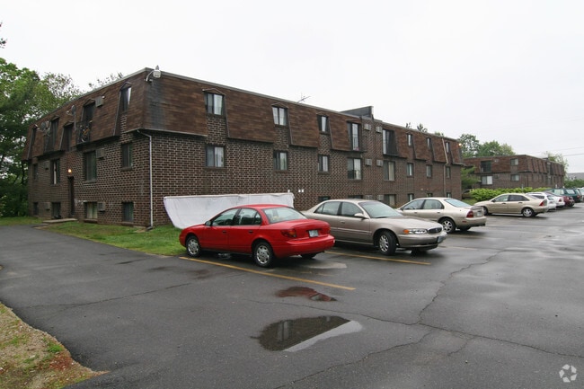
1 Burns Hill Rd
Apartment
Hillsborough
X
New Hampshire
33011C0656D
7.87 AC
2024
Outer Hillsborough County
2024
Boston
012302
Manchester-Nashua, NH
12,992 SF
HDSO-000204-000067
DEMOGRAPHICS near 1 Burns Hill Rd
1 Mile
3 Mile
5 Mile
2024 Total Population
5,268
60,816
123,452
2029 Population
5,403
62,040
125,934
Pop Growth 2024-2029
+ 2.56%
+ 2.01%
+ 2.01%
Average Age
43
40
41
2024 Total Households
2,049
24,924
49,692
HH Growth 2024-2029
+ 2.59%
+ 2.03%
+ 2.01%
Median Household Inc
$91,151
$81,880
$95,157
Avg Household Size
2.50
2.40
2.40
2024 Avg HH Vehicles
2.00
2.00
2.00
Median Home Value
$369,349
$357,881
$373,818
Median Year Built
1977
1968
1976
Nearby Places
Map Layers
Map Styles
 Street
 Aerial
- Restaurants
- Banks
- Shops
- Fitness
- Groceries
PUBLIC TRANSPORTATION
AIRPORT
Manchester Boston Regional
DRIVE
WALK
Distance
Manchester Boston Regional
33 min
17.7 mi
Freight Ports
Port of Boston
DRIVE
WALK
Distance
Port of Boston
67 min
47.9 mi
Nearby Properties
Address
Land Use
TOTAL SIZE
Lot Size
Zoning
Address
Land Use
TOTAL SIZE
Lot Size
Zoning
19.70 AC
RB
Address
Land Use
TOTAL SIZE
Lot Size
Zoning
29.77 AC
RC
Address
Land Use
TOTAL SIZE
Lot Size
Zoning
27.98 AC
GI
Address
Land Use
TOTAL SIZE
Lot Size
Zoning
20.72 AC
RC
Address
Land Use
TOTAL SIZE
Lot Size
Zoning
15.19 AC
RC
Address
Land Use
TOTAL SIZE
Lot Size
Zoning
522,476 SF
74.89 AC
GD
Address
Land Use
TOTAL SIZE
Lot Size
Zoning
220,295 SF
4.34 AC
D1MU
Address
Land Use
TOTAL SIZE
Lot Size
Zoning
118.50 AC
PI
Address
Land Use
TOTAL SIZE
Lot Size
Zoning
20.80 AC
RC
Address
Land Use
TOTAL SIZE
Lot Size
Zoning
5.30 AC
GIMU
Address
Land Use
TOTAL SIZE
Lot Size
Zoning
133,390 SF
97.42 AC
R2
Address
Land Use
TOTAL SIZE
Lot Size
Zoning
231,216 SF
1.88 AC
GIMU
Address
Land Use
TOTAL SIZE
Lot Size
Zoning
206,913 SF
18.30 AC
GB
Address
Land Use
TOTAL SIZE
Lot Size
Zoning
15.16 AC
GI
Address
Land Use
TOTAL SIZE
Lot Size
Zoning
21.40 AC
RC
Address
Land Use
TOTAL SIZE
Lot Size
Zoning
37.57 AC
R9
Address
Land Use
TOTAL SIZE
Lot Size
Zoning
8.87 AC
RC
Address
Land Use
TOTAL SIZE
Lot Size
Zoning
21.16 AC
D3MU
Address
Land Use
TOTAL SIZE
Lot Size
Zoning
312,738 SF
25.84 AC
ID
Address
Land Use
TOTAL SIZE
Lot Size
Zoning
12.55 AC
RC
Address
Land Use
TOTAL SIZE
Lot Size
Zoning
261,381 SF
3.78 AC
GIMU
Address
Land Use
TOTAL SIZE
Lot Size
Zoning
185,242 SF
35.75 AC
ID
Address
Land Use
TOTAL SIZE
Lot Size
Zoning
8.09 AC
RC
Address
Land Use
TOTAL SIZE
Lot Size
Zoning
116,602 SF
11.74 AC
GB
Address
Land Use
TOTAL SIZE
Lot Size
Zoning
77,276 SF
19.50 AC
PI
Address
Land Use
TOTAL SIZE
Lot Size
Zoning
160,329 SF
16.13 AC
RB
Address
Land Use
TOTAL SIZE
Lot Size
Zoning
233,668 SF
16.83 AC
PI
Address
Land Use
TOTAL SIZE
Lot Size
Zoning
129,441 SF
18.90 AC
R9
Address
Land Use
TOTAL SIZE
Lot Size
Zoning
28.33 AC
GI
Address
Land Use
TOTAL SIZE
Lot Size
Zoning
13.02 AC
R9
The World's #1 Commercial Real Estate Marketplace
Connect with us
© 2025 CoStar Group
The information above has been obtained from sources believed reliable. While we do not doubt its accuracy we have not verified it and make no guarantee, warranty or representation about it. It is your responsibility to independently confirm its accuracy and completeness. Any projections, opinions, assumptions, or estimates used are for example only and do not represent the current or future performance of the property. The value of this transaction to you depends on tax and other factors which should be evaluated by your tax, financial, and legal advisors. You and your advisors should conduct a careful, independent investigation of the property to determine to your satisfaction the suitability of the property for your needs.