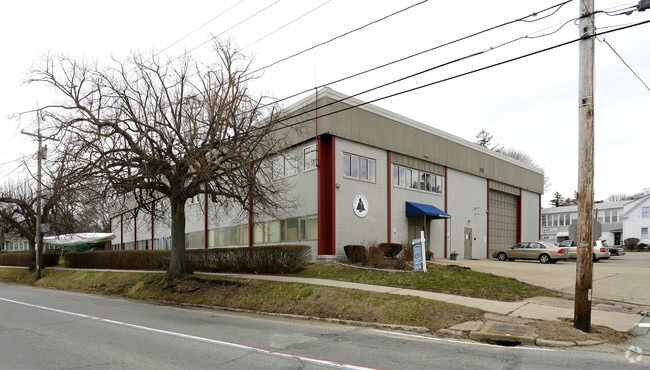
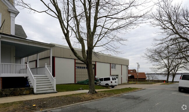
Property Record
1 Burnside St, Bristol, RI 02809

Property Detail
1 Burnside St
BRIS-000016-000000-000008-000003
Bristol
Taxexempt
Rhode Island
M
8-3
C and X Area of minimal flood hazard, usually depicted on FIRMs as above the 500-year flood level.
0.63 AC
0
Bristol County
2025
Providence
030800
Providence-Warwick, RI-MA
22,800 SF
NEARBY LISTINGS FOR SALE OR LEASE
DEMOGRAPHICS near 1 Burnside St
1 mile
3 mile
5 mile
2025 Total Population
8,378
21,777
54,910
2030 Population
8,178
21,440
53,920
Pop Growth 2025-2030
(2.39%)
(1.55%)
(1.80%)
Average Age
39
44
45
2025 Total Households
3,268
8,548
22,656
HH Growth 2025-2030
(2.33%)
(1.42%)
(1.64%)
Median Household Inc
$79,425
$92,212
$95,015
Avg Household Size
2.00
2.20
2.30
2025 Avg HH Vehicles
1.00
2.00
2.00
Median Home Value
$589,286
$526,964
$516,756
Median Year Built
1948
1965
1960
Nearby Places
Map Layers
Map Styles
 Street
 Aerial
Layers
 Traffic
 Biking
Places
Listings with unknown addresses are not visible on the map
- Restaurants
- Banks
- Shops
- Fitness
- Groceries
PUBLIC TRANSPORTATION
AIRPORT
Rhode Island Tf Green International
Drive
Walk
Distance
Rhode Island Tf Green International
41 min
24.6 mi
Freight Ports
Port of New Bedford Harbor
Drive
Walk
Distance
Port of New Bedford Harbor
33 min
23.5 mi
Nearby Properties
Address
Land Use
TOTAL SIZE
Lot Size
Zoning
Address
Land Use
TOTAL SIZE
Lot Size
Zoning
113,253 SF
85.69 AC
HPC
Address
Land Use
TOTAL SIZE
Lot Size
Zoning
17,500 SF
7.12 AC
EI
Address
Land Use
TOTAL SIZE
Lot Size
Zoning
159,363 SF
14.19 AC
R-10
Address
Land Use
TOTAL SIZE
Lot Size
Zoning
3,512 SF
30.88 AC
EI
Address
Land Use
TOTAL SIZE
Lot Size
Zoning
2,080 SF
11.01 AC
R-15
Address
Land Use
TOTAL SIZE
Lot Size
Zoning
18,236 SF
10.24 AC
LB
Address
Land Use
TOTAL SIZE
Lot Size
Zoning
44.10 AC
R-40
Address
Land Use
TOTAL SIZE
Lot Size
Zoning
4,152 SF
1.71 AC
W
Address
Land Use
TOTAL SIZE
Lot Size
Zoning
63,730 SF
12.97 AC
M
Address
Land Use
TOTAL SIZE
Lot Size
Zoning
38,176 SF
0.97 AC
R-6
Address
Land Use
TOTAL SIZE
Lot Size
Zoning
35.50 AC
R-40
Address
Land Use
TOTAL SIZE
Lot Size
Zoning
49.31 AC
R-40
Address
Land Use
TOTAL SIZE
Lot Size
Zoning
27,264 SF
0.26 AC
LB
Address
Land Use
TOTAL SIZE
Lot Size
Zoning
36,324 SF
24 AC
R-40
Address
Land Use
TOTAL SIZE
Lot Size
Zoning
61,332 SF
6.43 AC
R-6
Address
Land Use
TOTAL SIZE
Lot Size
Zoning
80,232 SF
1.32 AC
M
Address
Land Use
TOTAL SIZE
Lot Size
Zoning
4.80 AC
GB
Address
Land Use
TOTAL SIZE
Lot Size
Zoning
120,540 SF
6.33 AC
M
Address
Land Use
TOTAL SIZE
Lot Size
Zoning
5,028 SF
5.31 AC
R-40
Address
Land Use
TOTAL SIZE
Lot Size
Zoning
78,182 SF
10 AC
R10
Address
Land Use
TOTAL SIZE
Lot Size
Zoning
4,818 SF
60.80 AC
R-40
Address
Land Use
TOTAL SIZE
Lot Size
Zoning
68,144 SF
7.74 AC
M
Address
Land Use
TOTAL SIZE
Lot Size
Zoning
11,562 SF
7.08 AC
R-6
Address
Land Use
TOTAL SIZE
Lot Size
Zoning
4,144 SF
8.90 AC
R-40
Address
Land Use
TOTAL SIZE
Lot Size
Zoning
10,937 SF
1.02 AC
R-6
Address
Land Use
TOTAL SIZE
Lot Size
Zoning
15,120 SF
6.94 AC
M
Address
Land Use
TOTAL SIZE
Lot Size
Zoning
9,172 SF
7.60 AC
R-40
Address
Land Use
TOTAL SIZE
Lot Size
Zoning
92 AC
R-20
Address
Land Use
TOTAL SIZE
Lot Size
Zoning
2,304 SF
17 AC
R-40
Address
Land Use
TOTAL SIZE
Lot Size
Zoning
23,016 SF
1.06 AC
R-6
The World's #1 Commercial Real Estate Marketplace
Connect with us
© 2026 CoStar Group
The information above has been obtained from sources believed reliable. While we do not doubt its accuracy we have not verified it and make no guarantee, warranty or representation about it. It is your responsibility to independently confirm its accuracy and completeness. Any projections, opinions, assumptions, or estimates used are for example only and do not represent the current or future performance of the property. The value of this transaction to you depends on tax and other factors which should be evaluated by your tax, financial, and legal advisors. You and your advisors should conduct a careful, independent investigation of the property to determine to your satisfaction the suitability of the property for your needs.