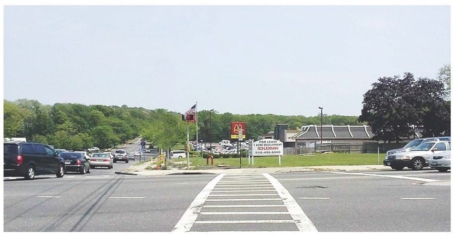
Property Record
1 Crooked Hill Rd, Commack, NY 11725


Current Lease Availabilities
Property Detail
1 Crooked Hill Rd
Nassau County-Suffolk County, NY
3-95351 TC-52 L I MOTOR PKWY SUCKERMAN SUCKERMAN ET ALCOMMACK RD
0800-172-00-01-00-005-000
SUFFOLK
Commercialacreage
New York
B and X Area of moderate flood hazard, usually the area between the limits of the 100-year and 500-year floods.
5
2024
0.36 AC
2025
Western Suffolk
135205
Long Island (New York)
NEARBY LISTINGS FOR SALE OR LEASE
DEMOGRAPHICS near 1 Crooked Hill Rd
1 mile
3 mile
5 mile
2025 Total Population
6,498
70,626
223,874
2030 Population
6,518
69,748
219,882
Pop Growth 2025-2030
+ 0.31%
(1.24%)
(1.78%)
Average Age
44
41
40
2025 Total Households
1,935
20,451
65,163
HH Growth 2025-2030
(0.31%)
(1.40%)
(1.96%)
Median Household Inc
$175,227
$156,997
$142,074
Avg Household Size
2.90
3.20
3.20
2025 Avg HH Vehicles
2.00
2.00
2.00
Median Home Value
$765,825
$697,357
$670,971
Median Year Built
1968
1965
1965
Nearby Places
Map Layers
Map Styles
 Street
 Aerial
Layers
 Traffic
 Biking
Places
Listings with unknown addresses are not visible on the map
- Restaurants
- Banks
- Shops
- Fitness
- Groceries
PUBLIC TRANSPORTATION
COMMUTER RAIL
Deer Park Station (Ronkonkoma Branch - Long Island Rail Road)
Drive
Walk
Distance
Deer Park Station (Ronkonkoma Branch - Long Island Rail Road)
7 min
4.7 mi
Brentwood Station (Ronkonkoma Branch - Long Island Rail Road)
Drive
Walk
Distance
Brentwood Station (Ronkonkoma Branch - Long Island Rail Road)
10 min
4.8 mi
AIRPORT
Long Island MacArthur
Drive
Walk
Distance
Long Island MacArthur
20 min
12.4 mi
John F Kennedy International
Drive
Walk
Distance
John F Kennedy International
49 min
37.6 mi
Freight Ports
NY - Red Hook Container Terminal
Drive
Walk
Distance
NY - Red Hook Container Terminal
63 min
43.1 mi
Nearby Properties
Address
Land Use
TOTAL SIZE
Lot Size
Zoning
Address
Land Use
TOTAL SIZE
Lot Size
Zoning
4.81 AC
AAA
Address
Land Use
TOTAL SIZE
Lot Size
Zoning
371.18 AC
AAA
Address
Land Use
TOTAL SIZE
Lot Size
Zoning
4.39 AC
AAA
Address
Land Use
TOTAL SIZE
Lot Size
Zoning
196.07 AC
AAA
Address
Land Use
TOTAL SIZE
Lot Size
Zoning
23.91 AC
IND1
Address
Land Use
TOTAL SIZE
Lot Size
Zoning
117.66 AC
AAA
Address
Land Use
TOTAL SIZE
Lot Size
Zoning
109.45 AC
AAA
Address
Land Use
TOTAL SIZE
Lot Size
Zoning
19.70 AC
A
Address
Land Use
TOTAL SIZE
Lot Size
Zoning
30 AC
IND1
Address
Land Use
TOTAL SIZE
Lot Size
Zoning
20.13 AC
Address
Land Use
TOTAL SIZE
Lot Size
Zoning
30.50 AC
A
Address
Land Use
TOTAL SIZE
Lot Size
Zoning
18.37 AC
IND1
Address
Land Use
TOTAL SIZE
Lot Size
Zoning
10.20 AC
B
Address
Land Use
TOTAL SIZE
Lot Size
Zoning
8.83 AC
Address
Land Use
TOTAL SIZE
Lot Size
Zoning
14.63 AC
IND1
Address
Land Use
TOTAL SIZE
Lot Size
Zoning
79.78 AC
AAA
Address
Land Use
TOTAL SIZE
Lot Size
Zoning
52.32 AC
AAA
Address
Land Use
TOTAL SIZE
Lot Size
Zoning
13.28 AC
IND1
Address
Land Use
TOTAL SIZE
Lot Size
Zoning
11.20 AC
A
Address
Land Use
TOTAL SIZE
Lot Size
Zoning
9.20 AC
IND1
Address
Land Use
TOTAL SIZE
Lot Size
Zoning
10.95 AC
IND1
Address
Land Use
TOTAL SIZE
Lot Size
Zoning
13.81 AC
IND1
Address
Land Use
TOTAL SIZE
Lot Size
Zoning
512 SF
10.55 AC
IND1
Address
Land Use
TOTAL SIZE
Lot Size
Zoning
1.84 AC
A
Address
Land Use
TOTAL SIZE
Lot Size
Zoning
1.88 AC
AAA
Address
Land Use
TOTAL SIZE
Lot Size
Zoning
8 AC
IND1
Address
Land Use
TOTAL SIZE
Lot Size
Zoning
8.59 AC
A
Address
Land Use
TOTAL SIZE
Lot Size
Zoning
9.30 AC
Address
Land Use
TOTAL SIZE
Lot Size
Zoning
3.01 AC
GSE
Address
Land Use
TOTAL SIZE
Lot Size
Zoning
10.16 AC
The World's #1 Commercial Real Estate Marketplace
Connect with us
© 2026 CoStar Group
The information above has been obtained from sources believed reliable. While we do not doubt its accuracy we have not verified it and make no guarantee, warranty or representation about it. It is your responsibility to independently confirm its accuracy and completeness. Any projections, opinions, assumptions, or estimates used are for example only and do not represent the current or future performance of the property. The value of this transaction to you depends on tax and other factors which should be evaluated by your tax, financial, and legal advisors. You and your advisors should conduct a careful, independent investigation of the property to determine to your satisfaction the suitability of the property for your needs.