Property Record
1 Covestro Cir, Pittsburgh, PA 15205
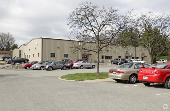

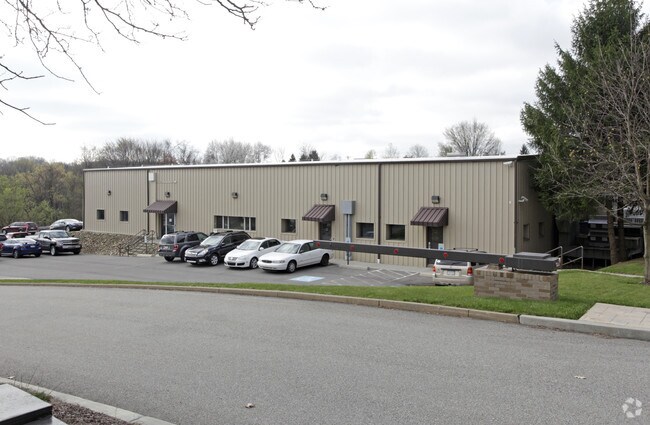

Property Detail
1 Covestro Cir
Pittsburgh
BAYER PLAN OF LOTS NO 2 LOT 1A = 379.25X112.86146.17X32.21X47.23X80.65X31.74X122.88X 191.14X12.15X240.38X97.09X301.37X101.64X102.39X101.39X
Pittsburgh, PA
Allegheny
0412-S-00100-0000-00
Pennsylvania
Officebuilding
100
2024
50.10 AC
2025
Parkway West Corridor
459201
NEARBY LISTINGS FOR SALE OR LEASE
DEMOGRAPHICS near 1 Covestro Cir
1 mile
3 mile
5 mile
2025 Total Population
1,656
25,153
81,843
2030 Population
1,669
25,036
81,007
Pop Growth 2025-2030
+ 0.79%
(0.47%)
(1.02%)
Average Age
37
42
43
2025 Total Households
804
10,658
35,175
HH Growth 2025-2030
+ 0.62%
(0.55%)
(1.09%)
Median Household Inc
$73,561
$101,853
$94,215
Avg Household Size
1.80
2.30
2.30
2025 Avg HH Vehicles
2.00
2.00
2.00
Median Home Value
$408,474
$305,279
$273,007
Median Year Built
1996
1990
1976
Nearby Places
Map Layers
Map Styles
 Street
 Aerial
Layers
 Traffic
 Biking
Places
Listings with unknown addresses are not visible on the map
- Restaurants
- Banks
- Shops
- Fitness
- Groceries
PUBLIC TRANSPORTATION
AIRPORT
Pittsburgh International
Drive
Walk
Distance
Pittsburgh International
14 min
7.7 mi
Freight Ports
Port of Toledo
Drive
Walk
Distance
Port of Toledo
258 min
227.3 mi
Nearby Properties
Address
Land Use
TOTAL SIZE
Lot Size
Zoning
Address
Land Use
TOTAL SIZE
Lot Size
Zoning
105.09 AC
Address
Land Use
TOTAL SIZE
Lot Size
Zoning
61.94 AC
Address
Land Use
TOTAL SIZE
Lot Size
Zoning
75.22 AC
Address
Land Use
TOTAL SIZE
Lot Size
Zoning
21.02 AC
Address
Land Use
TOTAL SIZE
Lot Size
Zoning
33.43 AC
Address
Land Use
TOTAL SIZE
Lot Size
Zoning
Address
Land Use
TOTAL SIZE
Lot Size
Zoning
16.97 AC
Address
Land Use
TOTAL SIZE
Lot Size
Zoning
11.21 AC
Address
Land Use
TOTAL SIZE
Lot Size
Zoning
20.19 AC
Address
Land Use
TOTAL SIZE
Lot Size
Zoning
Address
Land Use
TOTAL SIZE
Lot Size
Zoning
Address
Land Use
TOTAL SIZE
Lot Size
Zoning
14.19 AC
Address
Land Use
TOTAL SIZE
Lot Size
Zoning
20.40 AC
Address
Land Use
TOTAL SIZE
Lot Size
Zoning
10.07 AC
Address
Land Use
TOTAL SIZE
Lot Size
Zoning
Address
Land Use
TOTAL SIZE
Lot Size
Zoning
31.30 AC
Address
Land Use
TOTAL SIZE
Lot Size
Zoning
10.60 AC
Address
Land Use
TOTAL SIZE
Lot Size
Zoning
17.02 AC
Address
Land Use
TOTAL SIZE
Lot Size
Zoning
Address
Land Use
TOTAL SIZE
Lot Size
Zoning
3.30 AC
Address
Land Use
TOTAL SIZE
Lot Size
Zoning
7.59 AC
Address
Land Use
TOTAL SIZE
Lot Size
Zoning
Address
Land Use
TOTAL SIZE
Lot Size
Zoning
5.91 AC
Address
Land Use
TOTAL SIZE
Lot Size
Zoning
11.83 AC
Address
Land Use
TOTAL SIZE
Lot Size
Zoning
5.20 AC
Address
Land Use
TOTAL SIZE
Lot Size
Zoning
Address
Land Use
TOTAL SIZE
Lot Size
Zoning
1,610 AC
Address
Land Use
TOTAL SIZE
Lot Size
Zoning
26.97 AC
Address
Land Use
TOTAL SIZE
Lot Size
Zoning
72.58 AC
Address
Land Use
TOTAL SIZE
Lot Size
Zoning
71.10 AC
The World's #1 Commercial Real Estate Marketplace
Connect with us
© 2026 CoStar Group
The information above has been obtained from sources believed reliable. While we do not doubt its accuracy we have not verified it and make no guarantee, warranty or representation about it. It is your responsibility to independently confirm its accuracy and completeness. Any projections, opinions, assumptions, or estimates used are for example only and do not represent the current or future performance of the property. The value of this transaction to you depends on tax and other factors which should be evaluated by your tax, financial, and legal advisors. You and your advisors should conduct a careful, independent investigation of the property to determine to your satisfaction the suitability of the property for your needs.