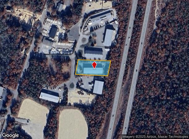
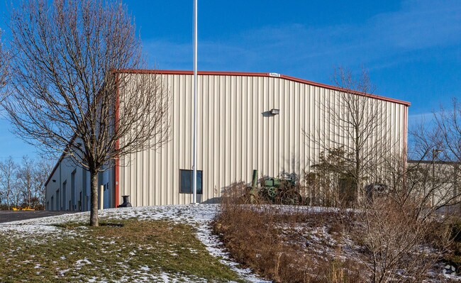
Property Record
1 Crane Cir, Cataumet, MA 02534

NEARBY LISTINGS FOR SALE OR LEASE
Property Detail
1 Crane Cir
Commercialbuilding
Barnstable
X
Massachusetts
25001C0511J
1.01 AC
2025
Cape Cod
2025
Other Market Areas
014002
Barnstable Town, MA
9,625 SF
BOUR-000520-000000-000095
DEMOGRAPHICS near 1 Crane Cir
1 mile
3 mile
5 mile
2024 Total Population
458
7,803
19,285
2029 Population
417
7,784
19,352
Pop Growth 2024-2029
(8.95%)
(0.24%)
+ 0.35%
Average Age
50
49
49
2024 Total Households
200
3,350
8,269
HH Growth 2024-2029
(9.50%)
(0.81%)
+ 0.02%
Median Household Inc
$118,749
$91,666
$92,045
Avg Household Size
2.10
2.20
2.20
2024 Avg HH Vehicles
2.00
2.00
2.00
Median Home Value
$488,815
$590,123
$513,574
Median Year Built
1982
1977
1980
Nearby Places
Map Layers
Map Styles
 Street
 Aerial
Transit
 Traffic
 Biking
Places
Listings with unknown addresses are not visible on the map
- Restaurants
- Banks
- Shops
- Fitness
- Groceries
PUBLIC TRANSPORTATION
COMMUTER RAIL
Drive
Walk
Distance
10 min
6.1 mi
Drive
Walk
Distance
17 min
9.1 mi
AIRPORT
Martha's Vineyard
Drive
Walk
Distance
Martha's Vineyard
82 min
26.1 mi
Freight Ports
Port of New Bedford Harbor
Drive
Walk
Distance
Port of New Bedford Harbor
46 min
33.4 mi
Nearby Properties
Address
Land Use
TOTAL SIZE
Lot Size
Zoning
Address
Land Use
TOTAL SIZE
Lot Size
Zoning
22,000 SF
749.29 AC
GD
Address
Land Use
TOTAL SIZE
Lot Size
Zoning
53,202 SF
29.20 AC
PU
Address
Land Use
TOTAL SIZE
Lot Size
Zoning
11.20 AC
Address
Land Use
TOTAL SIZE
Lot Size
Zoning
5.06 AC
R-80
Address
Land Use
TOTAL SIZE
Lot Size
Zoning
17.50 AC
Address
Land Use
TOTAL SIZE
Lot Size
Zoning
1,199 SF
3.70 AC
R40
Address
Land Use
TOTAL SIZE
Lot Size
Zoning
9,546 SF
2.14 AC
RB
Address
Land Use
TOTAL SIZE
Lot Size
Zoning
6,999 SF
2.84 AC
R40
Address
Land Use
TOTAL SIZE
Lot Size
Zoning
2.82 AC
Address
Land Use
TOTAL SIZE
Lot Size
Zoning
21,711 SF
157.40 AC
AGAA
Address
Land Use
TOTAL SIZE
Lot Size
Zoning
5,887 SF
1.58 AC
R40
Address
Land Use
TOTAL SIZE
Lot Size
Zoning
6,460 SF
1.38 AC
RB
Address
Land Use
TOTAL SIZE
Lot Size
Zoning
57,806 SF
14.39 AC
LIA
Address
Land Use
TOTAL SIZE
Lot Size
Zoning
15.80 AC
Address
Land Use
TOTAL SIZE
Lot Size
Zoning
6,631 SF
1.34 AC
R40
Address
Land Use
TOTAL SIZE
Lot Size
Zoning
11,262 SF
0.95 AC
R40
Address
Land Use
TOTAL SIZE
Lot Size
Zoning
5,204 SF
1.17 AC
R40
Address
Land Use
TOTAL SIZE
Lot Size
Zoning
4.10 AC
R-80
Address
Land Use
TOTAL SIZE
Lot Size
Zoning
4,576 SF
1.74 AC
R40
Address
Land Use
TOTAL SIZE
Lot Size
Zoning
7,676 SF
2.69 AC
RB
Address
Land Use
TOTAL SIZE
Lot Size
Zoning
7,033 SF
2.81 AC
R40
Address
Land Use
TOTAL SIZE
Lot Size
Zoning
8.91 AC
R-80
Address
Land Use
TOTAL SIZE
Lot Size
Zoning
7,034 SF
1.11 AC
R40
Address
Land Use
TOTAL SIZE
Lot Size
Zoning
6,287 SF
1.28 AC
R40
Address
Land Use
TOTAL SIZE
Lot Size
Zoning
3,172 SF
2.23 AC
R40
Address
Land Use
TOTAL SIZE
Lot Size
Zoning
5,506 SF
0.74 AC
RB
Address
Land Use
TOTAL SIZE
Lot Size
Zoning
25,713 SF
4.70 AC
M
Address
Land Use
TOTAL SIZE
Lot Size
Zoning
Address
Land Use
TOTAL SIZE
Lot Size
Zoning
1.41 AC
R40
Address
Land Use
TOTAL SIZE
Lot Size
Zoning
10.02 AC
R40
The World's #1 Commercial Real Estate Marketplace
Connect with us
© 2026 CoStar Group
The information above has been obtained from sources believed reliable. While we do not doubt its accuracy we have not verified it and make no guarantee, warranty or representation about it. It is your responsibility to independently confirm its accuracy and completeness. Any projections, opinions, assumptions, or estimates used are for example only and do not represent the current or future performance of the property. The value of this transaction to you depends on tax and other factors which should be evaluated by your tax, financial, and legal advisors. You and your advisors should conduct a careful, independent investigation of the property to determine to your satisfaction the suitability of the property for your needs.