Property Record
1 E Broad St, Hazleton, PA 18201
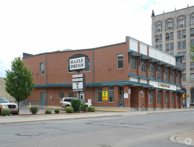
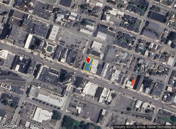
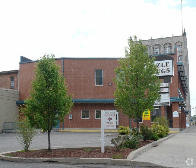
Property Detail
1 E Broad St
Scranton--Wilkes-Barre, PA
7 E BROAD ST
71-T8SW31-011-026-000
Luzerne
Commercialnec
Pennsylvania
X
26
42079C0630E
0.23 AC
2025
I-81 Corridor
2025
Philadelphia
217500
NEARBY LISTINGS FOR SALE OR LEASE
DEMOGRAPHICS near 1 E Broad St
1 mile
3 mile
5 mile
2024 Total Population
22,952
41,577
52,789
2029 Population
22,702
41,223
52,409
Pop Growth 2024-2029
(1.09%)
(0.85%)
(0.72%)
Average Age
37
38
40
2024 Total Households
8,253
15,478
20,188
HH Growth 2024-2029
(1.11%)
(0.89%)
(0.74%)
Median Household Inc
$39,635
$44,422
$47,161
Avg Household Size
2.70
2.60
2.50
2024 Avg HH Vehicles
1.00
1.00
2.00
Median Home Value
$94,536
$119,089
$128,843
Median Year Built
1948
1953
1954
Nearby Places
Map Layers
Map Styles
 Street
 Aerial
Transit
 Traffic
 Biking
Places
Listings with unknown addresses are not visible on the map
- Restaurants
- Banks
- Shops
- Fitness
- Groceries
PUBLIC TRANSPORTATION
AIRPORT
Wilkes-Barre/Scranton International
Drive
Walk
Distance
Wilkes-Barre/Scranton International
50 min
34.3 mi
Lehigh Valley International
Drive
Walk
Distance
Lehigh Valley International
70 min
45.1 mi
Nearby Properties
Address
Land Use
TOTAL SIZE
Lot Size
Zoning
Address
Land Use
TOTAL SIZE
Lot Size
Zoning
63.03 AC
Address
Land Use
TOTAL SIZE
Lot Size
Zoning
30.99 AC
Address
Land Use
TOTAL SIZE
Lot Size
Zoning
48.47 AC
Address
Land Use
TOTAL SIZE
Lot Size
Zoning
59.39 AC
Address
Land Use
TOTAL SIZE
Lot Size
Zoning
14.15 AC
Address
Land Use
TOTAL SIZE
Lot Size
Zoning
9.14 AC
Address
Land Use
TOTAL SIZE
Lot Size
Zoning
8.29 AC
Address
Land Use
TOTAL SIZE
Lot Size
Zoning
9.67 AC
Address
Land Use
TOTAL SIZE
Lot Size
Zoning
19.82 AC
Address
Land Use
TOTAL SIZE
Lot Size
Zoning
10.83 AC
Address
Land Use
TOTAL SIZE
Lot Size
Zoning
Address
Land Use
TOTAL SIZE
Lot Size
Zoning
50 AC
Address
Land Use
TOTAL SIZE
Lot Size
Zoning
12.21 AC
Address
Land Use
TOTAL SIZE
Lot Size
Zoning
25.48 AC
Address
Land Use
TOTAL SIZE
Lot Size
Zoning
23.17 AC
Address
Land Use
TOTAL SIZE
Lot Size
Zoning
12.25 AC
Address
Land Use
TOTAL SIZE
Lot Size
Zoning
14.10 AC
Address
Land Use
TOTAL SIZE
Lot Size
Zoning
Address
Land Use
TOTAL SIZE
Lot Size
Zoning
0.72 AC
Address
Land Use
TOTAL SIZE
Lot Size
Zoning
Address
Land Use
TOTAL SIZE
Lot Size
Zoning
4.11 AC
Address
Land Use
TOTAL SIZE
Lot Size
Zoning
0.34 AC
Address
Land Use
TOTAL SIZE
Lot Size
Zoning
55.38 AC
Address
Land Use
TOTAL SIZE
Lot Size
Zoning
33.40 AC
Address
Land Use
TOTAL SIZE
Lot Size
Zoning
2.70 AC
Address
Land Use
TOTAL SIZE
Lot Size
Zoning
100.14 AC
Address
Land Use
TOTAL SIZE
Lot Size
Zoning
Address
Land Use
TOTAL SIZE
Lot Size
Zoning
Address
Land Use
TOTAL SIZE
Lot Size
Zoning
19.60 AC
Address
Land Use
TOTAL SIZE
Lot Size
Zoning
9.45 AC
The World's #1 Commercial Real Estate Marketplace
Connect with us
© 2026 CoStar Group
The information above has been obtained from sources believed reliable. While we do not doubt its accuracy we have not verified it and make no guarantee, warranty or representation about it. It is your responsibility to independently confirm its accuracy and completeness. Any projections, opinions, assumptions, or estimates used are for example only and do not represent the current or future performance of the property. The value of this transaction to you depends on tax and other factors which should be evaluated by your tax, financial, and legal advisors. You and your advisors should conduct a careful, independent investigation of the property to determine to your satisfaction the suitability of the property for your needs.