Property Record
1 Etris Dr, Rogers, AR 72756


NEARBY LISTINGS FOR SALE OR LEASE
-
-
View all Rogers listings for sale on LoopNet.com
Property Detail
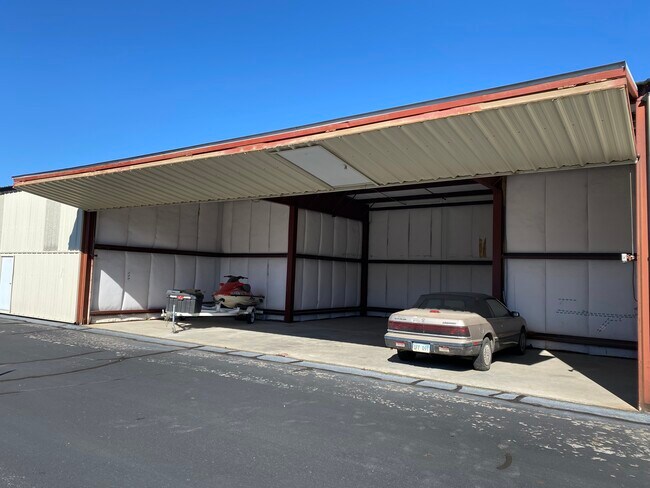
1 Etris Dr
Fayetteville/Springdale/Rogers
Rogers
Fayetteville-Springdale-Rogers, AR-MO
Benton
02-00643-000
Arkansas
Sfr
213.56 AC
X
East Rogers
05007C0280K
DEMOGRAPHICS near 1 Etris Dr
1 Mile
3 Mile
5 Mile
2024 Total Population
1,283
18,247
67,262
2029 Population
1,494
21,319
78,607
Pop Growth 2024-2029
+ 16.45%
+ 16.84%
+ 16.87%
Average Age
38
38
38
2024 Total Households
407
6,580
24,324
HH Growth 2024-2029
+ 16.71%
+ 16.87%
+ 16.93%
Median Household Inc
$73,557
$63,957
$65,635
Avg Household Size
2.80
2.60
2.70
2024 Avg HH Vehicles
2.00
2.00
2.00
Median Home Value
$227,011
$243,339
$208,438
Median Year Built
1989
1989
1990
Nearby Places
Map Layers
Map Styles
 Street
 Aerial
- Restaurants
- Banks
- Shops
- Fitness
- Groceries
PUBLIC TRANSPORTATION
AIRPORT
Northwest Arkansas Ntl
DRIVE
WALK
Distance
Northwest Arkansas Ntl
35 min
17.6 mi
Freight Ports
Tulsa Port of Inola
DRIVE
WALK
Distance
Tulsa Port of Inola
122 min
102.8 mi
SALE & LEASE HISTORY
LISTING DATE
SALE/LEASE

Jan 18, 2023
For Sale
Nearby Properties
Address
Land Use
TOTAL SIZE
Lot Size
Zoning
Address
Land Use
TOTAL SIZE
Lot Size
Zoning
117,522 SF
0.12 AC
Address
Land Use
TOTAL SIZE
Lot Size
Zoning
573,476 SF
57.80 AC
Address
Land Use
TOTAL SIZE
Lot Size
Zoning
249,843 SF
19.21 AC
Address
Land Use
TOTAL SIZE
Lot Size
Zoning
214,791 SF
9.13 AC
Address
Land Use
TOTAL SIZE
Lot Size
Zoning
156,100 SF
7.89 AC
Address
Land Use
TOTAL SIZE
Lot Size
Zoning
152,759 SF
12.01 AC
Address
Land Use
TOTAL SIZE
Lot Size
Zoning
114,250 SF
7.54 AC
Address
Land Use
TOTAL SIZE
Lot Size
Zoning
117,522 SF
13.66 AC
Address
Land Use
TOTAL SIZE
Lot Size
Zoning
231,576 SF
15.18 AC
Address
Land Use
TOTAL SIZE
Lot Size
Zoning
102,477 SF
7.15 AC
Address
Land Use
TOTAL SIZE
Lot Size
Zoning
46,851 SF
4.28 AC
Address
Land Use
TOTAL SIZE
Lot Size
Zoning
263,095 SF
13.17 AC
Address
Land Use
TOTAL SIZE
Lot Size
Zoning
402,500 SF
19.54 AC
Address
Land Use
TOTAL SIZE
Lot Size
Zoning
112,935 SF
6.75 AC
Address
Land Use
TOTAL SIZE
Lot Size
Zoning
195,563 SF
15.49 AC
Address
Land Use
TOTAL SIZE
Lot Size
Zoning
109,683 SF
Address
Land Use
TOTAL SIZE
Lot Size
Zoning
101,690 SF
8.76 AC
Address
Land Use
TOTAL SIZE
Lot Size
Zoning
143,368 SF
11.72 AC
Address
Land Use
TOTAL SIZE
Lot Size
Zoning
160,798 SF
14.84 AC
Address
Land Use
TOTAL SIZE
Lot Size
Zoning
57,609 SF
8.53 AC
Address
Land Use
TOTAL SIZE
Lot Size
Zoning
123,568 SF
12.12 AC
Address
Land Use
TOTAL SIZE
Lot Size
Zoning
77,040 SF
6.69 AC
Address
Land Use
TOTAL SIZE
Lot Size
Zoning
172,912 SF
9.80 AC
Address
Land Use
TOTAL SIZE
Lot Size
Zoning
34,037 SF
9.45 AC
Address
Land Use
TOTAL SIZE
Lot Size
Zoning
210,915 SF
15.28 AC
Address
Land Use
TOTAL SIZE
Lot Size
Zoning
109,704 SF
11.57 AC
Address
Land Use
TOTAL SIZE
Lot Size
Zoning
278,819 SF
20 AC
Address
Land Use
TOTAL SIZE
Lot Size
Zoning
16,768 SF
13.03 AC
Address
Land Use
TOTAL SIZE
Lot Size
Zoning
100,000 SF
5.50 AC
Address
Land Use
TOTAL SIZE
Lot Size
Zoning
42,663 SF
5.77 AC
The World's #1 Commercial Real Estate Marketplace
Connect with us
© 2025 CoStar Group
The information above has been obtained from sources believed reliable. While we do not doubt its accuracy we have not verified it and make no guarantee, warranty or representation about it. It is your responsibility to independently confirm its accuracy and completeness. Any projections, opinions, assumptions, or estimates used are for example only and do not represent the current or future performance of the property. The value of this transaction to you depends on tax and other factors which should be evaluated by your tax, financial, and legal advisors. You and your advisors should conduct a careful, independent investigation of the property to determine to your satisfaction the suitability of the property for your needs.