Property Record
1 Fairfield Way, Commack, NY 11725
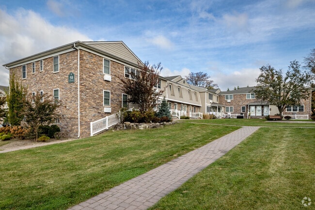
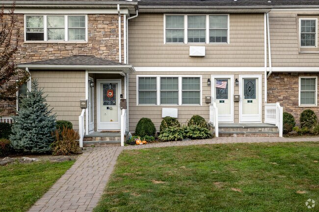
Property Detail
1 Fairfield Way
Nassau County-Suffolk County, NY
PRIVATE ROAD N-,S,E, GROTON EQUITIES W- TOWN OF HUNTINGTON
0800-116-00-02-00-032-003
SUFFOLK
Apartment
New York
B and X Area of moderate flood hazard, usually the area between the limits of the 100-year and 500-year floods.
60
2024
12.30 AC
2025
Commack
135205
Long Island (New York)
NEARBY LISTINGS FOR SALE OR LEASE
-
-
View all Commack listings for sale on LoopNet.com
DEMOGRAPHICS near 1 Fairfield Way
1 mile
3 mile
5 mile
2025 Total Population
11,312
69,505
198,641
2030 Population
11,267
69,037
195,962
Pop Growth 2025-2030
(0.40%)
(0.67%)
(1.35%)
Average Age
43
43
41
2025 Total Households
3,776
22,363
60,849
HH Growth 2025-2030
(0.77%)
(1.02%)
(1.61%)
Median Household Inc
$160,319
$164,102
$151,577
Avg Household Size
2.90
3.00
3.10
2025 Avg HH Vehicles
2.00
2.00
2.00
Median Home Value
$721,813
$739,252
$710,663
Median Year Built
1961
1964
1964
Nearby Places
Map Layers
Map Styles
 Street
 Aerial
Layers
 Traffic
 Biking
Places
Listings with unknown addresses are not visible on the map
- Restaurants
- Banks
- Shops
- Fitness
- Groceries
PUBLIC TRANSPORTATION
COMMUTER RAIL
Northport Station (Port Jefferson Branch - Long Island Rail Road)
Drive
Walk
Distance
Northport Station (Port Jefferson Branch - Long Island Rail Road)
10 min
4.5 mi
Kings Park Station (Port Jefferson Branch - Long Island Rail Road)
Drive
Walk
Distance
Kings Park Station (Port Jefferson Branch - Long Island Rail Road)
8 min
5.2 mi
AIRPORT
Long Island MacArthur
Drive
Walk
Distance
Long Island MacArthur
20 min
12.2 mi
John F Kennedy International
Drive
Walk
Distance
John F Kennedy International
52 min
39.7 mi
Freight Ports
Port of New Haven
Drive
Walk
Distance
Port of New Haven
134 min
55.7 mi
Nearby Properties
Address
Land Use
TOTAL SIZE
Lot Size
Zoning
Address
Land Use
TOTAL SIZE
Lot Size
Zoning
26.60 AC
Address
Land Use
TOTAL SIZE
Lot Size
Zoning
3.01 AC
GSE
Address
Land Use
TOTAL SIZE
Lot Size
Zoning
21.50 AC
Address
Land Use
TOTAL SIZE
Lot Size
Zoning
3.63 AC
IND2
Address
Land Use
TOTAL SIZE
Lot Size
Zoning
22.80 AC
Address
Land Use
TOTAL SIZE
Lot Size
Zoning
14.13 AC
Address
Land Use
TOTAL SIZE
Lot Size
Zoning
23.60 AC
Address
Land Use
TOTAL SIZE
Lot Size
Zoning
Address
Land Use
TOTAL SIZE
Lot Size
Zoning
2.76 AC
BUS1
Address
Land Use
TOTAL SIZE
Lot Size
Zoning
8.90 AC
BUS3
Address
Land Use
TOTAL SIZE
Lot Size
Zoning
17.20 AC
Address
Land Use
TOTAL SIZE
Lot Size
Zoning
6.41 AC
Address
Land Use
TOTAL SIZE
Lot Size
Zoning
10.40 AC
B
Address
Land Use
TOTAL SIZE
Lot Size
Zoning
88,200 SF
11.20 AC
Address
Land Use
TOTAL SIZE
Lot Size
Zoning
9.30 AC
Address
Land Use
TOTAL SIZE
Lot Size
Zoning
15.70 AC
Address
Land Use
TOTAL SIZE
Lot Size
Zoning
12.80 AC
Address
Land Use
TOTAL SIZE
Lot Size
Zoning
6.75 AC
Address
Land Use
TOTAL SIZE
Lot Size
Zoning
1.90 AC
IND2
Address
Land Use
TOTAL SIZE
Lot Size
Zoning
8.80 AC
R10
Address
Land Use
TOTAL SIZE
Lot Size
Zoning
11.28 AC
B
Address
Land Use
TOTAL SIZE
Lot Size
Zoning
15.60 AC
Address
Land Use
TOTAL SIZE
Lot Size
Zoning
2.42 AC
IND1
Address
Land Use
TOTAL SIZE
Lot Size
Zoning
148.70 AC
R40
Address
Land Use
TOTAL SIZE
Lot Size
Zoning
Address
Land Use
TOTAL SIZE
Lot Size
Zoning
Address
Land Use
TOTAL SIZE
Lot Size
Zoning
142,732 SF
16.90 AC
Address
Land Use
TOTAL SIZE
Lot Size
Zoning
9.30 AC
Address
Land Use
TOTAL SIZE
Lot Size
Zoning
The World's #1 Commercial Real Estate Marketplace
Connect with us
© 2026 CoStar Group
The information above has been obtained from sources believed reliable. While we do not doubt its accuracy we have not verified it and make no guarantee, warranty or representation about it. It is your responsibility to independently confirm its accuracy and completeness. Any projections, opinions, assumptions, or estimates used are for example only and do not represent the current or future performance of the property. The value of this transaction to you depends on tax and other factors which should be evaluated by your tax, financial, and legal advisors. You and your advisors should conduct a careful, independent investigation of the property to determine to your satisfaction the suitability of the property for your needs.