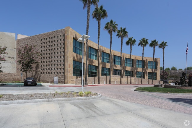
Property Record
1 Fire Authority Rd, Irvine, CA 92602

Property Detail
1 Fire Authority Rd
Anaheim-Santa Ana-Irvine, CA
A TR IRVINE SUB BLK 66 LOT 378 IRVINE SUB BLK 66 LOT 378 POR OF LOT AND BLK 66
502-454-07
ORANGE
Taxexempt
California
B and X Area of moderate flood hazard, usually the area between the limits of the 100-year and 500-year floods.
378
2024
13.34 AC
2025
Irvine
052434
Orange County (California)
NEARBY LISTINGS FOR SALE OR LEASE
DEMOGRAPHICS near 1 Fire Authority Rd
1 mile
3 mile
5 mile
2025 Total Population
16,381
122,891
344,189
2030 Population
16,454
123,995
344,868
Pop Growth 2025-2030
+ 0.45%
+ 0.90%
+ 0.20%
Average Age
39
40
39
2025 Total Households
5,478
42,295
115,612
HH Growth 2025-2030
+ 0.20%
+ 0.97%
+ 0.15%
Median Household Inc
$181,273
$143,252
$125,705
Avg Household Size
2.90
2.80
2.90
2025 Avg HH Vehicles
2.00
2.00
2.00
Median Home Value
$1,115,337
$1,097,397
$1,049,332
Median Year Built
2000
1992
1987
Nearby Places
Map Layers
Map Styles
 Street
 Aerial
Layers
 Traffic
 Biking
Places
Listings with unknown addresses are not visible on the map
- Restaurants
- Banks
- Shops
- Fitness
- Groceries
PUBLIC TRANSPORTATION
COMMUTER RAIL
Tustin (Inland Empire-Orange County Line - Southern California Regional Rail Authority (Metrolink), Orange County Line - Southern California Regional Rail Authority (Metrolink))
Drive
Walk
Distance
Tustin (Inland Empire-Orange County Line - Southern California Regional Rail Authority (Metrolink), Orange County Line - Southern California Regional Rail Authority (Metrolink))
7 min
4.2 mi
Santa Ana (Inland Empire-Orange County Line - Southern California Regional Rail Authority (Metrolink), Orange County Line - Southern California Regional Rail Authority (Metrolink))
Drive
Walk
Distance
Santa Ana (Inland Empire-Orange County Line - Southern California Regional Rail Authority (Metrolink), Orange County Line - Southern California Regional Rail Authority (Metrolink))
12 min
7.4 mi
AIRPORT
John Wayne/Orange County
Drive
Walk
Distance
John Wayne/Orange County
14 min
10.1 mi
Long Beach (Daugherty Field)
Drive
Walk
Distance
Long Beach (Daugherty Field)
35 min
28.2 mi
Ontario International
Drive
Walk
Distance
Ontario International
44 min
31.4 mi
Freight Ports
Port of Long Beach
Drive
Walk
Distance
Port of Long Beach
40 min
27.7 mi
Nearby Properties
Address
Land Use
TOTAL SIZE
Lot Size
Zoning
Address
Land Use
TOTAL SIZE
Lot Size
Zoning
9.70 AC
Address
Land Use
TOTAL SIZE
Lot Size
Zoning
21.73 AC
Address
Land Use
TOTAL SIZE
Lot Size
Zoning
21.76 AC
Address
Land Use
TOTAL SIZE
Lot Size
Zoning
16.13 AC
Address
Land Use
TOTAL SIZE
Lot Size
Zoning
15.96 AC
Address
Land Use
TOTAL SIZE
Lot Size
Zoning
42.94 AC
Address
Land Use
TOTAL SIZE
Lot Size
Zoning
39.60 AC
Address
Land Use
TOTAL SIZE
Lot Size
Zoning
19.06 AC
Address
Land Use
TOTAL SIZE
Lot Size
Zoning
139,196 SF
6.96 AC
Address
Land Use
TOTAL SIZE
Lot Size
Zoning
101,961 SF
11.99 AC
Address
Land Use
TOTAL SIZE
Lot Size
Zoning
16.58 AC
Address
Land Use
TOTAL SIZE
Lot Size
Zoning
13.65 AC
Address
Land Use
TOTAL SIZE
Lot Size
Zoning
7.19 AC
Address
Land Use
TOTAL SIZE
Lot Size
Zoning
10.08 AC
Address
Land Use
TOTAL SIZE
Lot Size
Zoning
134,824 SF
12.16 AC
Address
Land Use
TOTAL SIZE
Lot Size
Zoning
23.14 AC
Address
Land Use
TOTAL SIZE
Lot Size
Zoning
4.29 AC
Address
Land Use
TOTAL SIZE
Lot Size
Zoning
7.29 AC
Address
Land Use
TOTAL SIZE
Lot Size
Zoning
11.05 AC
Address
Land Use
TOTAL SIZE
Lot Size
Zoning
9.55 AC
Address
Land Use
TOTAL SIZE
Lot Size
Zoning
4.22 AC
Address
Land Use
TOTAL SIZE
Lot Size
Zoning
7.06 AC
Address
Land Use
TOTAL SIZE
Lot Size
Zoning
85,248 SF
4.64 AC
Address
Land Use
TOTAL SIZE
Lot Size
Zoning
90,955 SF
4.58 AC
Address
Land Use
TOTAL SIZE
Lot Size
Zoning
76,516 SF
3.22 AC
Address
Land Use
TOTAL SIZE
Lot Size
Zoning
114,923 SF
20.30 AC
Address
Land Use
TOTAL SIZE
Lot Size
Zoning
88,656 SF
6.47 AC
PCI
Address
Land Use
TOTAL SIZE
Lot Size
Zoning
91,216 SF
5.91 AC
M
Address
Land Use
TOTAL SIZE
Lot Size
Zoning
84,953 SF
4.04 AC
The World's #1 Commercial Real Estate Marketplace
Connect with us
© 2026 CoStar Group
The information above has been obtained from sources believed reliable. While we do not doubt its accuracy we have not verified it and make no guarantee, warranty or representation about it. It is your responsibility to independently confirm its accuracy and completeness. Any projections, opinions, assumptions, or estimates used are for example only and do not represent the current or future performance of the property. The value of this transaction to you depends on tax and other factors which should be evaluated by your tax, financial, and legal advisors. You and your advisors should conduct a careful, independent investigation of the property to determine to your satisfaction the suitability of the property for your needs.