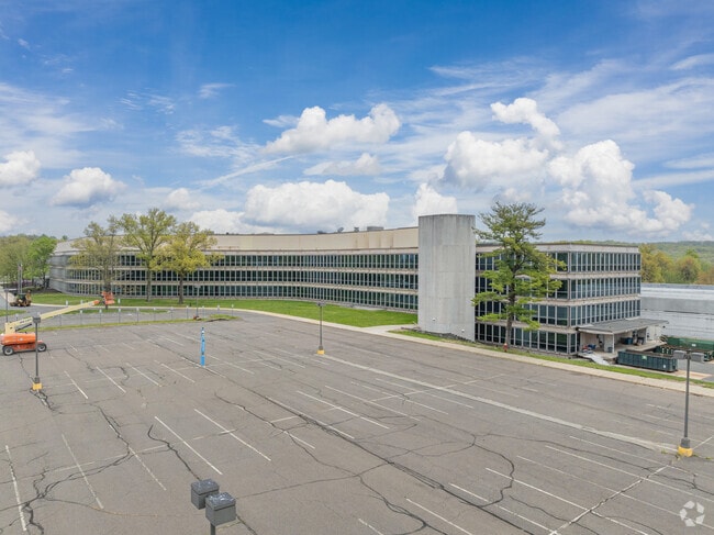
Property Record
Berdan Ave, Wayne, NJ 07470

NEARBY LISTINGS FOR SALE OR LEASE
Property Detail
Berdan Ave
New York-Jersey City-White Plains, NY-NJ
INCL BLK 4200 LOT 1 & BLK 3703 LOTS 1 - 3
14-04200-0000-00001
Passaic
Officebuilding
New Jersey
X
1
34031C0201G
10.46 AC
2024
Passaic Rt 46/23
2025
Northern New Jersey
246202
DEMOGRAPHICS near Berdan Ave
1 Mile
3 Mile
5 Mile
2024 Total Population
6,065
63,728
170,562
2029 Population
6,006
63,513
169,676
Pop Growth 2024-2029
(0.97%)
(0.34%)
(0.52%)
Average Age
43
43
43
2024 Total Households
2,089
22,875
61,095
HH Growth 2024-2029
(1.20%)
(0.51%)
(0.67%)
Median Household Inc
$147,017
$127,503
$122,165
Avg Household Size
2.90
2.70
2.70
2024 Avg HH Vehicles
2.00
2.00
2.00
Median Home Value
$579,286
$505,173
$503,293
Median Year Built
1973
1966
1966
Nearby Places
- Restaurants
- Banks
- Shops
- Fitness
- Groceries
PUBLIC TRANSPORTATION
COMMUTER RAIL
Mountain View (Montclair-Boonton Line - NJ Transit Commuter Rail (NJ Transit))
DRIVE
WALK
Distance
Mountain View (Montclair-Boonton Line - NJ Transit Commuter Rail (NJ Transit))
13 min
6.6 mi
Lincoln Park (Montclair-Boonton Line - NJ Transit Commuter Rail (NJ Transit))
DRIVE
WALK
Distance
Lincoln Park (Montclair-Boonton Line - NJ Transit Commuter Rail (NJ Transit))
16 min
8.1 mi
AIRPORT
Newark Liberty International
DRIVE
WALK
Distance
Newark Liberty International
37 min
27.5 mi
LaGuardia
DRIVE
WALK
Distance
LaGuardia
47 min
31.9 mi
Westchester County
DRIVE
WALK
Distance
Westchester County
59 min
43.5 mi
Freight Ports
Port Newark Container Terminal
DRIVE
WALK
Distance
Port Newark Container Terminal
42 min
26.8 mi
Nearby Properties
Address
Land Use
TOTAL SIZE
Lot Size
Zoning
Address
Land Use
TOTAL SIZE
Lot Size
Zoning
128.12 AC
HOBR
Address
Land Use
TOTAL SIZE
Lot Size
Zoning
50.16 AC
CO
Address
Land Use
TOTAL SIZE
Lot Size
Zoning
10.88 AC
Address
Land Use
TOTAL SIZE
Lot Size
Zoning
18.76 AC
C-3
Address
Land Use
TOTAL SIZE
Lot Size
Zoning
10.55 AC
IP
Address
Land Use
TOTAL SIZE
Lot Size
Zoning
5.01 AC
IP
Address
Land Use
TOTAL SIZE
Lot Size
Zoning
334,755 SF
107.89 AC
Address
Land Use
TOTAL SIZE
Lot Size
Zoning
8.07 AC
IP
Address
Land Use
TOTAL SIZE
Lot Size
Zoning
14.04 AC
B2
Address
Land Use
TOTAL SIZE
Lot Size
Zoning
79,562 SF
10.33 AC
AHO3
Address
Land Use
TOTAL SIZE
Lot Size
Zoning
10.42 AC
B2
Address
Land Use
TOTAL SIZE
Lot Size
Zoning
231.26 AC
PRC
Address
Land Use
TOTAL SIZE
Lot Size
Zoning
145,949 SF
50 AC
Address
Land Use
TOTAL SIZE
Lot Size
Zoning
259,919 SF
48.14 AC
Address
Land Use
TOTAL SIZE
Lot Size
Zoning
9.08 AC
H-C
Address
Land Use
TOTAL SIZE
Lot Size
Zoning
7.58 AC
R-4
Address
Land Use
TOTAL SIZE
Lot Size
Zoning
6.99 AC
IP
Address
Land Use
TOTAL SIZE
Lot Size
Zoning
28.69 AC
RA-2
Address
Land Use
TOTAL SIZE
Lot Size
Zoning
6 AC
IP
Address
Land Use
TOTAL SIZE
Lot Size
Zoning
8.87 AC
RA1
Address
Land Use
TOTAL SIZE
Lot Size
Zoning
6.30 AC
I-2
Address
Land Use
TOTAL SIZE
Lot Size
Zoning
2,372 SF
5 AC
IP
Address
Land Use
TOTAL SIZE
Lot Size
Zoning
4.96 AC
I3
Address
Land Use
TOTAL SIZE
Lot Size
Zoning
145,904 SF
14.20 AC
IP
Address
Land Use
TOTAL SIZE
Lot Size
Zoning
2,511 SF
17.63 AC
Address
Land Use
TOTAL SIZE
Lot Size
Zoning
2.50 AC
B2
Address
Land Use
TOTAL SIZE
Lot Size
Zoning
357,779 SF
16.98 AC
Address
Land Use
TOTAL SIZE
Lot Size
Zoning
145,639 SF
27.40 AC
Address
Land Use
TOTAL SIZE
Lot Size
Zoning
103,650 SF
4.81 AC
I-1
Address
Land Use
TOTAL SIZE
Lot Size
Zoning
3.07 AC
IP
The World's #1 Commercial Real Estate Marketplace
Connect with us
© 2025 CoStar Group
The information above has been obtained from sources believed reliable. While we do not doubt its accuracy we have not verified it and make no guarantee, warranty or representation about it. It is your responsibility to independently confirm its accuracy and completeness. Any projections, opinions, assumptions, or estimates used are for example only and do not represent the current or future performance of the property. The value of this transaction to you depends on tax and other factors which should be evaluated by your tax, financial, and legal advisors. You and your advisors should conduct a careful, independent investigation of the property to determine to your satisfaction the suitability of the property for your needs.