Property Record
1 Gulf Rd, Cohoes, NY 12047

NEARBY LISTINGS FOR SALE OR LEASE
-
-
View all Cohoes listings for sale on LoopNet.com
Property Detail
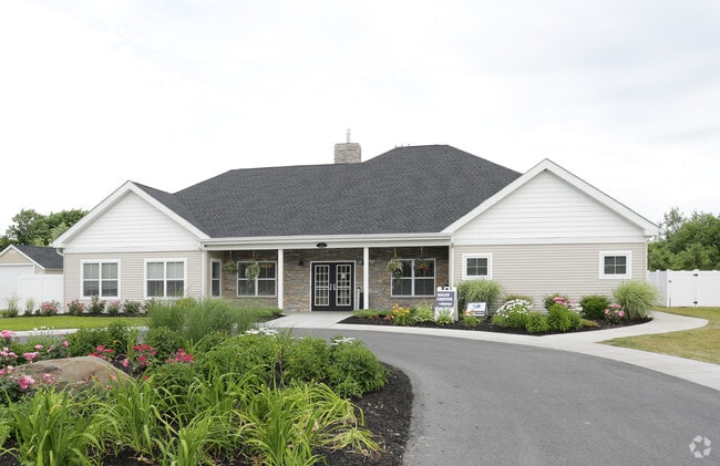
1 Gulf Rd
012689-004-002-0002-015-000-0000
Ph 2 Apartment Lots Shelter Cove Pud She
Apartment
Albany
X
New York
36001C0086D
15.000
2025
5.84 AC
2024
Outer Albany County
013000
Albany/Schenectady/Troy
23,402 SF
Albany-Schenectady-Troy, NY
DEMOGRAPHICS near 1 Gulf Rd
1 Mile
3 Mile
5 Mile
2024 Total Population
1,866
38,461
102,488
2029 Population
1,885
38,763
102,481
Pop Growth 2024-2029
+ 1.02%
+ 0.79%
(0.01%)
Average Age
40
42
42
2024 Total Households
741
16,773
44,145
HH Growth 2024-2029
+ 1.21%
+ 0.66%
(0.14%)
Median Household Inc
$130,734
$82,743
$78,466
Avg Household Size
2.50
2.20
2.30
2024 Avg HH Vehicles
2.00
2.00
2.00
Median Home Value
$386,999
$259,777
$262,457
Median Year Built
1988
1978
1973
Nearby Places
Map Layers
Map Styles
 Street
 Aerial
- Restaurants
- Banks
- Shops
- Fitness
- Groceries
PUBLIC TRANSPORTATION
AIRPORT
Albany International
DRIVE
WALK
Distance
Albany International
12 min
6.8 mi
Freight Ports
Albany, NY Port
DRIVE
WALK
Distance
Albany, NY Port
26 min
16.2 mi
Nearby Properties
Address
Land Use
TOTAL SIZE
Lot Size
Zoning
Address
Land Use
TOTAL SIZE
Lot Size
Zoning
150,000 SF
45.60 AC
07 - MIXED
Address
Land Use
TOTAL SIZE
Lot Size
Zoning
90,316 SF
57.10 AC
04 - FARM
Address
Land Use
TOTAL SIZE
Lot Size
Zoning
242,630 SF
18.50 AC
16
Address
Land Use
TOTAL SIZE
Lot Size
Zoning
501,506 SF
48 AC
01 - NOT Z
Address
Land Use
TOTAL SIZE
Lot Size
Zoning
20,444 SF
40.95 AC
02 - SINGL
Address
Land Use
TOTAL SIZE
Lot Size
Zoning
193,144 SF
41.18 AC
Address
Land Use
TOTAL SIZE
Lot Size
Zoning
135,396 SF
19.81 AC
12
Address
Land Use
TOTAL SIZE
Lot Size
Zoning
4,680 SF
26.74 AC
Address
Land Use
TOTAL SIZE
Lot Size
Zoning
1.30 AC
Address
Land Use
TOTAL SIZE
Lot Size
Zoning
Address
Land Use
TOTAL SIZE
Lot Size
Zoning
73,736 SF
7.58 AC
14
Address
Land Use
TOTAL SIZE
Lot Size
Zoning
12,234 SF
32 AC
05 - COMME
Address
Land Use
TOTAL SIZE
Lot Size
Zoning
93,373 SF
4.50 AC
02 - SINGL
Address
Land Use
TOTAL SIZE
Lot Size
Zoning
12,294 SF
36.70 AC
03 - MULTI
Address
Land Use
TOTAL SIZE
Lot Size
Zoning
16,545 SF
21.40 AC
04 - FARM
Address
Land Use
TOTAL SIZE
Lot Size
Zoning
8,270 SF
16.74 AC
A1
Address
Land Use
TOTAL SIZE
Lot Size
Zoning
3,844 SF
3.18 AC
Address
Land Use
TOTAL SIZE
Lot Size
Zoning
195,069 SF
28.40 AC
07 - MIXED
Address
Land Use
TOTAL SIZE
Lot Size
Zoning
12,010 SF
39.89 AC
01 - NOT Z
Address
Land Use
TOTAL SIZE
Lot Size
Zoning
22,401 SF
9.69 AC
25
Address
Land Use
TOTAL SIZE
Lot Size
Zoning
42,075 SF
4.30 AC
02 - SINGL
Address
Land Use
TOTAL SIZE
Lot Size
Zoning
61,697 SF
5.04 AC
14
Address
Land Use
TOTAL SIZE
Lot Size
Zoning
212,672 SF
3.90 AC
07 - MIXED
Address
Land Use
TOTAL SIZE
Lot Size
Zoning
100 SF
173.60 AC
04 - FARM
Address
Land Use
TOTAL SIZE
Lot Size
Zoning
46,420 SF
3.47 AC
14
Address
Land Use
TOTAL SIZE
Lot Size
Zoning
101,016 SF
2.30 AC
07 - MIXED
Address
Land Use
TOTAL SIZE
Lot Size
Zoning
528 SF
5.90 AC
02 - SINGL
Address
Land Use
TOTAL SIZE
Lot Size
Zoning
60,024 SF
12.50 AC
04 - FARM
Address
Land Use
TOTAL SIZE
Lot Size
Zoning
120,645 SF
17.43 AC
15
The World's #1 Commercial Real Estate Marketplace
Connect with us
© 2025 CoStar Group
The information above has been obtained from sources believed reliable. While we do not doubt its accuracy we have not verified it and make no guarantee, warranty or representation about it. It is your responsibility to independently confirm its accuracy and completeness. Any projections, opinions, assumptions, or estimates used are for example only and do not represent the current or future performance of the property. The value of this transaction to you depends on tax and other factors which should be evaluated by your tax, financial, and legal advisors. You and your advisors should conduct a careful, independent investigation of the property to determine to your satisfaction the suitability of the property for your needs.