Property Record
1 Gunsmoke Rd, Cheyenne, WY

NEARBY LISTINGS FOR SALE OR LEASE
Property Detail
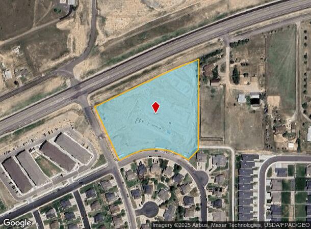
1 Gunsmoke Rd
Cheyenne, WY
Saddle Ridge
1-7897-0002-0001-0
SADDLE RIDGE: LOT 1, BLOCK 2
Commercialacreage
Laramie
X
Wyoming
56021C1111F
1
2024
5.27 AC
2025
I-80 Corridor/Cheyenne
000600
Other Market Areas
DEMOGRAPHICS near 1 Gunsmoke Rd
1 Mile
3 Mile
5 Mile
2024 Total Population
4,755
28,656
53,150
2029 Population
4,909
29,250
54,212
Pop Growth 2024-2029
+ 3.24%
+ 2.07%
+ 2.00%
Average Age
35
39
40
2024 Total Households
1,725
11,539
22,236
HH Growth 2024-2029
+ 3.19%
+ 2.20%
+ 2.10%
Median Household Inc
$83,704
$72,043
$64,677
Avg Household Size
2.80
2.40
2.30
2024 Avg HH Vehicles
2.00
2.00
2.00
Median Home Value
$354,378
$289,533
$280,096
Median Year Built
2010
1988
1979
Nearby Places
Map Layers
Map Styles
 Street
 Aerial
- Restaurants
- Banks
- Shops
- Fitness
- Groceries
SALE & LEASE HISTORY
LISTING DATE
SALE/LEASE

Sep 24, 2016
For Sale
Nearby Properties
Address
Land Use
TOTAL SIZE
Lot Size
Zoning
Address
Land Use
TOTAL SIZE
Lot Size
Zoning
1,120,931 SF
149.20 AC
Address
Land Use
TOTAL SIZE
Lot Size
Zoning
639,397 SF
67.52 AC
Address
Land Use
TOTAL SIZE
Lot Size
Zoning
243,960 SF
60.52 AC
Address
Land Use
TOTAL SIZE
Lot Size
Zoning
210,717 SF
18.28 AC
Address
Land Use
TOTAL SIZE
Lot Size
Zoning
156,244 SF
4.75 AC
Address
Land Use
TOTAL SIZE
Lot Size
Zoning
136,488 SF
13.38 AC
CB
Address
Land Use
TOTAL SIZE
Lot Size
Zoning
109,096 SF
4.03 AC
MR2
Address
Land Use
TOTAL SIZE
Lot Size
Zoning
37,714 SF
4.29 AC
Address
Land Use
TOTAL SIZE
Lot Size
Zoning
88,107 SF
10.73 AC
Address
Land Use
TOTAL SIZE
Lot Size
Zoning
96,088 SF
8.34 AC
Address
Land Use
TOTAL SIZE
Lot Size
Zoning
73,266 SF
8.08 AC
Address
Land Use
TOTAL SIZE
Lot Size
Zoning
59,223 SF
9.91 AC
HI
Address
Land Use
TOTAL SIZE
Lot Size
Zoning
54,666 SF
3.69 AC
MR2
Address
Land Use
TOTAL SIZE
Lot Size
Zoning
135,125 SF
8.87 AC
Address
Land Use
TOTAL SIZE
Lot Size
Zoning
174,000 SF
11.57 AC
MR2
Address
Land Use
TOTAL SIZE
Lot Size
Zoning
82,494 SF
17.27 AC
Address
Land Use
TOTAL SIZE
Lot Size
Zoning
46,705 SF
14.11 AC
HI
Address
Land Use
TOTAL SIZE
Lot Size
Zoning
33,080 SF
8.91 AC
Address
Land Use
TOTAL SIZE
Lot Size
Zoning
131,194 SF
17.67 AC
MR2
Address
Land Use
TOTAL SIZE
Lot Size
Zoning
48,566 SF
3.96 AC
MR2
Address
Land Use
TOTAL SIZE
Lot Size
Zoning
58,373 SF
0.85 AC
CB
Address
Land Use
TOTAL SIZE
Lot Size
Zoning
114,503 SF
11.43 AC
MR2
Address
Land Use
TOTAL SIZE
Lot Size
Zoning
137,934 SF
15.52 AC
HI
Address
Land Use
TOTAL SIZE
Lot Size
Zoning
98,923 SF
14.06 AC
Address
Land Use
TOTAL SIZE
Lot Size
Zoning
104,870 SF
6.44 AC
Address
Land Use
TOTAL SIZE
Lot Size
Zoning
66,102 SF
4.96 AC
HR1
Address
Land Use
TOTAL SIZE
Lot Size
Zoning
44,695 SF
4.93 AC
Address
Land Use
TOTAL SIZE
Lot Size
Zoning
58,429 SF
2.82 AC
Address
Land Use
TOTAL SIZE
Lot Size
Zoning
67,728 SF
34.57 AC
HI
Address
Land Use
TOTAL SIZE
Lot Size
Zoning
69,680 SF
3.72 AC
HR1
The World's #1 Commercial Real Estate Marketplace
Connect with us
© 2026 CoStar Group
The information above has been obtained from sources believed reliable. While we do not doubt its accuracy we have not verified it and make no guarantee, warranty or representation about it. It is your responsibility to independently confirm its accuracy and completeness. Any projections, opinions, assumptions, or estimates used are for example only and do not represent the current or future performance of the property. The value of this transaction to you depends on tax and other factors which should be evaluated by your tax, financial, and legal advisors. You and your advisors should conduct a careful, independent investigation of the property to determine to your satisfaction the suitability of the property for your needs.