Property Record
1 Harold Ives Dr, North Little Rock, AR 72117


This Property Is For Sale
NEARBY LISTINGS FOR SALE OR LEASE
Property Detail
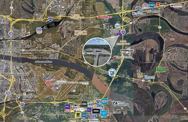
1 Harold Ives Dr
23N-034-01-020-02
Phase Iii I-440 Industrial Park
Officebuilding
PT NE NE SECTION 34-2N-11 MPDA COM NE COR NE TH S1*W258.23 TO POB TH CONT S1*W662.1 S83*1820W662.26 N39*3929W68.16 N10*3519W605.97 N2*3544E251.15 S88*2736E443.83 S00*0000W130 S87*4600E377
AH
Pulaski
05119C0368G
Arkansas
2025
13.86 AC
2025
North Little Rock
003900
Little Rock/N Little Rock
24,374 SF
Little Rock-North Little Rock-Conway, AR
DEMOGRAPHICS near 1 Harold Ives Dr
1 Mile
3 Mile
5 Mile
2024 Total Population
107
9,745
31,966
2029 Population
108
9,923
32,312
Pop Growth 2024-2029
+ 0.93%
+ 1.83%
+ 1.08%
Average Age
39
39
40
2024 Total Households
43
3,952
13,804
HH Growth 2024-2029
0.00%
+ 1.80%
+ 1.19%
Median Household Inc
$73,124
$29,709
$48,110
Avg Household Size
2.50
2.40
2.30
2024 Avg HH Vehicles
2.00
2.00
2.00
Median Home Value
$150,000
$83,660
$148,665
Median Year Built
2008
1974
1978
Nearby Places
Map Layers
Map Styles
 Street
 Aerial
- Restaurants
- Banks
- Shops
- Fitness
- Groceries
PUBLIC TRANSPORTATION
COMMUTER RAIL
Little Rock Union Station (Texas Eagle - Amtrak)
DRIVE
WALK
Distance
Little Rock Union Station (Texas Eagle - Amtrak)
15 min
8.2 mi
AIRPORT
Bill and Hillary Clinton Ntl/Adams Field
DRIVE
WALK
Distance
Bill and Hillary Clinton Ntl/Adams Field
12 min
7.9 mi
Freight Ports
Port of Shreveport
DRIVE
WALK
Distance
Port of Shreveport
259 min
240.9 mi
Nearby Properties
Address
Land Use
TOTAL SIZE
Lot Size
Zoning
Address
Land Use
TOTAL SIZE
Lot Size
Zoning
35,462 SF
109.74 AC
Address
Land Use
TOTAL SIZE
Lot Size
Zoning
18,133 SF
71.16 AC
Address
Land Use
TOTAL SIZE
Lot Size
Zoning
725,800 SF
128.27 AC
Address
Land Use
TOTAL SIZE
Lot Size
Zoning
4,112 SF
15.95 AC
Address
Land Use
TOTAL SIZE
Lot Size
Zoning
157,784 SF
66.14 AC
Address
Land Use
TOTAL SIZE
Lot Size
Zoning
349,200 SF
20 AC
Address
Land Use
TOTAL SIZE
Lot Size
Zoning
207,760 SF
13.31 AC
Address
Land Use
TOTAL SIZE
Lot Size
Zoning
70,344 SF
19.22 AC
Address
Land Use
TOTAL SIZE
Lot Size
Zoning
38,160 SF
14 AC
Address
Land Use
TOTAL SIZE
Lot Size
Zoning
51,758 SF
17.08 AC
Address
Land Use
TOTAL SIZE
Lot Size
Zoning
33,952 SF
6.46 AC
Address
Land Use
TOTAL SIZE
Lot Size
Zoning
40,286 SF
4.52 AC
Address
Land Use
TOTAL SIZE
Lot Size
Zoning
870 SF
18.01 AC
Address
Land Use
TOTAL SIZE
Lot Size
Zoning
Address
Land Use
TOTAL SIZE
Lot Size
Zoning
2,999 SF
28.40 AC
Address
Land Use
TOTAL SIZE
Lot Size
Zoning
178,750 SF
10.75 AC
Address
Land Use
TOTAL SIZE
Lot Size
Zoning
19,200 SF
23.38 AC
Address
Land Use
TOTAL SIZE
Lot Size
Zoning
41,384 SF
27.12 AC
Address
Land Use
TOTAL SIZE
Lot Size
Zoning
35,485 SF
16 AC
Address
Land Use
TOTAL SIZE
Lot Size
Zoning
2,940 SF
10.08 AC
Address
Land Use
TOTAL SIZE
Lot Size
Zoning
27,896 SF
21.10 AC
Address
Land Use
TOTAL SIZE
Lot Size
Zoning
105,760 SF
20.75 AC
Address
Land Use
TOTAL SIZE
Lot Size
Zoning
33,920 SF
18.12 AC
Address
Land Use
TOTAL SIZE
Lot Size
Zoning
16,685 SF
23.13 AC
Address
Land Use
TOTAL SIZE
Lot Size
Zoning
144,000 SF
10.74 AC
Address
Land Use
TOTAL SIZE
Lot Size
Zoning
4,410 SF
10.95 AC
Address
Land Use
TOTAL SIZE
Lot Size
Zoning
50,046 SF
2.61 AC
Address
Land Use
TOTAL SIZE
Lot Size
Zoning
12,255 SF
10.13 AC
Address
Land Use
TOTAL SIZE
Lot Size
Zoning
41,177 SF
37.87 AC
Address
Land Use
TOTAL SIZE
Lot Size
Zoning
5,835 SF
20.17 AC
The World's #1 Commercial Real Estate Marketplace
Connect with us
© 2026 CoStar Group
The information above has been obtained from sources believed reliable. While we do not doubt its accuracy we have not verified it and make no guarantee, warranty or representation about it. It is your responsibility to independently confirm its accuracy and completeness. Any projections, opinions, assumptions, or estimates used are for example only and do not represent the current or future performance of the property. The value of this transaction to you depends on tax and other factors which should be evaluated by your tax, financial, and legal advisors. You and your advisors should conduct a careful, independent investigation of the property to determine to your satisfaction the suitability of the property for your needs.