Property Record
1 Howe Rd, Fishers, IN 46038


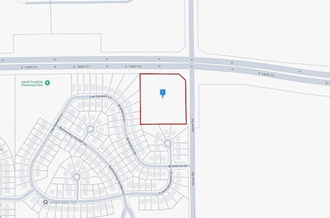
Property Detail
1 Howe Rd
Indianapolis-Carmel-Greenwood, IN
ACREAGE 4.45, SECTION 20, TOWNSHIP 18, RANGE 5
29-11-20-000-006.000-021
HAMILTON
Recreationalacreage
Indiana
B and X Area of moderate flood hazard, usually the area between the limits of the 100-year and 500-year floods.
4.45 AC
2024
Fishers/Geist
2025
Indianapolis
110807
NEARBY LISTINGS FOR SALE OR LEASE
DEMOGRAPHICS near 1 Howe Rd
1 mile
3 mile
5 mile
2025 Total Population
10,487
67,407
152,666
2030 Population
11,114
71,808
163,240
Pop Growth 2025-2030
+ 5.98%
+ 6.53%
+ 6.93%
Average Age
35
36
38
2025 Total Households
3,732
24,257
55,789
HH Growth 2025-2030
+ 6.16%
+ 6.73%
+ 7.13%
Median Household Inc
$107,493
$112,640
$116,389
Avg Household Size
2.80
2.70
2.70
2025 Avg HH Vehicles
2.00
2.00
2.00
Median Home Value
$323,773
$356,123
$384,266
Median Year Built
2008
2005
2003
Nearby Places
Map Layers
Map Styles
 Street
 Aerial
Layers
 Traffic
 Biking
Places
Listings with unknown addresses are not visible on the map
- Restaurants
- Banks
- Shops
- Fitness
- Groceries
PUBLIC TRANSPORTATION
AIRPORT
Indianapolis International
Drive
Walk
Distance
Indianapolis International
55 min
34.7 mi
Freight Ports
Port of Toledo
Drive
Walk
Distance
Port of Toledo
245 min
206.9 mi
Nearby Properties
Address
Land Use
TOTAL SIZE
Lot Size
Zoning
Address
Land Use
TOTAL SIZE
Lot Size
Zoning
403,964 SF
36.77 AC
Address
Land Use
TOTAL SIZE
Lot Size
Zoning
584,003 SF
55.95 AC
Address
Land Use
TOTAL SIZE
Lot Size
Zoning
450,420 SF
24.54 AC
Address
Land Use
TOTAL SIZE
Lot Size
Zoning
480,315 SF
21.53 AC
Address
Land Use
TOTAL SIZE
Lot Size
Zoning
528,117 SF
57.02 AC
Address
Land Use
TOTAL SIZE
Lot Size
Zoning
1,395,736 SF
77.82 AC
Address
Land Use
TOTAL SIZE
Lot Size
Zoning
450,918 SF
35.32 AC
Address
Land Use
TOTAL SIZE
Lot Size
Zoning
1,008,279 SF
60.59 AC
Address
Land Use
TOTAL SIZE
Lot Size
Zoning
426,525 SF
16.44 AC
Address
Land Use
TOTAL SIZE
Lot Size
Zoning
326,255 SF
13.21 AC
Address
Land Use
TOTAL SIZE
Lot Size
Zoning
434,376 SF
35.75 AC
Address
Land Use
TOTAL SIZE
Lot Size
Zoning
375,289 SF
20.36 AC
Address
Land Use
TOTAL SIZE
Lot Size
Zoning
286,120 SF
8.03 AC
Address
Land Use
TOTAL SIZE
Lot Size
Zoning
280,736 SF
9.06 AC
Address
Land Use
TOTAL SIZE
Lot Size
Zoning
234,304 SF
5.85 AC
Address
Land Use
TOTAL SIZE
Lot Size
Zoning
279,101 SF
14.95 AC
Address
Land Use
TOTAL SIZE
Lot Size
Zoning
224,086 SF
17.81 AC
Address
Land Use
TOTAL SIZE
Lot Size
Zoning
185,155 SF
18.54 AC
Address
Land Use
TOTAL SIZE
Lot Size
Zoning
224,860 SF
18.52 AC
Address
Land Use
TOTAL SIZE
Lot Size
Zoning
241,325 SF
26 AC
Address
Land Use
TOTAL SIZE
Lot Size
Zoning
229,136 SF
30.77 AC
Address
Land Use
TOTAL SIZE
Lot Size
Zoning
110,632 SF
39.20 AC
Address
Land Use
TOTAL SIZE
Lot Size
Zoning
152,767 SF
21.92 AC
Address
Land Use
TOTAL SIZE
Lot Size
Zoning
76,666 SF
9.41 AC
Address
Land Use
TOTAL SIZE
Lot Size
Zoning
132,291 SF
12.56 AC
Address
Land Use
TOTAL SIZE
Lot Size
Zoning
139,271 SF
15.06 AC
Address
Land Use
TOTAL SIZE
Lot Size
Zoning
643,957 SF
34.93 AC
Address
Land Use
TOTAL SIZE
Lot Size
Zoning
247,344 SF
16.02 AC
Address
Land Use
TOTAL SIZE
Lot Size
Zoning
131,742 SF
90.64 AC
Address
Land Use
TOTAL SIZE
Lot Size
Zoning
127,664 SF
11.47 AC
The World's #1 Commercial Real Estate Marketplace
Connect with us
© 2026 CoStar Group
The information above has been obtained from sources believed reliable. While we do not doubt its accuracy we have not verified it and make no guarantee, warranty or representation about it. It is your responsibility to independently confirm its accuracy and completeness. Any projections, opinions, assumptions, or estimates used are for example only and do not represent the current or future performance of the property. The value of this transaction to you depends on tax and other factors which should be evaluated by your tax, financial, and legal advisors. You and your advisors should conduct a careful, independent investigation of the property to determine to your satisfaction the suitability of the property for your needs.